


Good morning bloggers,
It is a wet start to Tuesday morning. Have that rain gear ready. Here is a look at the radar as of 7:15 a.m. showing the large area of rain moving in:

This large area of rain is just inching its way northward. There will be new bands of rain forming and rotating around this developing storm system in the next 48 hours. This will lead to a good soaking in most areas with a bit too much rain possible farther west and south.
There is a slow moving storm system just now intensifying over the plains. By tomorrow night, the center of the storm will be moving across southeastern Kansas. Kansas City will be in the circulation around this storm system as you can see here.

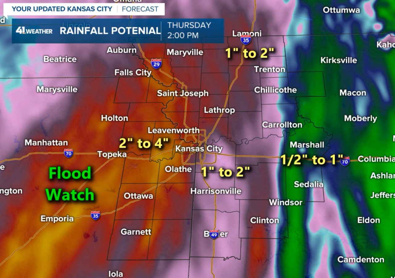
The final band of rain for our area is most likely on Thursday. Rainfall amounts may exceed four inches west and southwest of KC. Wide spread 1-2 inch amounts are in the KC metro forecast as you can see below:
This storm is producing a severe weather risk south of our region. Incredibly, our streak with no Tornado Watches is going to reach three years on May 28. Here is today's risk:

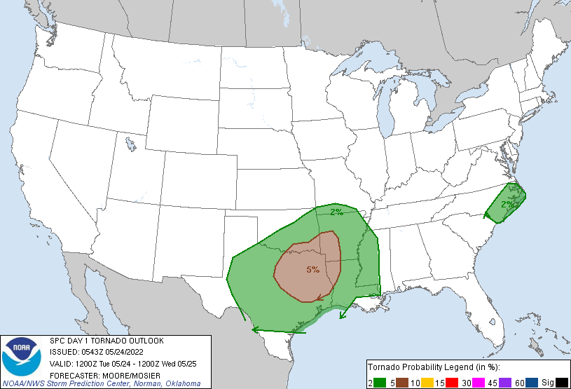
There is a tornado risk today from southeast Oklahoma and southwest Arkansas south into parts of Louisiana and Texas. Yesterday there were some rather large and picturesque tornadoes over western Texas:

These tornadoes yesterday were over open fields, thank goodness. This storm system affecting us will produce another risk today as shown above, but Kansas City is once again protected. We will just get a nice rainstorm rotating around the upper level system.
Kansas City Forecast Time-Line:
- Today: Cloudy with a 100% chance of rain. It may be heavy at times with a possibility of a thunderstorm. High: 60°
- Tonight: A 100% chance of rain. It may be heavy at times with possibly a thunderstorm or two. Low: 54°
- Wednesday: Cloudy with a 100% chance of rain, but not all day. High: 62°
- Thursday: Cloudy with a 70% chance of rain. The rain ending by late in the day. High: 59°
Rainfall Forecast: 1" to 2" likely. Areas west of KC may have 2" to 4". Areas farther east may have 1/2" to 1".
What if this was snow instead of rain?
Imagine if this were a snow forecast. It would be like me saying 5" to 40" possible. If we correct for much colder air it would be like us forecasting A dusting to 15" possible. Think about this! I will try to make a graphic and explain this on KSHB 41 tonight. This is one of the reasons why snow forecasting is much more difficult. The reason it is more difficult is because the impact difference of 15" of snow versus 1" of snow is huge, whereas the impact difference between 1/2" of rain and 2" of rain is much less.
Thank you for spending a few minutes of your day reading the weather blog and sharing in this weather experience.
Have a great Tuesday!
Gary
