


Good morning bloggers,
Get the sunscreen on and prepare for a record breaking day. The record high is 95° set back on this date in 1954. We will likely break it with our forecast high of 96°. We tied the record yesterday, and Tuesday may be hotter than today.
And, we need rain! The KC region has been excessively dry this summer and it isn't ending as we move into fall:

There is a chance of rain on Wednesday night and Thursday. The set-up does not look great for anything significant that will cut into this rainfall deficit, however.
It is still technically summer and it is going to be very hot the next two days. A fall cold front will be approaching and moving through by Thursday, which just happens to be the first day of fall.
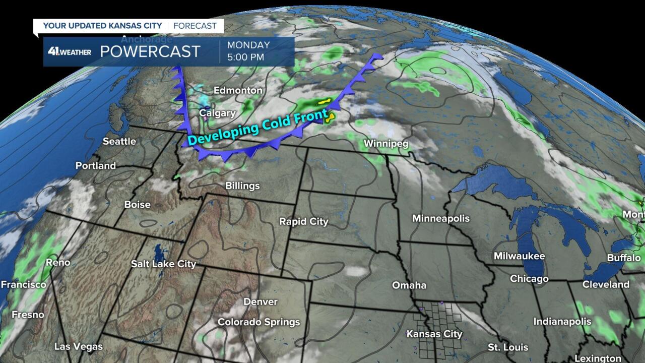
The cold front will be developing later today and tonight as it forms and crosses the Canada/USA border in northern Montana later this afternoon.
And, then by Wednesday morning the front will be on our doorstep, as shown below:
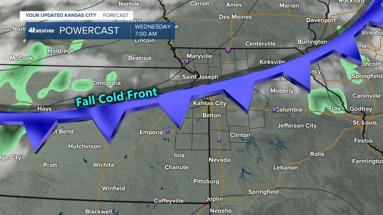
The record breaking temperatures will happen ahead of this cold front, and then we will have a big temperature drop late Wednesday into Thursday.
HURRICANE FIONA
Hurricane Fiona absolutely blasted Puerto Rico yesterday as it was moving very slowly. Fiona is over the Dominican Republic right now. We can see the center of the storm over land.
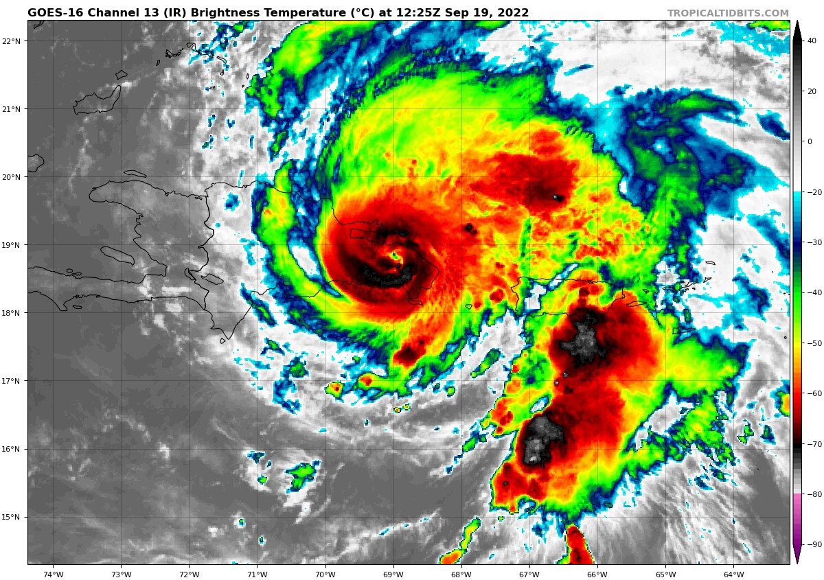
Puerto Rico likely has just had another disaster hit them. The power is out and the flooding is likely extreme. It is now blasting Hispaniola, and centered over Dominican Republic. It will curve north today and tonight and this may become a major hurricane by mid-week.
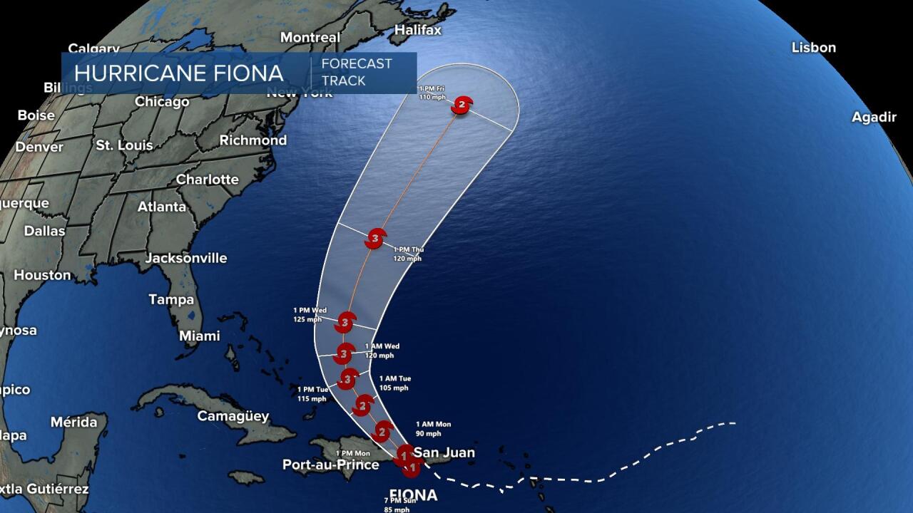
Hurricane Fiona will turn north, intensify into what may be our first Major Hurricane of the season, and then race off to the northeast by the weekend.
Kansas City Weather Timeline:
- Today: Mostly sunny with a light south breeze. High: 96° (Record is 95° in 1954)
- Tonight: Staying warm with a low in the middle 70s.
- Tuesday: Sunny, hot, and humid with southwest winds 10-15 mph. High: 97° (another record)
- Wednesday: Starting out warm in the middle 70s. Expect increasing clouds with the wind shifting to the northwest and becoming gusty. Temperature dropping from the 80s into the 60s later in the day.
Thank you for spending a few minutes of your day reading the weather blog and sharing in this weather experience. Have a great day!
Gary
