


Good morning bloggers,
Last week was rather fascinating with the 1" to 8" rainfall event we had. Yes, the KC metro area had a few spots with only 1" of rain, while others had around 8" of rain. This week is starting out nice, and it will end with a good chance of thunderstorms. We will take a look and go in-depth on our newscasts on KSHB-41 News. And, we will share with you our LRC Model from Weather2020.com and show the outlook for September.
Tropical Storm Fred is intensifying as it approaches Florida, and this is topping our weather news this morning. Take a look at the enhancement in the thunderstorms around the center of Fred as of 7 AM:
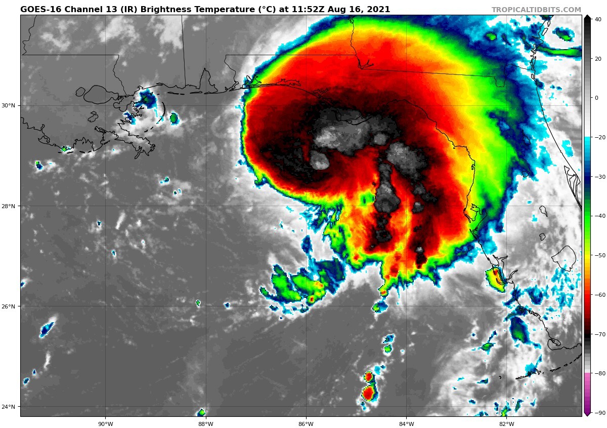
The red to white enhancement colors show the high cloud tops. This shows that this system is intensifying and it has strengthened. Fred is still below hurricane status. Fred is now becoming a stronger tropical storm with 55 mph winds sustained with gusts to hurricane force, which is 74 mph, or 65 knots. Fred would only be named a hurricane if the sustained winds, a wind lasting 1 full minute, reach 65 knots, or 74 mph. It will make a Florida landfall as predicted 200 days ago by the LRC.
Right here on this blog, in February, we predicted this system would form around mid-August. Here is that prediction:

The L that is plotted is where I placed it on this map in February. The track of Fred went right over the prediction I made 200 days ago. The bright red path shows the prediction of the most likely track for this system, and Fred formed on the north side of the track, crossed right through the L I drew in, and now it is on the left side of the track.
Kansas City Weather:
- Today: GREAT weather with a high in the upper 80s with a light wind.
The weather was gorgeous early today with temperatures in the 60s. It will be warming up to near 90 degrees this week and then there will be a chance of thunderstorms by Thursday night or Friday. Take a look at this forecast valid Thursday night at 1 AM Friday:
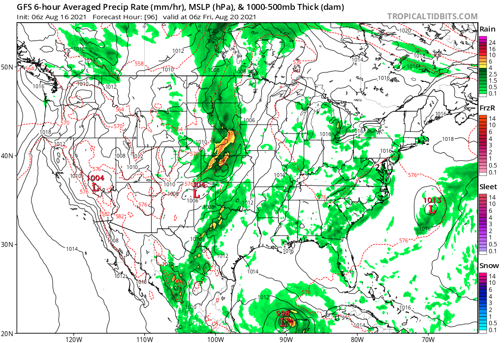
On this map, there is a weak cold front over northwest Kansas we will be monitoring and tracking, also a tropical system way south in the Gulf of Mexico, and another tropical system off the east coast of the United States. As we move into September, the jet stream will be strengthening and beginning to shift south. Our first fall cold front often shows up in these next four weeks, but I don's see one yet. Speaking of fall, let's take a look at the outlook for next month.
LRC Model Outlook For September:
The weather pattern is cycling through the seventh LRC cycle in the 2020/2021 weather pattern that set up last fall. In October a unique pattern, one that has never happened before, will be setting up once again. That is still around 7 weeks away, so for now we are still in the same pattern. The LRC model, a statistical weather model, has been quite accurate. This model just made an accurate prediction of Tropical Storm Fred, currently in progress. The model predicted this rainfall pattern months ago:

It showed a highly enhanced area of rainfall right near the track of Fred. Again, this was made two months ago by the LRC model! The LRC is both art and science combined to create a paradigm shift in weather forecasting. It's a 35 year effort thus far. We learn more every year! So, we are showing we are predicting tropical systems, and many of you who have been following our blog for almost 20 years know, the LRC describes the order in chaos. Let's apply what we have learned to our September forecast.
This LRC model has an outlook for September also made months ago. Take a look at the outlook for Kansas and Missouri:

This model is taking all of the locations in Kansas and Missouri and blending them together. This graphic above shows cooler than average and cooler than last year in the first part of September, and then warmer than average and much warmer than a year ago in the middle of the month.

I will get a bit more specific for Kansas City on our weather forecasts today and tonight on KSHB-41 News.
Thank you for spending a few minutes of your day reading the Gabbing With Gary blog, and sharing in this weather experience. Have a great start to the week.
Gary
