


Good morning bloggers,
Snow is in the forecast tonight and accumulations are likely. Let's begin with the weather forecast timeline:

We expect it to be dry with increasing clouds through early afternoon. By 3 p.m. to 6 p.m. bands of rain and snow will be approaching Kansas City from the southwest.
6 p.m. Powercast:
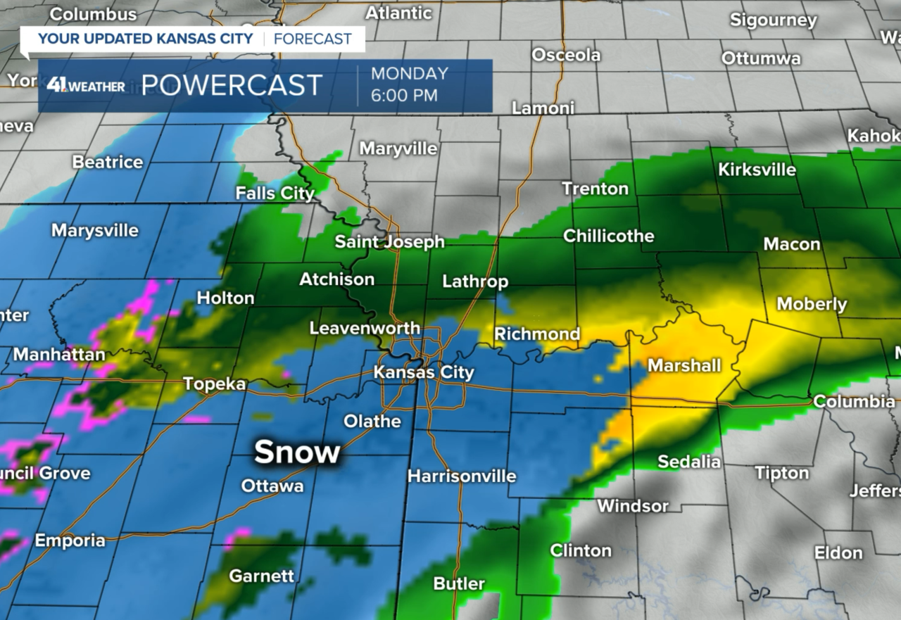
There is a storm system approaching us from the southwest. It is not a strong storm. The conditions just happen to be very favorable for snow with this set up we have tonight. As you can see above, the green to yellow shades show the rain and the blue shows the snow. The pink shade may be some sleet. We are NOT expecting any freezing rain with this setup.
Midnight Powercast:

By midnight, the storm system will be reorganizing and a twisting/circulating area of snow will be developing near Kansas City, or just northwest of the city. Look at what happens by 6 a.m. Tuesday:
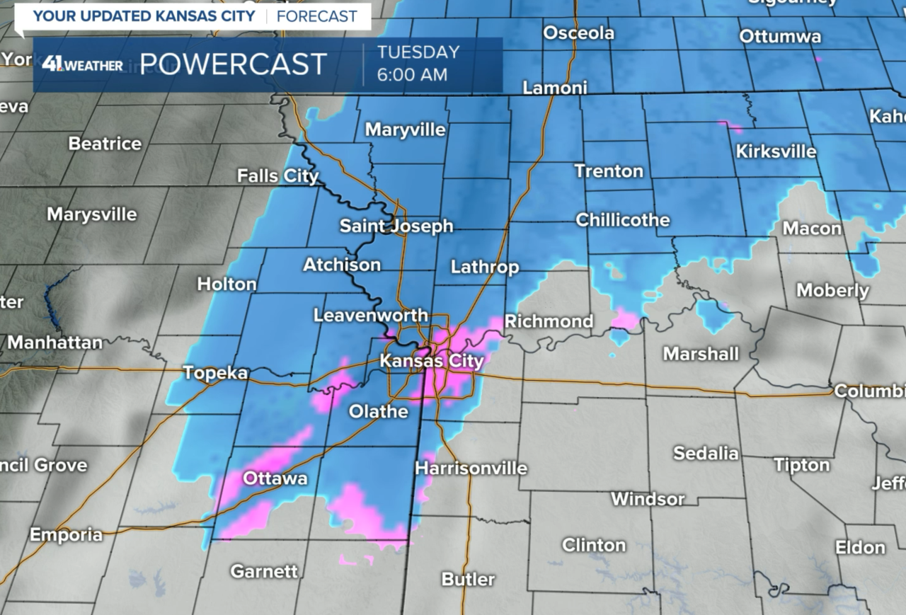
By 6 a.m. in the morning, that trailing area of snow will likely be coming when the temperatures are closer to 30 degrees. This is forecast to be that twisting disturbance that forms overnight. If this does indeed form, the snowfall amounts may increase by 1" at the very end.
Snowfall Forecast:

This disturbance, that is forecast by most of the models now, that will begin twisting the area of snow overhead, is important. I am not sure exactly where it will form, but it will likely add 1" of snow to the totals along its path. This is why I upped the snowfall forecast to a dusting to 3" of snow near Kansas City. Where this disturbance forms will likely be determining factor on who will only have a dusting by morning and where the 3" will fall.
Possible snowfall accumulation results:
- The disturbance may form farther north. If this happens, then a dusting to under 1" is likely. This will be the result in many spots
- The timing of when the disturbance forms is also important. It may form a bit later, and if it does, then the snowfall amounts will be under 1"
- Right now, it appears it will form just northwest of Kansas City after midnight and then track over northern Missouri by sunrise. This would result in around 1" of snow in Kansas City
Road conditions: Will it be wet or slick?
Every degree matters! There is a huge difference between it dropping to 30° tonight or staying 33° or higher. 32° is the freezing point and it works. If it doesn't drop below 32°, then the snow will not accumulate on the roads unless it comes down very hard. Right now I am expecting it to drop to right around 32°. Every 1° matters and this is something we will discuss on our weather forecasts today and tonight!
Thank you for spending a few minutes of your day reading the blog and sharing in this weather experience. We will be going in-depth with Kansas City's Most Accurate forecast on KSHB 41 News tonight.
Gary
