


KANSAS CITY, Mo. — Good morning bloggers,
A storm system is developing and about to impact our region. The National Weather Service has issued a winter weather advisory for most of our region with a winter storm warning farther northeast due to some higher amounts.
This will be a rather dramatic 24 hours. It will be warming up into the 50s in the area today with a crash in temperatures down into the teens by sunrise Saturday. There is an inverted trough that will try to hold the warmer temperatures in here. The amount of snow will depend on many factors, with one of the biggest factors being that layer of warmer air near this inverted trough. When will it drop to 32 degrees?
3 p.m. forecast:
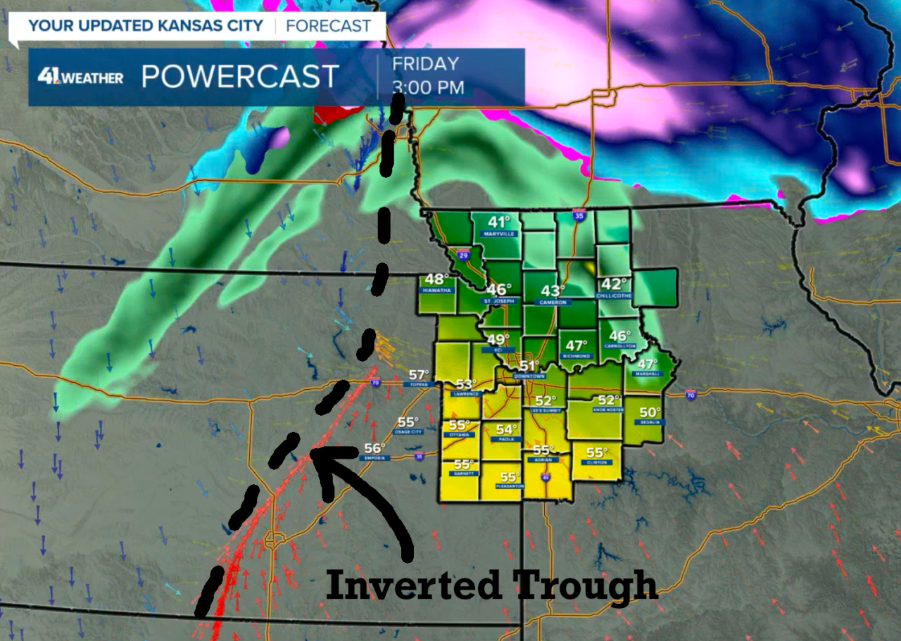
A surface low pressure center will be forming over Texas, and this is an inverted trough extending north over eastern Kansas this afternoon. This inverted trough is going to be a problem for snow lovers out there. After the warmer air builds on the east side of this inverted trough, it will then be a slow process to get the temperatures to drop low enough for the rain to change to snow.
Yes, it is going to rain first. Take a look at the next two forecast maps.
6 p.m. forecast:

The inverted trough can be seen by looking at the blue arrows all concentrated in that line. Notice this model's prediction of 45 degrees with rain approaching at 6 p.m., and then by 9 p.m., this model is still showing the temperatures as way above freezing. Even Hiawatha is 33 degrees and raining on this model as you can see below.
9 p.m. forecast:

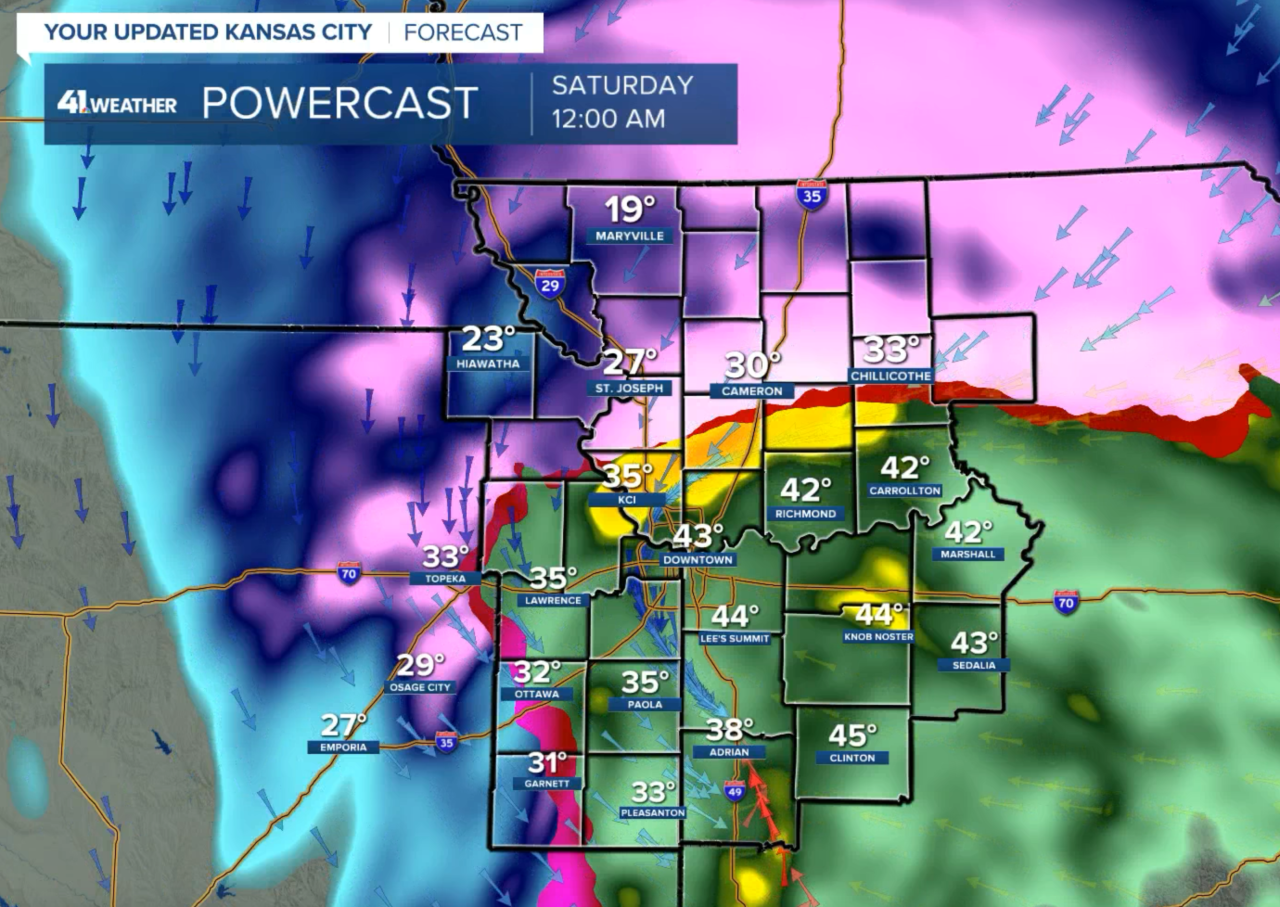
By midnight, that inverted trough is still in play and holding in a wedge of warmer air rotating around the Kansas City area with 43 degrees downtown. If you are a snow lover, then this is not a good number.
Midnight forecast:
Finally, by 5 a.m., an Arctic blast is now overtaking the inverted trough, and cold air is blasting into our area. It is forecasted to drop into the teens by 5 or 6 a.m. with the snow still falling. This is when we will likely have most of our snow accumulation.
5 a.m. forecast:

The snow is already forecast to end from north to south before noon on Saturday.
8 a.m. forecast:

The new data coming in this morning was disturbing and good for snow lovers, depending on where you live. The NAM model that has 4.1 inches in Kansas City has less than 1 inch just east of Kansas City in a little "snow shadow" that develops. I have experienced these "snow shadows" before, and one area gets all kinds of snow while just a bit off to the northeast or east of this snow band is an area that gets much lower amounts. This is also a possibility.

Here is the latest NAM model forecast:

That snow shadow is showing up southeast of Kansas City. This data that just came out shows a band of heavier snow west of the state line. I do not put a lot of weight into this model, but it is interesting to look at.
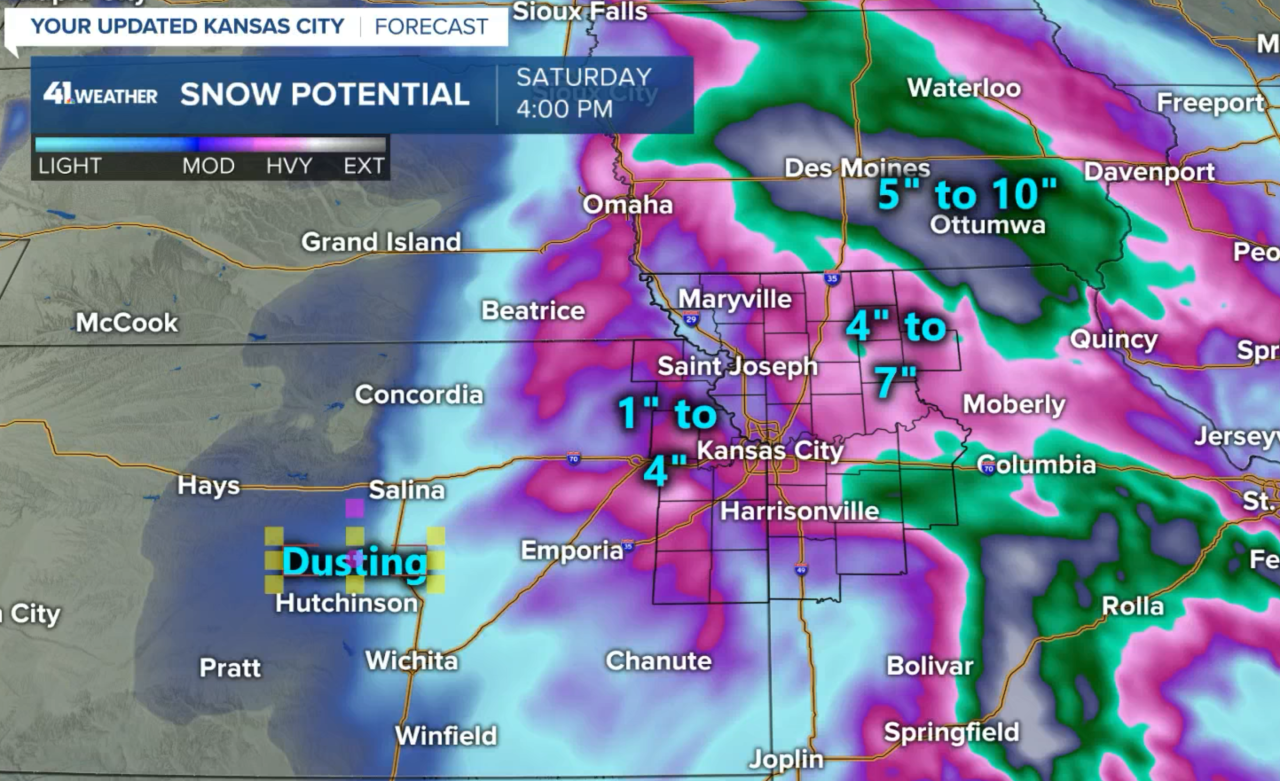
Our snowfall forecast:
We will be analyzing the new data and the latest trends. The forecast will improve Sunday for the Chiefs game with dry weather and just a breeze switching to the northwest during the game. I am expecting a kickoff temperature near 30 degrees. Go Chiefs!
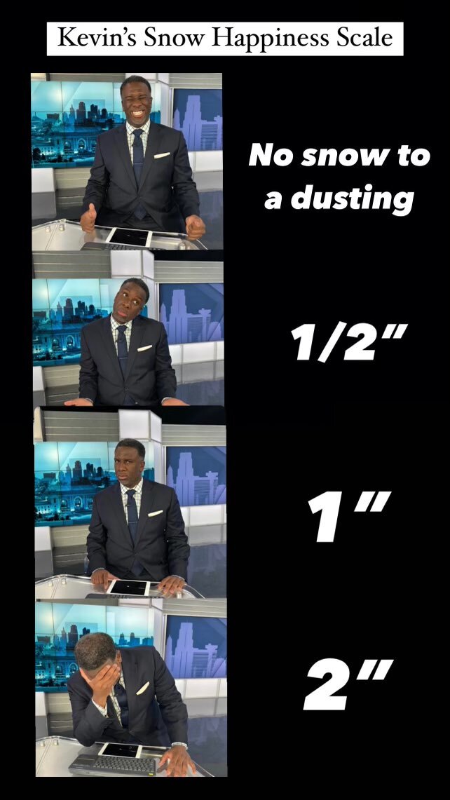
So, where are you on the snow happiness scale? Are you with Sunny The Weather Dog or our evening anchor, Kevin Holmes?

Kevin's Snow Happiness Scale:
New data will be rolling in soon. We will keep you updated on KSHB 41 News!
Thank you for spending a few minutes reading the weather blog and sharing in this weather experience. Have a great day!
Gary
