


KANSAS CITY, Mo. — Good Thursday bloggers!
There's a headline floating around "El Niño is ending"... and while there are signs that we know when it is going to end we still have a potentially historic El Niño to get through this winter.
The latest update from the Climate Prediction Center (CPC) is that "El Niño is expected to continue through the Northern Hemisphere winter, with a transition to ENSO-neutral favored during April-June 2024." So what does this all mean?
The oceans are warm, off the California Coast, along the Gulf, and more importantly through the Equator.

Where the CPC monitors for El Niño signals we are still seeing an ONI of +1.8°C. The Oceanic Nino Index (ONI) a three-month running mean of two different anomaly readings in the Nino 3.4 region, and this keeps us in that strong category currently.
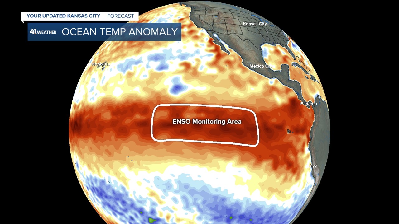
The CPC is forecasting our +1.8°C will continue to warm and peak in the low 2-degree Celsius anomaly range. That would place us in the top five for strongest events. But there is change signaling a shift down the road.
El Niño of course is just the Ocean component to our winter weather. The warm Ocean water reinforces what we called the "Walker Circulation." Think of this as an ocean atmosphere loop that feeds from east to west across the tropics creating storms for the subtropical jet to pick up and carry through the southern tier of the U.S. This coupling is critical to the "health" of El Niño.
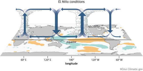
When we start to see weakening in this feedback loop it can be a signal that there is cooling somewhere and there is a slight weakening in the Walker Circulation in an area between Tahiti and Australia.

So the forecast right now is leaning on a strong El Niño holding through the winter months into early April. Then ENSO neutral conditions arriving this Spring with the possibility to La Niña by the summer. Yes F=GmM/r^2 (the law of gravity) and things that go up must eventually come back down. A big swing from a potentially historic El Niño to a La Niña seems odd right now, but all of our historic El Niño's have been followed by a La Niña so actually this would be pretty much on trend.

