


KANSAS CITY, Mo. — Good morning bloggers,
There is a storm showing up in the models that fits the LRC perfectly. This end-of-the-week storm is one of the storm systems we predicted would bring us a chance of a winter storm, around a month ago, to arrive this week. Since we are still waiting for our first inch of snow on the Country Club Plaza we will be a bit more cautious on predicting this next system, but look at the latest data:

If you watched our weather forecasts yesterday on KSHB 41, then you may remember I showed this forecast map, and there is a huge difference. The storm and snow shifted much farther west, and if this trend continues, it will be targeting our area Friday night.
Now, the trend is for this to be shifting farther west. The overnight data placed Kansas City in the snowstorm Friday night into early Saturday. Take a look at this:

This model produced 5 inches of snow near Kansas City, and the European Model also produced 5 inches of snow. But, I am sure a lot of you remember what happened with the last two storm systems on the models. The snow under-produced on each of the last two snow chances, so let's be careful before we get the kids excited about this next chance. It takes 1 inch to end the snowflake contest, so let's see if that truly shows a chance of happening. Right now I am up to around a 30% chance we have 1 inch or more. If it looks more likely, then we will update this prediction in the next few days.
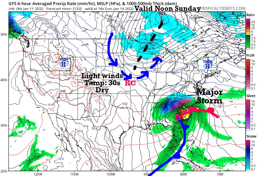
The storm is going through a phase of intensification into what will likely be a major storm in the eastern USA. Look at what happens by Sunday as the Chiefs and Steelers are getting ready to take the field:
Sunday Night Football forecast:
With the trend for this storm system to possibly affect our area Friday night into Saturday and the fact that it is now just three days away from that possible storm, I feel we can count on how the models are set up for Sunday.
- It looks sunny and dry with a southwest breeze Sunday shifting to the northwest. We are at the base of a "U" as Jeff Penner and I have called it for the past couple of decades. Look at the shape of the blue arrows on that Sunday forecast map. This will allow us to warm up Sunday, but only into the 30s. With sunshine, it is looking pretty nice for tailgating, but bring your heavy coat for Sunday Night Football as it will be a bit cold.
- The weather during the evening will likely be a little breezy with temperatures near 32 degrees for the game.
There is this trend in the models. Let's see how this looks in the next couple of days!
Today's forecast:
Mostly sunny and much warmer. A southwest breeze at 10 to 20 miles per hour. High: 55 to 60 degrees
Thank you for spending a few minutes of your day reading the weather blog and sharing this weather experience. Have a great Tuesday.
Gary
