

Good Monday bloggers,
This time of year is, on average, one of the wettest times of year and the thick of severe weather season. We are in a rather cool May weather pattern and this reduces the severe weather chances as thunderstorms feed off of heat and humidity.
Highs through Friday will run 5 to 15 degrees below average. You can see the highs next weekend, we begin to creep up to average or even a bit above. So, could the warmer air lead to bigger thunderstorms? Let's go through this.

TUESDAY-THURSDAY:
We will see lots of clouds with more sun possible Thursday. Highs will be mostly in the 60s with lows in the 40s. Western Kansas will see highs in the 40s and 50s where it is raining, 20-30 degrees below average.
There will be a chance of a few rain showers Tuesday into Wednesday, but most rain will fall apart before it reaches our area.
Here is a Powercast image of Tuesday morning at 7 AM. There is a heavy, cold May rain for the southwest 1/2 of Kansas and snow in Colorado!

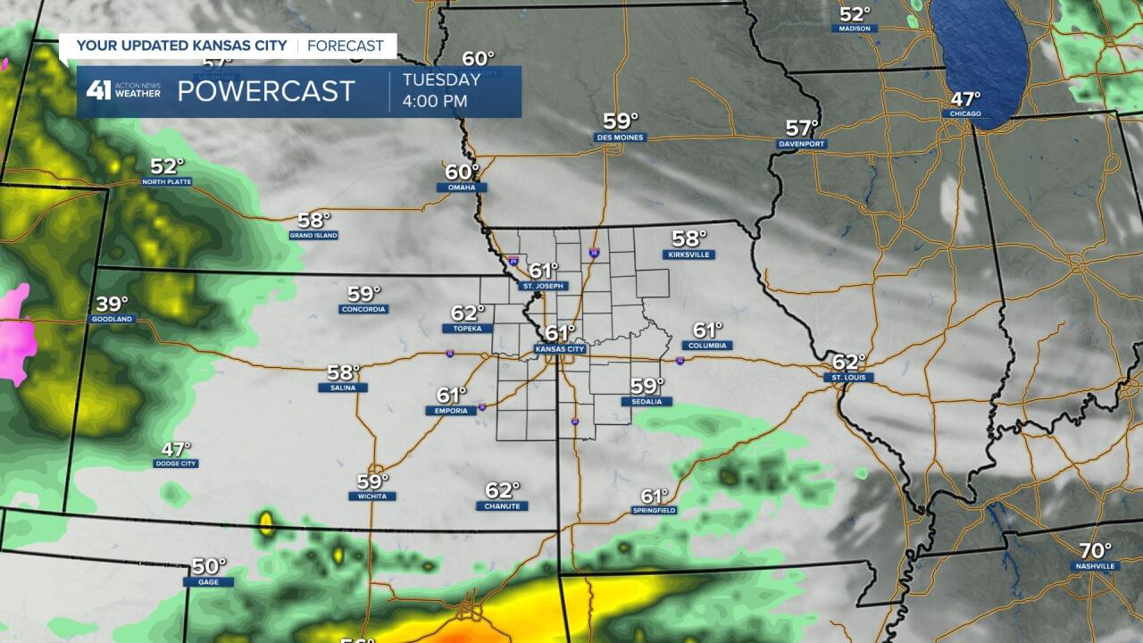
By Tuesday afternoon at 4 PM the rain is mostly gone as it moved east and fell apart. So, we have a chance to see some rain as it limps in here.
FRIDAY-SUNDAY:
A cold front will arrive Friday bringing a chance of showers and thunderstorms with highs in the 60s.
The cold front will stall and become a slow moving warm front Saturday and Sunday. Highs in the 50s and 60s will be separated from highs in the 80s and 90s. We will lie in between with highs in the 60s and 70s.
Below is a Powercast image of Sunday at 5 PM. It is representative of the set up for the weekend. We will go into more detail as we get closer. You can see quite a bit of thunderstorm activity in our area. The set up is there for very heavy rain and flash flooding. The severe threat is also there, but low as there are no big storm systems and the flow aloft is on the weaker side. Now, that being said, anytime there is a chance of thunderstorms in April, May and June we have to be aware of a severe weather threat.
These are not all day rains Friday-Sunday. We will be able to time it out better as we get closer.

RAINFALL FORECAST MONDAY-THURSDAY:
You can see we are on the eastern edge of the rain with amounts of a trace to .10". 1" to 2" of rain is likely in western Kansas. This is good for the Hard Red Winter Wheat crop. But, sometimes the rain can be too much of a good thing causing rust.

RAINFALL FORECAST FRIDAY-SUNDAY:
Rainfall amounts are 1-2" in a very large area. If the thunderstorms get going, some locations could see 2"-4" of rain.

We don't really need rain as we are around average for May through the 10th. Average for the entire month is 5.23".

Rainfall for 2021, since January 1st, has been 13.02" which is 2.43" above average. The rainfall has been distributed pretty even from month to month so far. This has prevented us from getting too dry and getting too wet.


Have a great week and stay healthy.
