


Good Tuesday bloggers,
We have seen windy conditions the last few days, but today and Wednesday will see the wind take a step up as gusts reach 40-50 mph. These are the winds of change as they originate in the middle of the Gulf of Mexico. These winds are bringing in much higher moisture content air.
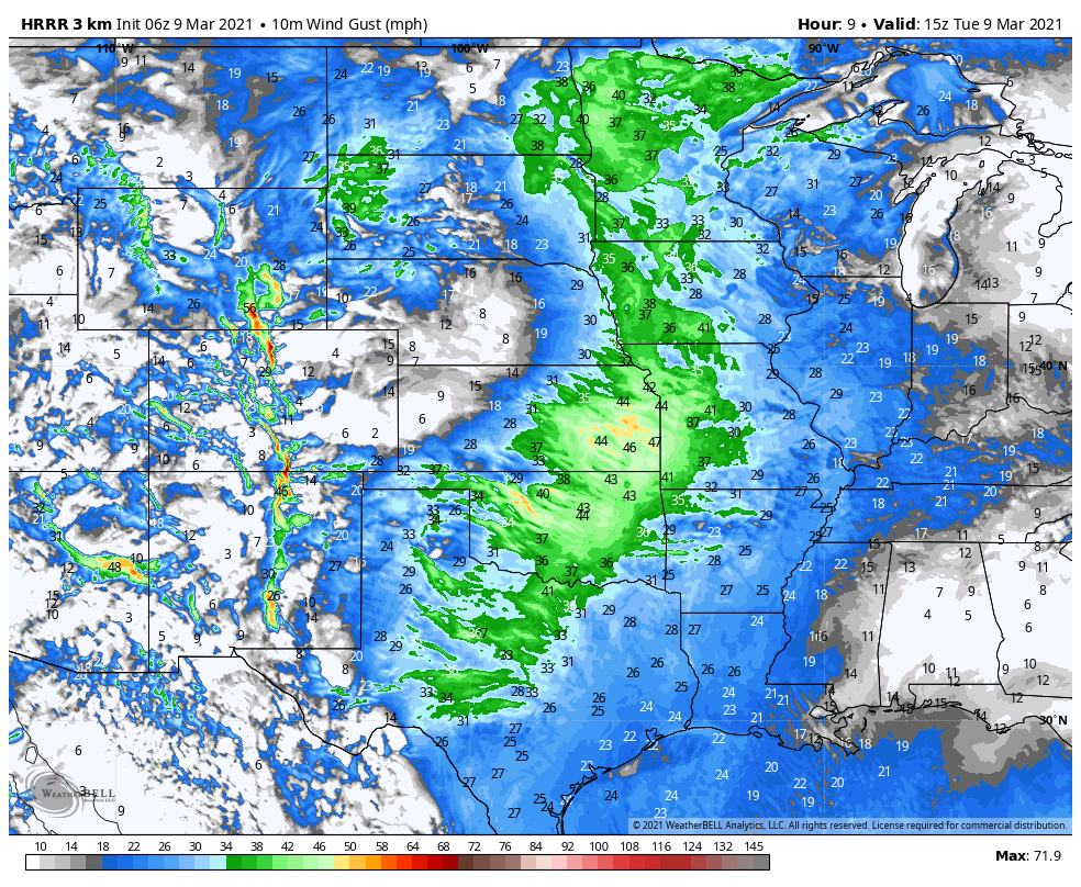
This is an image of the forecast wind gusts today. You can see some numbers in eastern Kansas getting close to 50 mph.
The higher humidity will first lower the fire danger without rain. Then, as a cold front moves through Wednesday night this higher moisture air will help to generate showers and thunderstorms, some strong with hail the main threat. Some locations could see a quick 1" of rain.
A slow moving storm system will track in from the southwest USA this weekend. This storm system will force the warmer and more moist air over the colder air we will have in place. This will generate waves of widespread rain and a few thunderstorms. This will end the fire danger and bring much need water to rapidly drying out soil.
We are zero for March when it comes to rain. We should have around .50" by the 9th of March and the whole month averages 2.37".

The video below has the details on our big weather change.
Have a great rest of your week and stay healthy.
