

Good morning bloggers,
We are a week or so away from setting the record for the longest cold spell in Kansas City's recorded history. Back in 1983, Kansas City experienced 11 days in a row under 20°. Today is our fifth day in a row under 20°, so a week from tomorrow would tie the record if we stay that cold, and it appears that we will. In fact another surge of Arctic air, another Arctic Blast will arrive tonight and put us into the single digits for around a week with a good chance of dropping to below zero,
What is going on? As discussed in the earlier week blogs, there has been a block over Canada. This finally became strong enough to blast the Arctic air south. And, now that it has arrived, it is difficult to move it out. The blocking that helped cause this is going to weaken and fall apart in the next few days. It may take another ten days to finally move this Arctic air out.
It dropped to 9 degrees this morning, and a cold surge is arriving. Here is that record that we may tie or break later next week.

While we are in the deep freeze there is a series of storm systems that will bombard many locations from Texas, Oklahoma, and Kansas, northeast across Missouri to New York. How much of the southern cities will be impacted and will KC get hit by one or two of these snow storms? Let's take a look at the European Model and the GFS Model from last nights model runs:

The European Model, above, had two storm systems affect KC with the bull-eye south of Kansas City. The two storms are timed for Sunday/Monday, and then Tuesday. The American Model shows these two storms and there is an interesting sliver of lower snowfall amounts right over the KC metro area.

The lowest amount in our area is around 2 to 3 inches with the potential for a lot more. The reason the American Model had much lower snowfall amounts in our area is due to the track it takes the big storm. It tracked that storm south of KC, and the European Model tracked that storm right over Kansas City. Here is that European Model track on Monday.

We will analyze the new data and update our forecast on 41 Action News. I will be looking at the track from all of the models and deciding which one I believe is going to be the most likely, and then we will share it with you on our newscasts today and tonight.
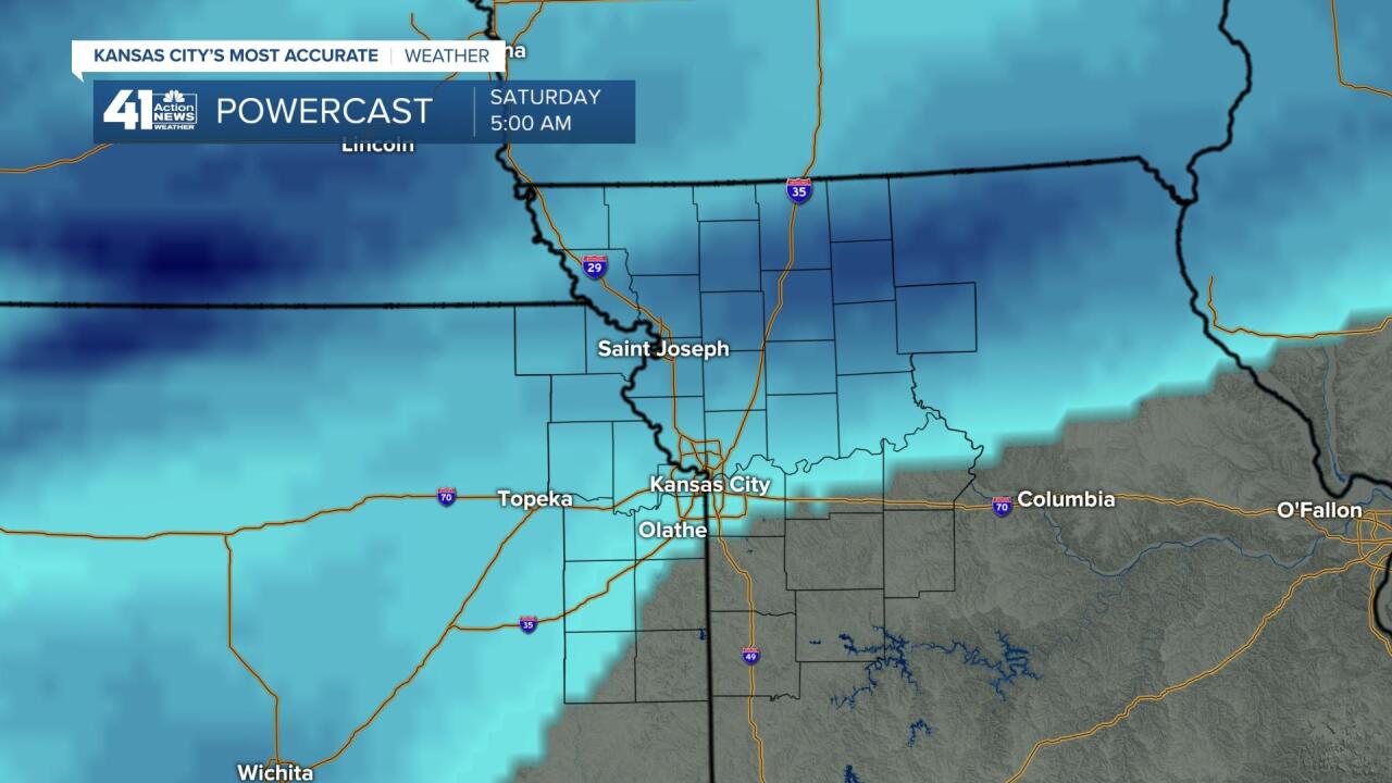
Before we get to next weeks storm systems, we have a chance Friday night. It is looking like this snow will get to us Friday night, but the word "us" may still mean it misses some of us southeast of KC. By early Saturday morning this system is about to fall apart. And, southeast of KC may only see some flurries. Around an inch of snow is possible from this lead storm of the series of storms.
Thank you for spending a few minutes of your day reading the Action Weather Blog. Have a great day!
Gary
