

Good morning bloggers,
Thunderstorms welcomed us early this morning. Here is the radar at 5:42 AM:
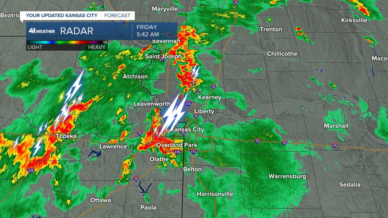
These thunderstorms have been producing rather vivid lightning, booming thunder, and heavy rain. That second band is moving our way as well. These have not been severe, so just beneficial rainfall. A Flash Flood Watch has been issued for areas south of KC. Thunderstorms will be developing off and on, and later tonight into Saturday there is a good chance of excessive rainfall in a few spots.
6:45 AM Update:

The morning thunderstorms will continue and there will likely be a break later this morning. Most of the KC metro area is experiencing these heavy thunderstorms. Just west, Lawrence, KS and Douglas county is under a Flash Flood Warning. Water will rise quickly in area creeks and they could be become raging rivers in a short period of time. Remember, "Turn around, don't drown".
This band of rain will move through and past Kansas City by mid to late morning. This will likely leave the rest of the day mostly cloudy with either lingering showers, or drying out for many hours this afternoon and evening. The high school football games will likely be having to monitor the sky for any new development. The most likely scenario will be for thunderstorms to form west of KC again after sunset and head our way by morning as you can see here:

This map, above, shows a slow moving cold front near KC. If it is indeed near Kansas City, then 2" to 5" of additional rainfall is likely. There is a chance it could line up a bit farther south, so we will be monitoring this closely. Flooding is the main risk with lightning and thunder. Other severe weather types are not expected at this time.
Kansas City Weather Time-Line:
- Today: Rain ending before noon. The chance of rain will go from 100% this morning to 30% this afternoon. The chance of rain will increase after sunset tonight, and more likely after midnight. High: 78° to 80°
- Tonight: Cloudy with rain and thunderstorms forming. The most likely time-frame for thunderstorms is after midnight. The chance of rain will increase from 30% at sunset to 100% by Saturday morning. Low: 65°
- Saturday: Rain likely in the morning. A Flash Flood Watch is in effect. High water in the usual spots and possible high water along usually low creek beds need to be monitored closely. The rain will taper off by around noon. It will be mostly cloudy with some sun later in the day possible. High: 76°
- Sunday & Labor Day: Mostly sunny with light winds. Highs 80° to 83°
Thank you for spending a few minutes of your day reading the weather blog. Have a great holiday weekend. Watch KSHB-41 News and we'll keep you advised!
Gary
