


Happy 2024 bloggers,
I hope everyone had a happy New Year and great holiday season.
Before we look ahead, we will look back at December 2023 and all of 2023. This past year was the 17th warmest in Kansas City's history. The winter months of 2023 (January, February and December) were some of the warmest months with the average winter temperature sitting 6.1° above normal.
Taking a look back at 2023 it was the 17th warmest year on record here in Kansas City with 10 of the 12 months sitting above average and a lot of winter warmth. Winter warming is becoming the new normal with Kansas City (and 200+ other cities) trending up since 1970 #mowx @KSHB41 pic.twitter.com/WXZPyxFGOn
— ☀️ Cassie Wilson (@CassieKSHB) January 2, 2024
When you look at our temperatures across 2023 it was the highs that pulled our trend up. The average high in 2023 in Kansas City was the 10th warmest at 67.6°, placing us in the top 7th percentile for afternoon warmth. Our average was closer to the middle of the distribution but still leaned warmer than normal.

In terms of precipitation we fared alright when it came to rain but not so much when it came to snow. Our rain total for 2023 was 37.37" placing us right about in the middle of the record. But snow was low at 10.5", 2023 was the 21st lowest snow year in Kansas City's history.

DECEMBER 2023:
It was much warmer than average, especially on the low temperatures. We ranked as the fifth warmest in our 136 years of history on the lows.
As a matter of fact, this was the fourth December in our 136 years of KC weather records where we did not have a low below 20°. Our coldest low was 21° on the 19th, which was the second warmest low. The warmest was 24° in 1931.

We received 3.04" of rain, which ranked as the 11th wettest in 136 years. Snowfall was the 36th least as we saw just 1" of snow, which is 3" below average.

What does January average?
JANUARY AVERAGES:
On average, January is our driest month, averaging just 1.16" of rain/melted snow. We average 4.9" of snow, which is the second highest on average.
The month with the highest average snowfall is February at 5.9".

The average high and low do not change much — 39° to 40° on the highs and 21° to 20° on the lows from the 1st to 31st.

One thing you may notice by the end of the month: we gain 41 minutes of daylight as we start the march to spring. The sun sets at 5:01 p.m. on the 1st and 5:31 p.m. on the 31st.

KC seldom stays on average. We are tracking three storm systems between Jan. 5-10. They may veer us off average in one parameter.
You can for sure see the system for Friday and Saturday. There is a very small system for Sunday that is hard to find.
The third and biggest system is not formed yet either, but it is embedded in the jet stream behind the massive storm in the Gulf of Alaska.

SYSTEM #1 (FRIDAY-SATURDAY):

SYSTEM #2 (SUNDAY):

These systems will bring areas of mostly light snow, rain, drizzle or a rain/snow mix with temperatures between 32° and 38°.
This is a very similar setup to last week when we saw snow for three days and accumulations on grassy surfaces were a dusting to 2". Decks, overpasses and some surfaces had areas of slush, but most surfaces stayed wet.
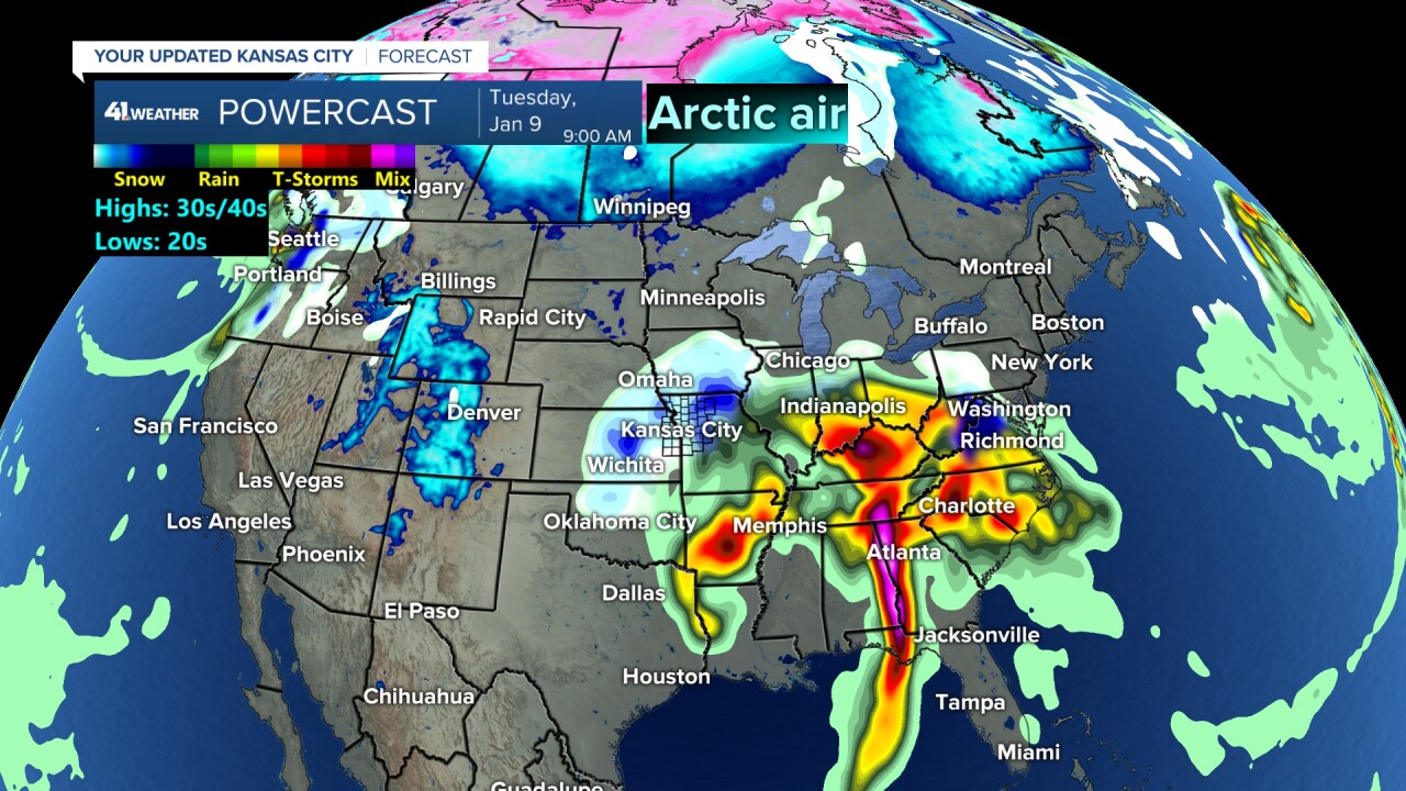
Clouds will keep lows at or above 32° as you can see the Arctic air, temperatures 10° or colder, is in Canada.
SYSTEM #3 (NEXT MONDAY-TUESDAY):
This is a bigger storm, but there is still no Arctic air as it remains stuck in Canada. So, we are dealing with a rain-to-snow or rain or rain/snow mix situation.
This storm will have a better chance to see snow accumulation as it is stronger. So, if it snows, it could come down hard enough to overcome the 32° temperatures.
And, since it is bigger, it may pull down slightly colder air, cold enough for there to be a true accumulating snow.
There are still questions on all of this. We will be updating each day.

RAIN/SNOW FORECAST NEXT 10 DAYS:
Based on this data, the main accumulating snow is north of our area. But this is far from set. Our best chance to see accumulating snow will be with the third storm system.
Notice the rainfall. We could see .50-1.50", regardless of how much snow sticks.
Remember, that is a lot of rain for January. We average 1.16" for the whole month, so this is the parameter that will be skewed away from the average.
At the very least, we will get rain or wet snow that does not accumulate much, helping the drought conditions.

Have a great first week of 2024.
Stay healthy.
—
