


Good Saturday bloggers,
We are tracking a small winter system today. The computer models have been all over the place on amounts and placement of the precipitation. Add in temperatures around freezing and you get the making of a complex forecast.
So, when this happens you have to take the forecast one hour at a time. This means more nowcasting which entails looking out the window and monitoring radar.
As of 8:15 a.m. we have not seen any precipitation falling to the ground as most of it is likely evaporating before it reaches the ground.
Radar, however, is starting to light up.
We are seeing snow from northeast Kansas to northwest Missouri. This is virga, evaporating before reaching the ground.
Sleet, snow and rain showers are increasing from around I-70 and south. Some of the precipitation may be reaching the ground, but look at the temperatures. They are above freezing. So, anything that does reach the ground will melt turning surfaces damp or wet.

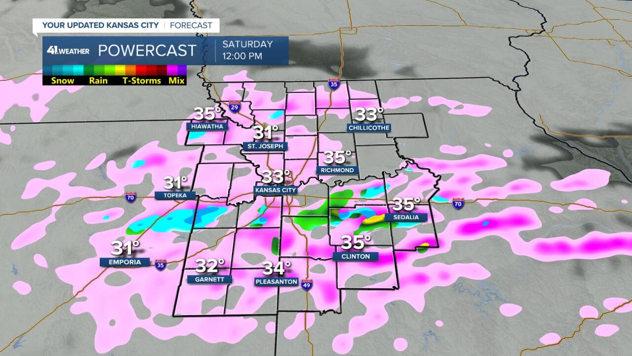
Let's go through the forecast.
NOW-NOON:
We will see the mixed (rain, sleet, snow) precipitation increase with temperatures at or above freezing. So, most surfaces will become damp to wet. If a location is seeing a heavier sleet/snow shower then surfaces would get slick.
NOON-4 P.M.:
The rain, sleet, snow showers will trend to all snow as temperatures drop a degree or two, which means in the 30°-32° range. This is the period where the sun angle decreases, so the chance of slick spots, and some snow accumulating increases. Not only is the sun angle decreasing, but the temperature is dropping.
If you are headed somewhere to watch the Chiefs game be aware of the possible slick road conditions.

4 P.M.-MIDNIGHT:
The mix/snow will end 6-8 p.m. as temperatures drop to the mid and upper 20s by midnight. So, any surfaces that are wet will freeze. Also, some paved surfaces may have some snow on them with water and ice underneath.
Total snowfall will be a dusting to 1" on mostly grassy surfaces.

WEATHER TIMELINE REVIEW:
The main time for slick spots will be this afternoon, especially after 3-4 p.m.

SUNDAY:
Any snow or ice from today will melt as the sun returns and highs reach the low 40s. Monday will see 50s for high temperatures.

Have a great weekend.
Stay healthy
