


Good Tuesday bloggers,
BLOG UPDATE 4:30 PM:
A line of thunderstorms will cross the south side of the KC area. The best chance of severe weather will occur south of Olathe where 60 mph wind gusts are possible. Locations to the north will see a period of beneficial rain and thunderstorms with 30-50 mph wind gusts.
The timing is between 5 and 7 PM. Lighter rain may linger until 10 PM.
Hopefully your yard or farm will receive .10" to 1" of rain.

———————————————————————————————————————————————————-We are in for an odd weather day as we are tracking a line of severe thunderstorms in northwest Kansas. This line is heading towards KC, but we feel it will weaken just as it approaches. That being said, locations west of a Lawrence to Ottawa line have a chance to see damaging winds and large hail, slight chance of a tornado. That is close to KC, so we have to watch this closely.
This line of thunderstorms is going to track along and just north of the stationary front shown below. The front may drift north this afternoon, so this is why we have to watch it here in KC.
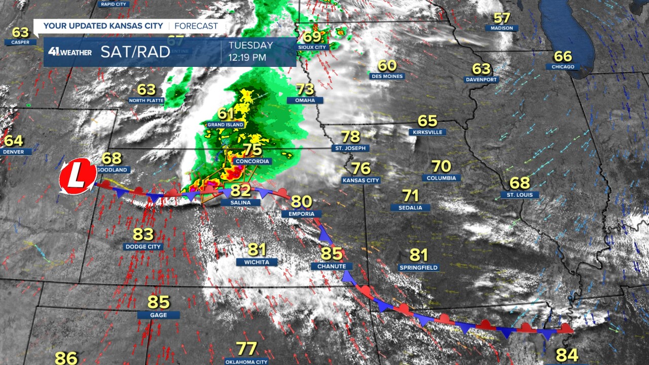
The timing for this line is for it to arrive in KC 6-7 PM and Lawrence 5-6 PM. Temperatures will drop very fast from 75-80 to 60-65 with the area of rain and thunderstorms. Hopefully, we get the much needed rain and not the severe weather.

So, the latest timeline for KC weather today.
NOW-5 PM:
Dry with highs in the low 80s.
5-9 PM:
A good chance of thunderstorms with the main threat of severe weather west. Damaging wind and large hail are the main threats. Hopefully, we get .25-1" of rain.
AFTER 9 PM:
Chance for scattered, non-severe showers and thunderstorms.

We will update the blog this afternoon.
Have a great day and week.
Be weather aware and stay healthy.
