

Good Friday bloggers,
You are not supposed to have your most legitimate chances of severe weather around here during the summer. But, that is what we have as we track a series of disturbances coming out of the Rockies along with a weak cold and warm front. These features combined with extreme humidity are the ingredients for thunderstorms. Since the flow aloft is just strong enough, severe weather is possible and due to the extreme amount of moisture in the air, flooding is likely as rainfall rates can be 1"-3" per hour!
Take a look at the rainfall estimated by radar during the last 24 hours from about 2 AM this morning. 6" to 10" of rain has occurred across the northeast corner of Kansas to St. Joseph, MO. These were some rather dry areas, and needed rain, but this is ridiculous. Locations in the KC area still need rain as there was a sharp cutoff and amounts have been in the .25" to 1.30" range.
There are many rain chances the next 7 days, so if you still need rain on your yard or farm, remember patience is a virtue. You will likely not have to wait long anyway. Locations that have seen too much rain, well, there could be some issues the next 7 days.

There was some severe weather as well. There were numerous wind reports on Thursday across northern Missouri. There were 3 tornado reports from southwest Iowa to western Illinois as well.

What's next?
Today we are in a level 2 of 5 risk with the primary threats large hail and damaging winds. The chance of a tornado or two is there. The chance of seeing a tornado within 25 miles of your location today is 2%. So, odds are you will not see a tornado today. That being said, be weather aware today as you should all days, but especially a day like this.
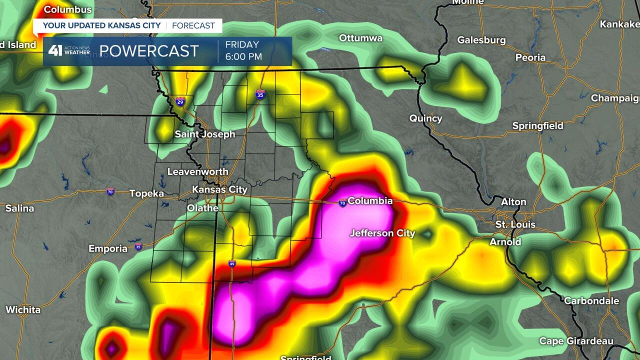
There is also a Flash Flood Watch. Remember 6" of flowing water can float an SUV. "Turn Around Don't Drown."

There are 3-4 scenarios on how this day will play out. The location of new thunderstorms will depend on where surface boundaries are left after the Thursday night-Friday morning thunderstorms.
SCENARIO #1:
This is the development of a strong to severe line northwest of KC 3-6 PM along a cold front located there. This line would come rolling through 6-10 PM with possible strong winds and flash flooding. The tornado threat is there as well. Especially northwest of KC.

SCENARIO #2:
The strong to severe thunderstorms form near our area 12-3 PM. They could produce strong winds, hail, flash flooding and perhaps a tornado.
SCENARIO #3:
This configuration of thunderstorms rolls through this morning from a disturbance out west. This would bring heavy rain and possibly strong winds with some flash flooding. If this happens, it would lead to scenario #4. Now, if the morning thunderstorms roll through very weak, scenario #2 or even #1, are still in play.
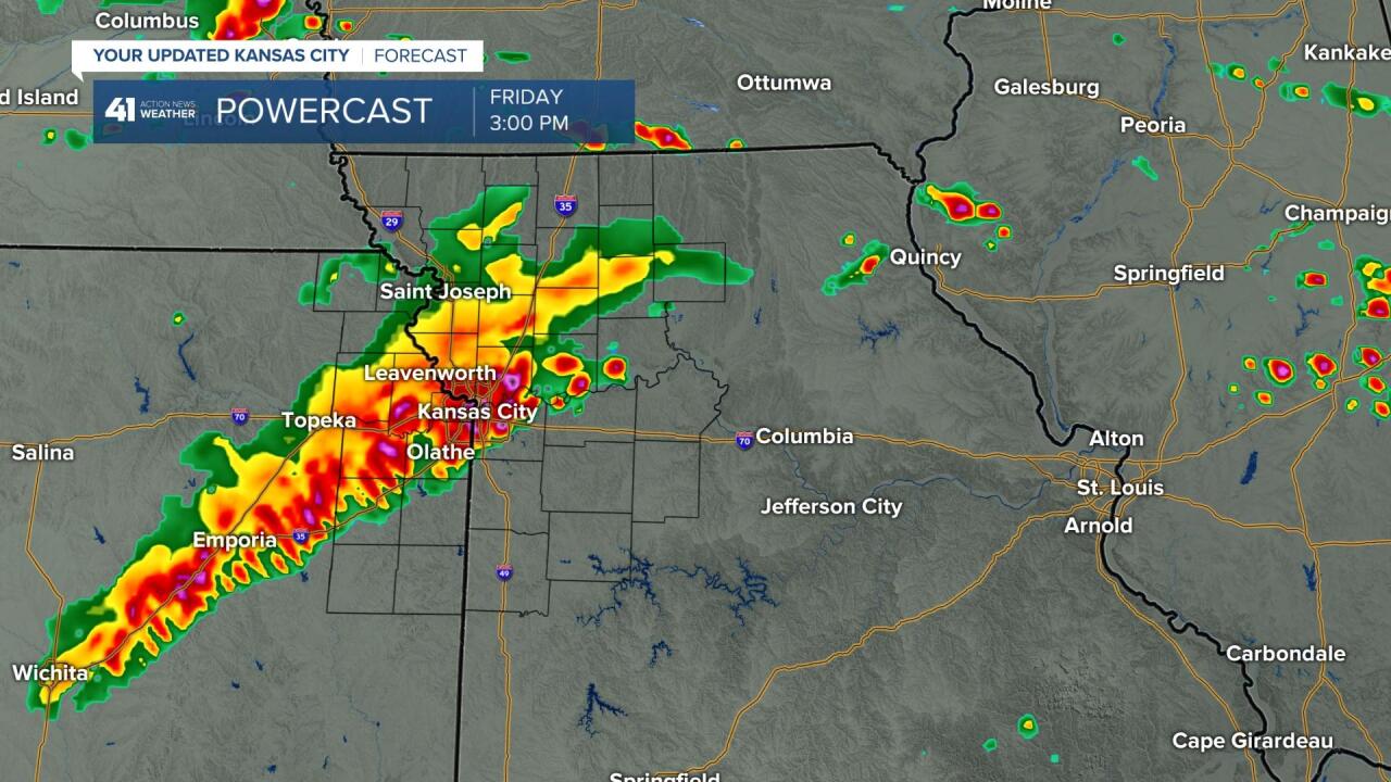
SCENARIO #4:
Since morning thunderstorms would roll through during the morning, it pushes the front farther south. This would mean strong to severe thunderstorms (flash flooding, strong winds, and a tornado would be possible) would form south of KC and then head south, missing KC.
Which one is right?
We lean with #3 or #4, but we have to see how the weather evolves the next few hours.
We will update the blog as needed.
Have a great weekend, stay healthy and weather aware.
