

Good morning bloggers,
Tropical Storm Elsa tops the weather news today. Elsa is another system predicted by the LRC months ago. Take a look at our forecast path that I drew in on this map on February 1st to arrive around late June or early July. And, look at the actual track. For those of you with interests in this region, the fact that this system did form as predicted triggers an 84% chance of a stronger named storm either in mid-late August or in early October, one of the next two LRC cycles.

Elsa is now about to make landfall and it will track across northern Florida into Georgia today. This is a fast moving system which will limit the rainfall amounts. There will still be flooding impacts and winds gusting to 50 mph or stronger today along the path with a chance of a few tornadoes.
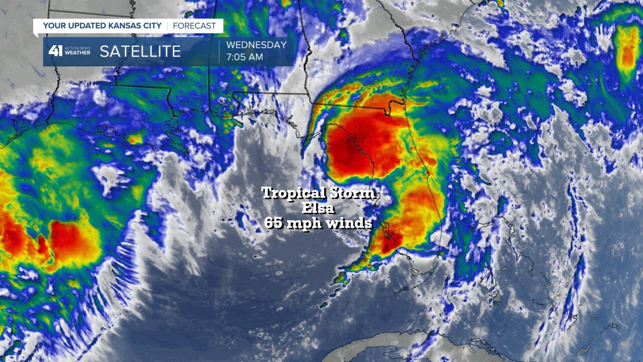
Elsa was intensifying just a bit as it approached landfall.
Kansas City Weather:
While Elsa moves inland, our weather in KC is becoming interesting. Let's take a look.

A weak cold front is approaching from the northwest this morning. This will gradually move southeast across our area this afternoon and evening. A few showers and thunderstorms will likely form, and they already did form northwest of KC this morning. The best chance of thunderstorms will be between 2 PM and 7 PM this afternoon and evening. We aren't expecting any severe weather today.
There is a slight risk of severe thunderstorms Friday night into Saturday as a much stronger cold front moves through. How do 70s for high temperatures sound. It is difficult to have sunshine and 70s at this time of the year, but that is the forecast for Sunday. As the stronger cold front moves through, thunderstorms will be likely. A few spots may have very heavy rainfall.

By Saturday morning, the stronger front will be approaching, and by Saturday night it will move through cooling us off on Sunday.
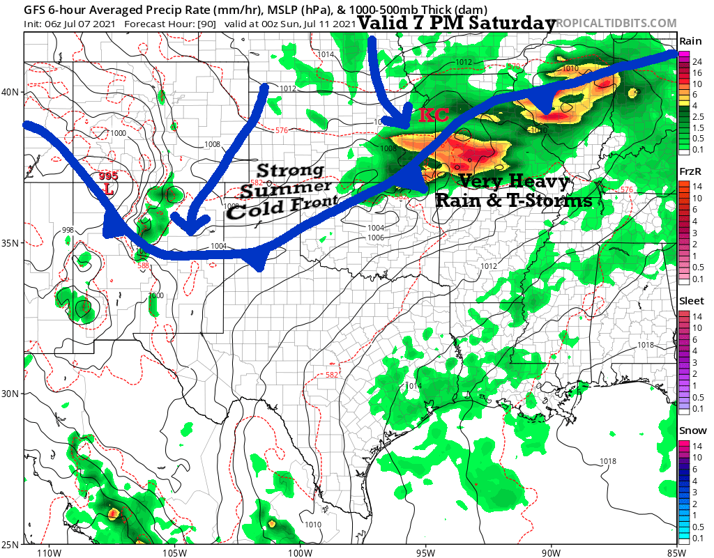
This latest data has the heavy thunderstorms north of KC, then south of KC. We will be monitoring the computer models closely as this approaches us Friday. Out ahead of the stronger summer cold front there will be a big warming trend. So, the best pool day appears to be Friday with south winds and hot temperatures. Get that sunscreen ready.
Kansas City Weather Timeline:
- Today: A few clouds building up with the sun shining through. There is a 60% chance of showers or thunderstorms this afternoon. High: 86°
- Tonight: The wind shifts to the north at 5 to 10 mph. It will be a bit cooler by morning. Low: 64°
- Thursday: Mostly sunny. Light south winds return. High: 84°
- Friday: Sunny, hot, and humid. South winds 10-20 mph. High: 94°
- Saturday: Cloudy with showers and thunderstorms likely. Heavy rain is possible with 1/2" to 2" of rain expected around our region. The wind will shift to the north. High: 82°
- Sunday: Morning showers and thunderstorms ending. Cooler air will move in with sunshine returning. High: 78°
Thank you for sharing in this weather experience. Have a great Wednesday!
Gary
