


Good Tuesday morning blog readers —
Our active weather continues across the region with showers and storms moving through this morning. These storms produced a couple reported of tornadoes in eastern Kansas.
These storms will continue to move east this morning.
But there is a lingering second round of storms that could fire this afternoon as well.
Morning: 6 a.m. to 12 p.m.
- Confidence: High
- 50-60 mph wind gusts
- Quarter-size hail possible
- Low threat for a tornado
- Storm movement: ENE ~50 mph
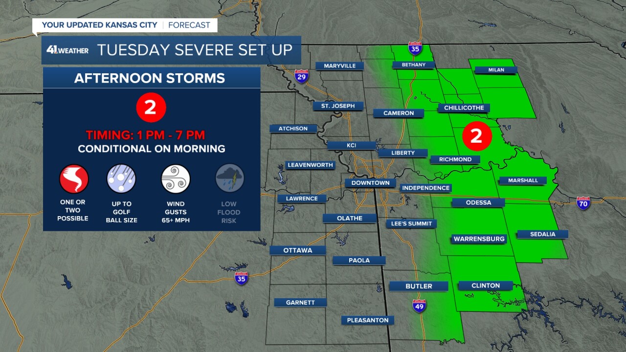
Afternoon: 1 p.m. to 7 p.m.
- Confidence: Medium (conditional on how much stabilizing we see through the morning. Regardless the threat is well east of KC)
- 65+ mph wind gusts
- Up to golf ball size hail
- Isolated tornado possible
- Storm movement: East ~40 mph
There is also one other key factor to your Tuesday forecast — the wind! Baseline winds are going to be rough with gusts up to 45 miles per hour possible.
There is a wind advisory for all of eastern Kansas and western Missouri until 7pm.
Brace yourself, your patio, your trash can etc. as we will hold onto gusty south based winds. Wednesday we stay breezy with wind improvement coming by Wednesday night.

Next Chance for Rain: Thursday
There is another system lining up to impact the Kansas City area and southern Plains by Thursday.
This system right now is tracking slightly south and setting up to bring severe weather back to Oklahoma.
There is a chance areas south of I-70 could be added into a low end severe risk. But right now I don't love the energy to big thunderstorms in Kansas City.

So by the end of the week are we looking to pick up a lot of rain and do we even need rain? Short answer, some rain, and yes we need the rain!
After a wet winter, the past 30 days Kansas City has dried out a bit. We are currently sitting at 34% of normal.
Now Thursdays rain totals are a bit variable but after today and Thursday we could pick up 0.5 to 1 inch of rain this week.


But Thursdays system has a bigger impact that we need to talk about — cool air.
Expect temperatures to drop rapidly to close the work week, bringing us into the 50's for the weekend. So our summer air will fade fast as we fall below average for a few days.

