

Good morning bloggers,
Thunderstorms are possible today into the weekend. The activity moving our way this morning will likely weaken and perhaps bring us a brief shower or two, but with no risk of severe weather until later tonight. There is a disturbance heading our way:

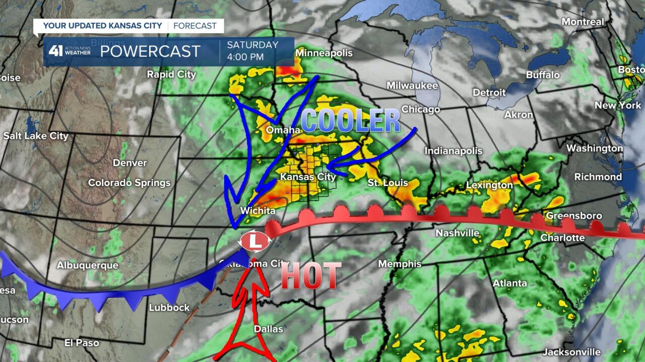
These morning showers and thunderstorms are associated with a fast moving disturbance. This will pass by early this afternoon and we may have a brief shower or thunderstorm as it moves by. These are, what we call, elevated which means they are not surface based showers and thunderstorms which will limit the chance of them becoming severe. This disturbance will go by, and then we will look for new development along and north of the warm front, the red line on this forecast map below:

We will be analyzing the surface conditions closely as this warm front sets up. Right now, I see the best chance of any severe thunderstorm development as being north of the front near the Iowa border. And, this chance is most likely to develop around sunset or around 8 or 9 PM. After these thunderstorms form, they will organize and move south and southeast. This is why I am thinking the best chance of any significant thunderstorm activity in KC will be closer to 4 or 5 AM on Saturday.

The Storm Prediction Center has placed a level 3 out of 5 severe weather risk in our region. Again, I believe this risk is closer to the Iowa border, but we must see how this mornings thunderstorms impact where the warm front lines up. We are in northwest flow aloft, as you can see below:
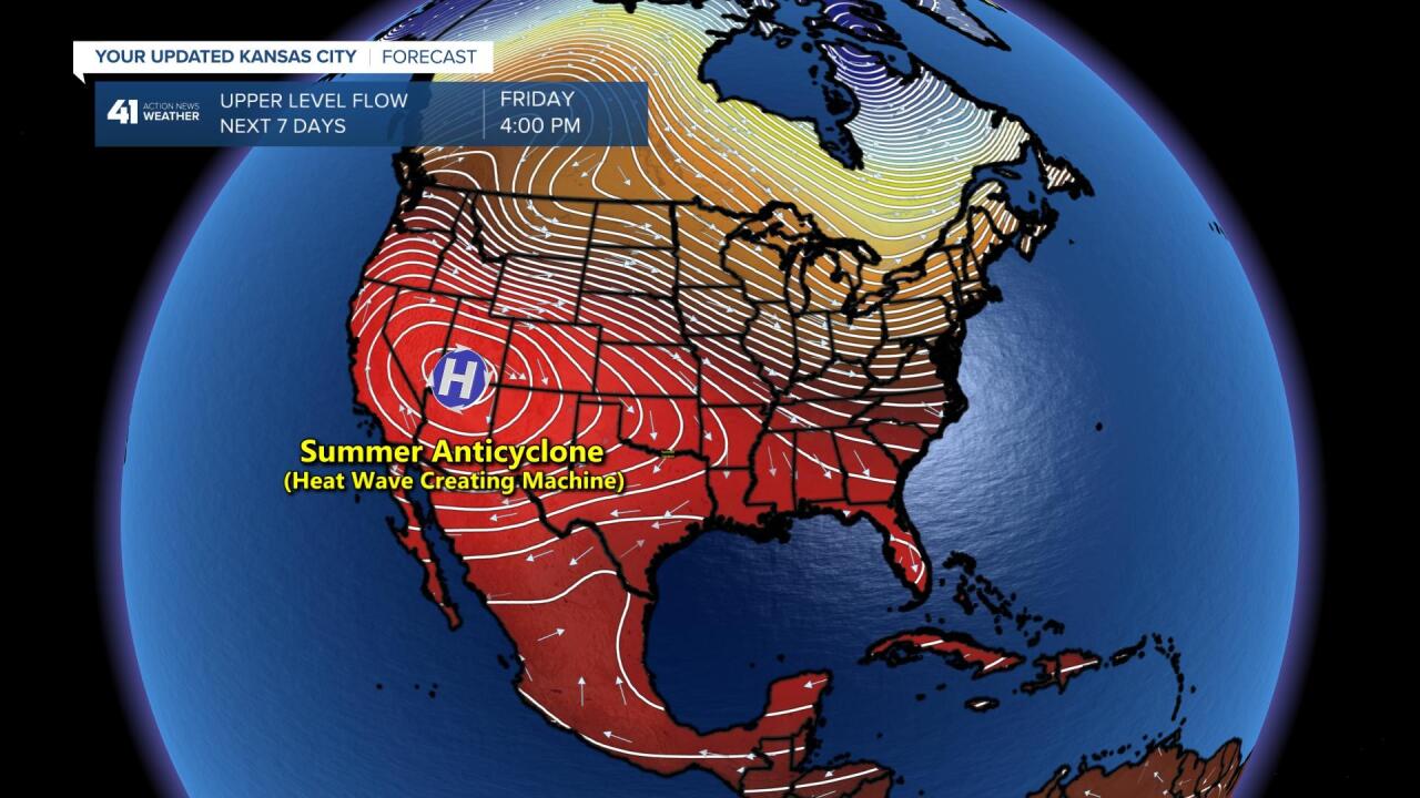
This fascinating summer pattern is producing the conditions for the risk of severe weather. Usually, when you are in northwest flow, the best chance of thunderstorms in our area is late at night. into the morning hours. The summer "anticyclone" or heat wave creating machine is developing out west. It may get close to 120 degrees in California in the next few days. Look at what develops by the end of the weekend, below:
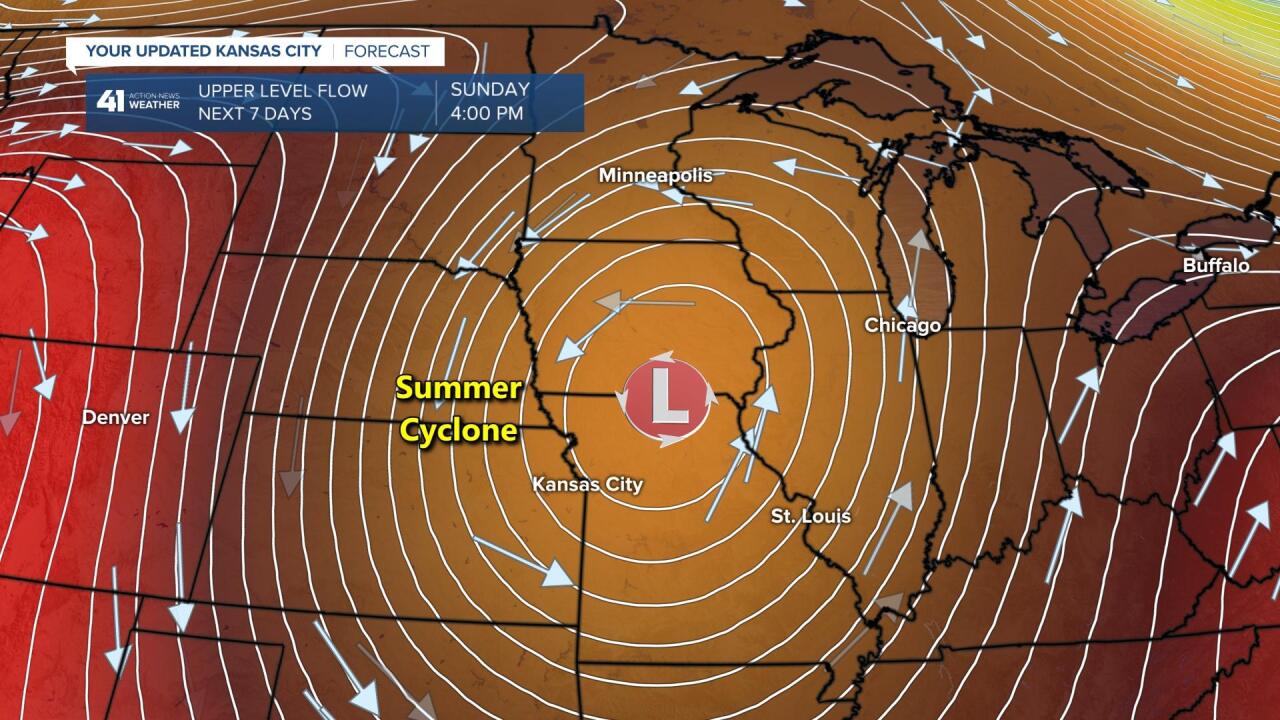
A rare summer cyclone is going to form this weekend over Iowa and possibly drop south over Missouri. A cyclone is really any low pressure center. A hurricane is a cyclone. A tornado is a cyclone, and a strong upper level storm system shown above is a cyclone. This is a strong system that develops northeast of KC. Little disturbances will rotate around this developing storm and we will see a chance of a few periods of showers and thunderstorms over the weekend. I am expecting around three to four bands of rain and thunderstorms between now and Monday with 1 - 3 inches of rain possible.
The new data is coming in validating our thoughts and forecast. The best chance of any significant thunderstorm activity is after sunset, and more likely around 6 AM Saturday morning.
Kansas City Weather Timeline:
- Today: Partly cloudy with a chance of a few showers and thunderstorms later this morning into early this afternoon. High: Near 90°
- Tonight: Mostly cloudy with a chance of strong thunderstorms after 3 AM. Low: 73°
- Saturday: Mostly cloudy with a couple periods of showers and thunderstorms. High: 80°
- Sunday: Mostly cloudy with a few showers and thunderstorms likely. High: 73°
Thank you for spending a few minutes of your day reading the Gabbing With Gary blog. We will be monitoring the developments closely. Have a great day! And, have a great Friday Night In The Big Town.
Gary
