


Good Wednesday bloggers,
We have seen temperatures rise since midnight Tuesday night when it was 9°. Temperatures are around 40° early Wednesday. The steady to rising temperatures will basically continue until around noon-4 p.m. Thursday ahead of a weak cold front.
The temperature may dip a few degrees this evening before resuming the upward trend.

THURSDAY:
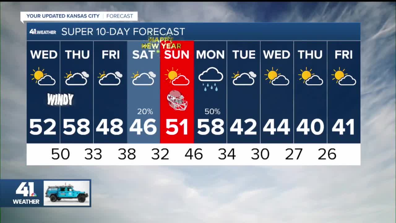
The high on Thursday will be somewhere between 55° and 61°. There are two factors that will make the difference between highs in the mid 50s or low 60s.
The two factors are the timing of a weak cold front and the chance of lower stratus clouds. If the front holds off until 3-4 p.m. and there are no low clouds we will see highs in the low 60s. If the front holds off, but there are low clouds we will be in the upper 50s. If the front comes through around noon or sooner, regardless of low clouds highs will be in the mid 50s.
We lean with seeing highs around 60° as the front looks slower and low clouds may get shunted off to the east.

The cold front we are tracking on Thursday is associated with a storm system that will bring a period of snow and rain to Nebraska, Colorado and perhaps to northwest Kansas. The snow and rain will track northeast, staying well north of KC. Showers and thunderstorms will increase across Arkansas, Louisiana, eastern sections of Oklahoma and Texas and southern Missouri. This will be well southeast of KC.

FRIDAY:
Another system will bring rain and a few thunderstorms to eastern Missouri. Bigger thunderstorms will be possible in the southeast USA. We will see periods of clouds, highs in the 40s and an east-southeast wind 5-15 mph.

NEW YEAR'S EVE:
Another weak system will race by bringing our area the chance of a few rain showers. If they do move through, they will most likely be over during the evening as we ring in 2023. Highs here will be in the 40s after lows in the 30s.

NEW YEAR'S DAY:
2023 is going to start with some rather nice weather. Highs will be around 50° after lows in the 30s with an increasing east breeze at 5-15 mph. The sun will be shining through high clouds. So, the weather for the Broncos game will be far more tolerable than it was for the Seahawks game.

MONDAY:
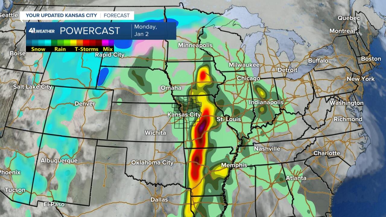
The second day of 2023 will feature a bigger storm system tracking out of the southwest USA into the Plains. This storm will bring rain and a few thunderstorms from around Interstate 35 and east. The rain-snow line is north of Minneapolis which gives you an idea of the milder weather pattern in place for now. Arctic air may be returning towards the second half of January.

As the storm system moves east, the rain and thunderstorms will increase. Some severe weather will be possible later Monday and Tuesday next week from eastern Missouri to Louisiana and points east.
Have a great week and stay healthy.
