


KANSAS CITY, Mo. — Good morning bloggers,
Winter storm warning: A winter storm warning has been issued for our region. A dramatic 48 hours of weather is in the forecast as we go from 60 degrees to a potential snowstorm this week.
As we open the discussion on how much snow may fall, let's begin by looking at what has fallen so far this season:

Every model has been coming in with a forecast of at least the 5.3 inches we have had all season thus far. We will go over the models as they come in this morning. Some of them have had over a foot of snow near the south side of the city. I am not ready to go there yet with our forecast. I think that we will see at least 2 or 3 inches of snow, which is rarely ever a sure thing around Kansas City. And, the potential for a lot more is there.
I usually emphasize waiting to get specific on numbers until we are within 48 hours of it starting. Well, we are at that point now, and we have seen many times that the new data at this point will trend a bit south or a bit north. If the trend is a bit south, then suddenly we would be on the edge of the significant snowfall. And, if it trends a bit north, then we are full into the meat of this storm system with higher snowfall amounts possible. I will be looking for this trend today.
7 a.m. Wednesday forecast:
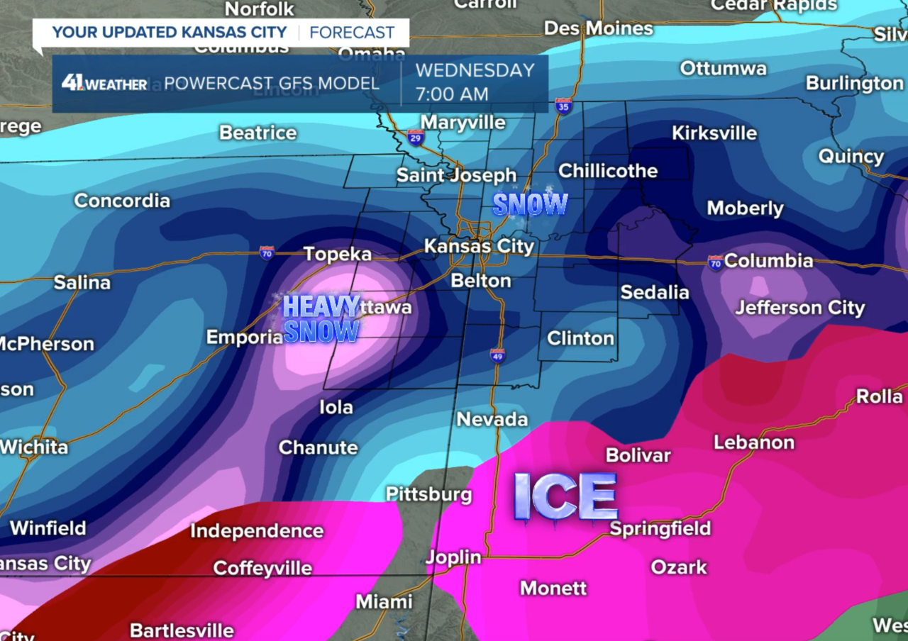
This storm will likely have two main waves of energy that will head our way. The first wave will move across Wednesday and the second wave will move across Wednesday night and Thursday. The areas that get hit by both waves will have the highest snowfall totals.
The second wave of energy has a well defined northern edge as you can see below
Midnight Wednesday night forecast:

Look at that northern edge. It is of extreme importance that we watch where this lines up. Notice how on this second wave, this model shows snow to no snow cutoff line just north of St. Joseph. Again, if this storm is ever so slightly farther south, then that line could suddenly be near or south of Kansas City. This would significantly cut into the totals. If it is ever so slightly farther north, then we would suddenly be in both waves of snow and the higher amounts are possible.
Another factor that I have yet to discuss: An Arctic blast is arriving with this chance of snow. Temperatures will be crashing Wednesday into Thursday and possibly get down to below zero by Friday morning.
I will fill in these model totals as the new data rolls in. The NAM model is the first one on the clock. It will be in by 9 AM. And, then the other models will follow between now and when the European Model comes in around 12:15 PM. So, check back in.
Model forecast predictions:
- NAM Model: This model came in with a south shift this morning. This model is not the most reliable one, so we will see how the other models come in. It has 4" in St. Joseph, 6" at I-29 & Barry Road, 9" in Lee's Summit, and 14" in Sedalia. Wow!
- ICON Model: The trend was a south shift on this model too, with KC on the edge of the heaviest snow. This model has 4" near St. Joseph, 6" near I-29 & Barry Road, 8" in Lee's Summit, and 15" in Sedalia. Wow again!
- GFS Model (American Model): This model came out with a farther south shift. It has 2" at St. Joseph, 4" at I-29 & Barry Road, 8" in Lee's Summit, and 14" in Sedalia
- Canadian Model: This model had wide spread 4 to 7 inch amounts
- European Model: The European Model came out with all locations of KC getting at least 6" of snow
Our initial forecast prediction: 2-3 inches at the low end near the Kansas City metro area. We will go over these possibilities with our forecast tonight!
Thank you for sharing this weather experience and spending a few minutes of your day reading the weather blog. Have a great start to the week.
Gary
