

Good Friday bloggers,
All I can say is "wow!"
Almost drought to deluge! Our area had moved into a level 1 of 5 drought (also known as "abnormally dry") situation during the last drought monitor update on Aug. 10. Olathe, Kansas, has seen around 8.30 inches of rain the last 24 hours after seeing around 1.50 inches of rain during the previous six weeks. Downtown Kansas City, Missouri, to Olathe to Lee's Summit had seen just 30% average rainfall July 11 to Aug. 11.
This is the percent average rainfall during the 30 day period from July 11 to Aug. 11. Downtown KCMO to Knob Noster and St. Joseph to Cameron were the driest with 20-35% average rainfall.

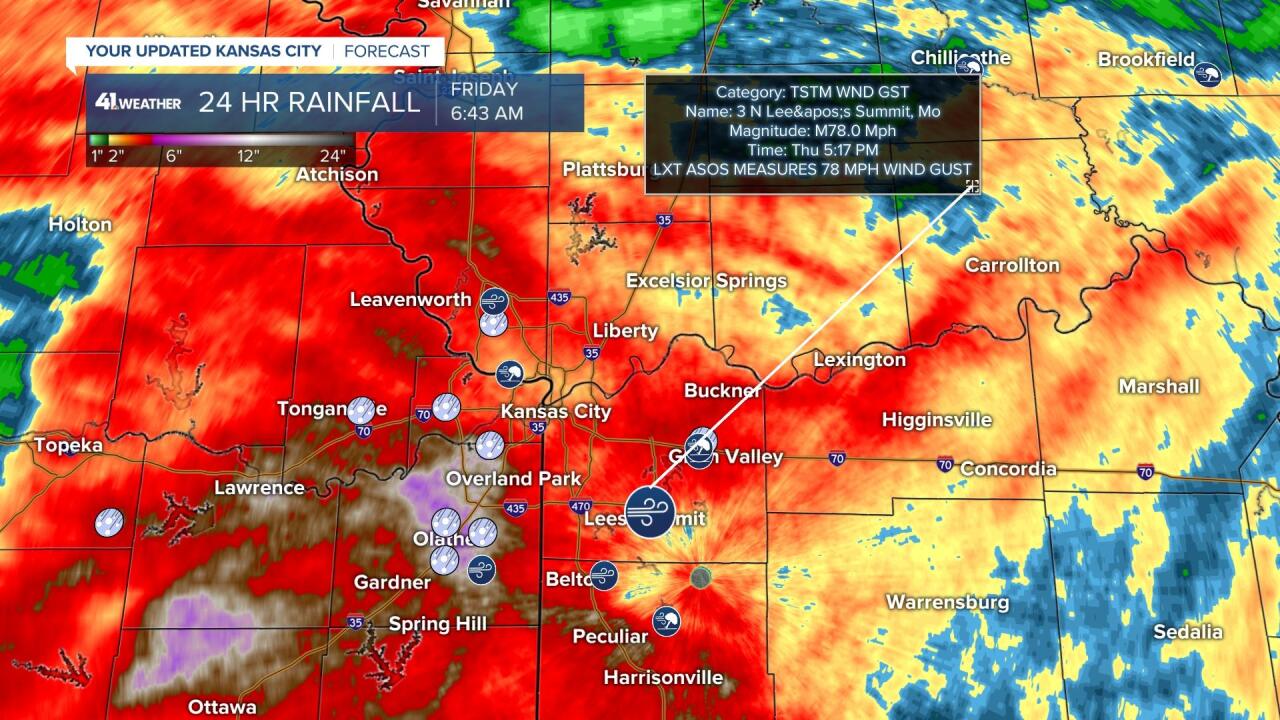
This is the radar estimated rainfall during the last 24 hours. Your rain gauge may read different, but you get the picture. The heaviest rain occurred over some areas that really needed the rain. Indian Creek would have overflowed had we seen heavier rain the last seven days. But, thankfully it was dry the last six weeks so much of the rain could soak in, instead of run off. Heavy rain can soak in to dry ground as it is rather flat around here and the ground was not like it is in Arizona.

The bulls eye was around Olathe where around 8.30 inches of rain occurred. Overland Park and Lenexa saw nearly seven inches of rain.

The lowest totals were found from around Parkville to North Kansas City and Missouri City to Excelsior Springs. One to two inches of rain occurred and this is still a good soaking, but more is needed there.

Camden Point to Fort Leavenworth saw four to five inches of rain.

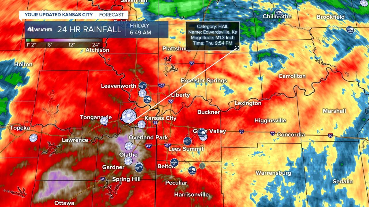
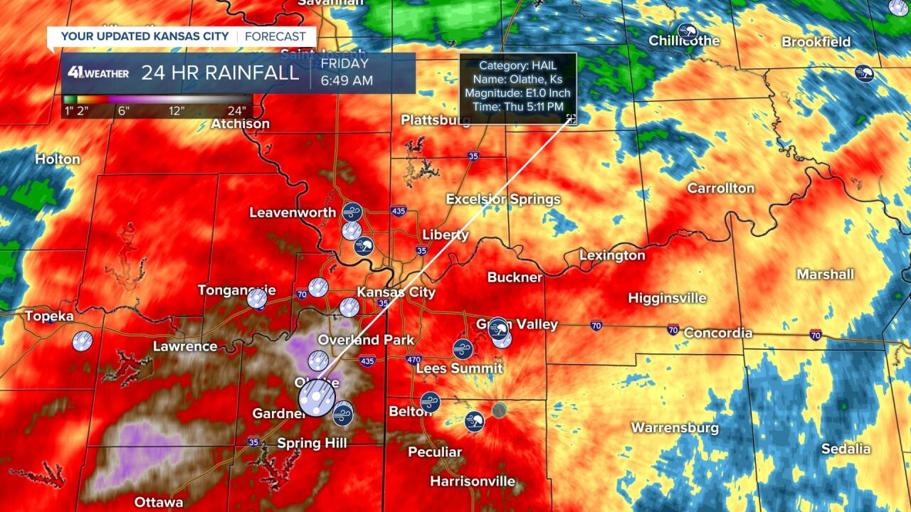
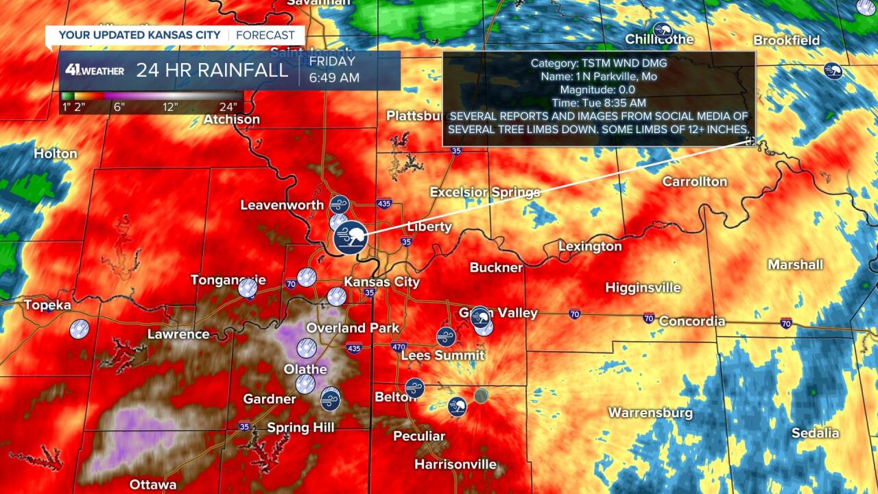
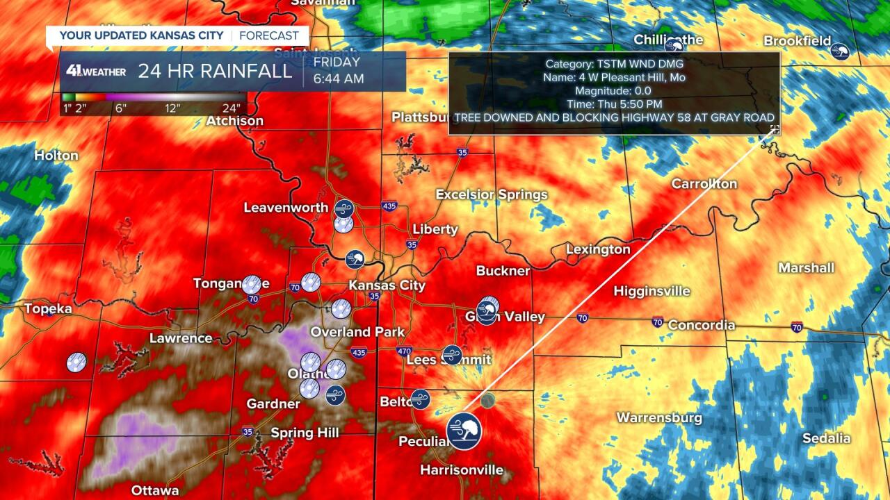
There were severe thunderstorms prior to the flooding thunderstorms. Severe hail and wind were the issues. Here are the severe weather reports over the radar estimated rainfall.


Here is an impressive satellite view of the complex of rain and thunderstorms that formed from eight to 10 p.m. on Thursday night. It was centered over KCMO and did not move fast.

What is next?
The rain and thunderstorm chances will shift to the south and west as we see a partly cloudy sky and less humidity this weekend. Highs will be in the 80s with lows in the 60s. The wind will be from the east and northeast bringing in drier air.

The area of rain and thunderstorms in central Kansas Sunday is associated with a small storm system that will arrive around Tuesday. This could bring a decent round of rain and thunderstorms. We will have more on this over the weekend.

Have a great weekend. Stay healthy.
