


KANSAS CITY, Mo. — A line of severe thunderstorms moved through the Kansas City area during Thursday night's evening rush hour.
More scattered storms are forecast to move through, possibly after 10 p.m., according to KSHB 41 meteorologist Wes Peery.
Read our updates throughout the evening below.
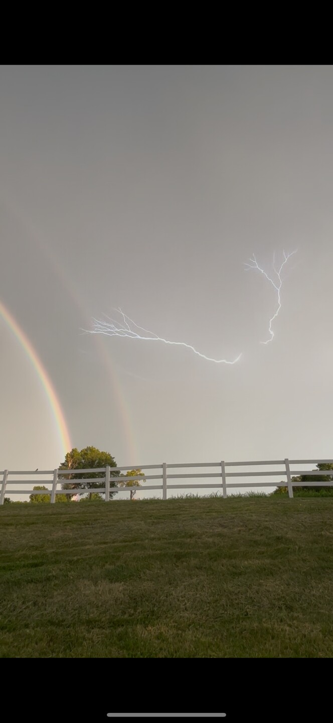
UPDATE, 9:40 p.m. | Trevor Stoakes captured a double rainbow and a lightning strike happening at the same time while in Peculiar.
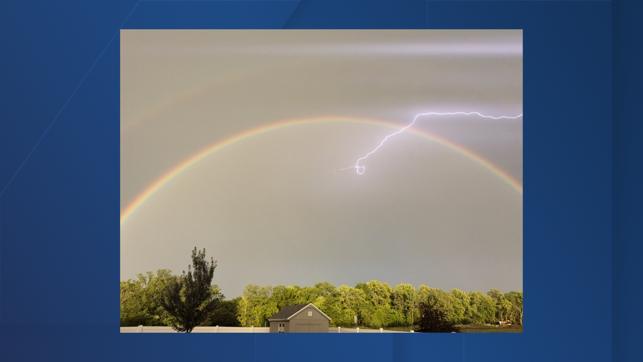
UPDATE, 9 p.m. | Ashli Williams took a picture of a rainbow and a lightning strike out in Raytown.
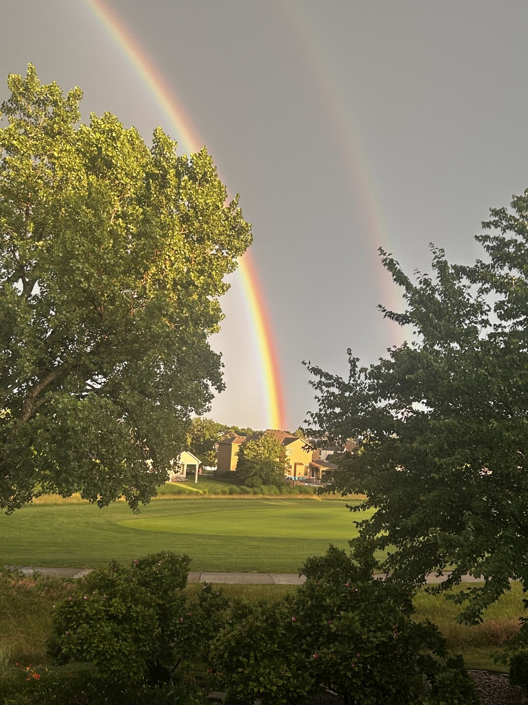
UPDATE, 8:45 p.m. | A wild double rainbow appears!
UPDATE, 7:45 p.m. | KSHB 41 meteorologist Wes Peery says there are more scattered storms forecast to move through, possibly after 10 p.m.
7:35pm--There are more scattered storms forecast to move through, probably after 10pm for the KC Metro
— Wes Peery (@WesWeather) June 27, 2025
I can't rule out some storms producing strong or damaging wind gusts#mowx #kswx #kcwx pic.twitter.com/ivq4IhOtIQ
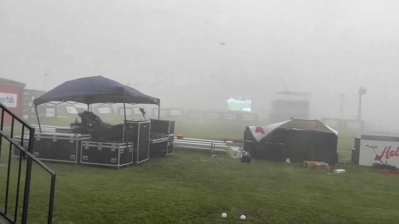
UPDATE, 7:40 p.m. | Matt Gasper took a video of a storm passing through at HomeField KC in Kansas City, Kansas.
UPDATE, 7:30 p.m. | KSHB 41's Jeff Penner captured pockets of tree damage near 95th Street and Mission Road.
Pockets of tree damage. One pocket was located where I grew up near 95th and Mission. @KSHB41 pic.twitter.com/Goa8JjsJpi
— Jeff Penner (@JeffPennerKSHB) June 27, 2025
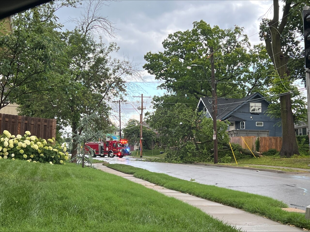
UPDATE, 7:10 p.m. | KSHB 41's Elyse Schoenig took a picture of a fallen tree in the area of 55th Street and Troost Avenue.
UPDATE, 7 p.m. | The Azura Amphitheater in Bonner Springs, hosting Country Stampede 2025, was evacuated as severe weather continued. People are now being readmitted to enter, a spokesperson told KSHB 41.
UPDATE, 6:55 p.m. | KSHB 41's Sarah Plake caught video of a fallen tree blocking a street in the Brookside neighborhood in Kansas City, Missouri.
Watch the scene in the video player below.
UPDATE, 6:45 p.m. | A Ring camera shows a tree falling down the Waldo neighborhood in Kansas City, Missouri, due to severe weather in the area.
Watch the damage in the video player below.
UPDATE, 6:40 p.m. | More than 13,000 customers are now without power, according to Evergy.
UPDATE, 6:30 p.m. | Evergy reports more than 12,000 customers without power as a line of severe thunderstorms continues to move through the KC area.
UPDATE, 6:25 p.m. | Near KSHB 41, meteorologist Jeff Penner says torrential rain and winds up to 40 mph are hitting the area.
Torrential rain and 30-40 mph winds on the Plaza. Higher wind gusts possible just south of the Plaza the next 30 minutes. @KSHB41 pic.twitter.com/H7gnD4XLxO
— Jeff Penner (@JeffPennerKSHB) June 26, 2025
UPDATE, 6:20 p.m. | Evergy reports more than 10,000 customers without power due to the storm. The Board of Public Utilities in Kansas City, Kansas, reports more than 3,300 customers without power.
ORIGINAL REPORT | The watch runs through 9 p.m. Thursday and includes northwestern and north-central Missouri, including the Interstate 35 corridor north of Kansas City. The watch includes places like St. Joseph, Maryville and Cameron, Missouri.
There is also a severe thunderstorm warning including cities such as Leavenworth and Atchison, Kansas, and Platte City, Missouri, until 4:45 p.m.
Storms may contain isolated hail up to the size of quarters and scattered wind gusts up to 70 miles per hour. A couple of tornadoes are also possible.
LINK | Latest KSHB 41 Weather blog
LINK | Latest KSHB 41 Weather forecast
In addition to the possibility of severe thunderstorms, The threat of heavy rains Thursday night into Friday morning could lead to areas of flooding.
The Kansas City area is included in a flood watch from 5 p.m. Thursday through 3 a.m. Friday.
The National Weather Service says excessive runoff may result in flooding of rivers, creeks, streams and other low-lying and flood-prone areas.
The watch also includes portions of northwest Missouri, which have seen several inches of rain from thunderstorms earlier this week.
Look a the beautiful skies in NW Missouri!
— Wes Peery (@WesWeather) June 25, 2025
The storms in Nodaway County have dumped 3-7" in the last couple of days but also produced this awesome looking shelf cloud.
[Heater Doyle & Annie Townsend] #mowx pic.twitter.com/bL8it15UO8
