


KANSAS CITY, Mo. — The KSHB 41 Weather team is monitoring the potential for severe weather, as several Kansas City-area counties are included in a tornado watch through 11 p.m. Monday.
Make sure to stay weather aware.
LINK | KSHB 41 Weather Radar
LINK | KSHB 41 Traffic
LINK | KSHB 41 Weather forecast
LINK | KSHB 41 Weather Blog
LINK | KSHB 41 Severe Alerts
KSHB 41 is continuing to monitor reports of damage and power outages in Ottawa and near Hillsdale Lake in Kansas following tonight's storms. You can watch our coverage live in the video player below.
Check back for updates.
—
10:55 p.m. | KSHB 41's Lily O'Shea Becker is in Ottawa, where the damage is clear from storms in the area Monday.
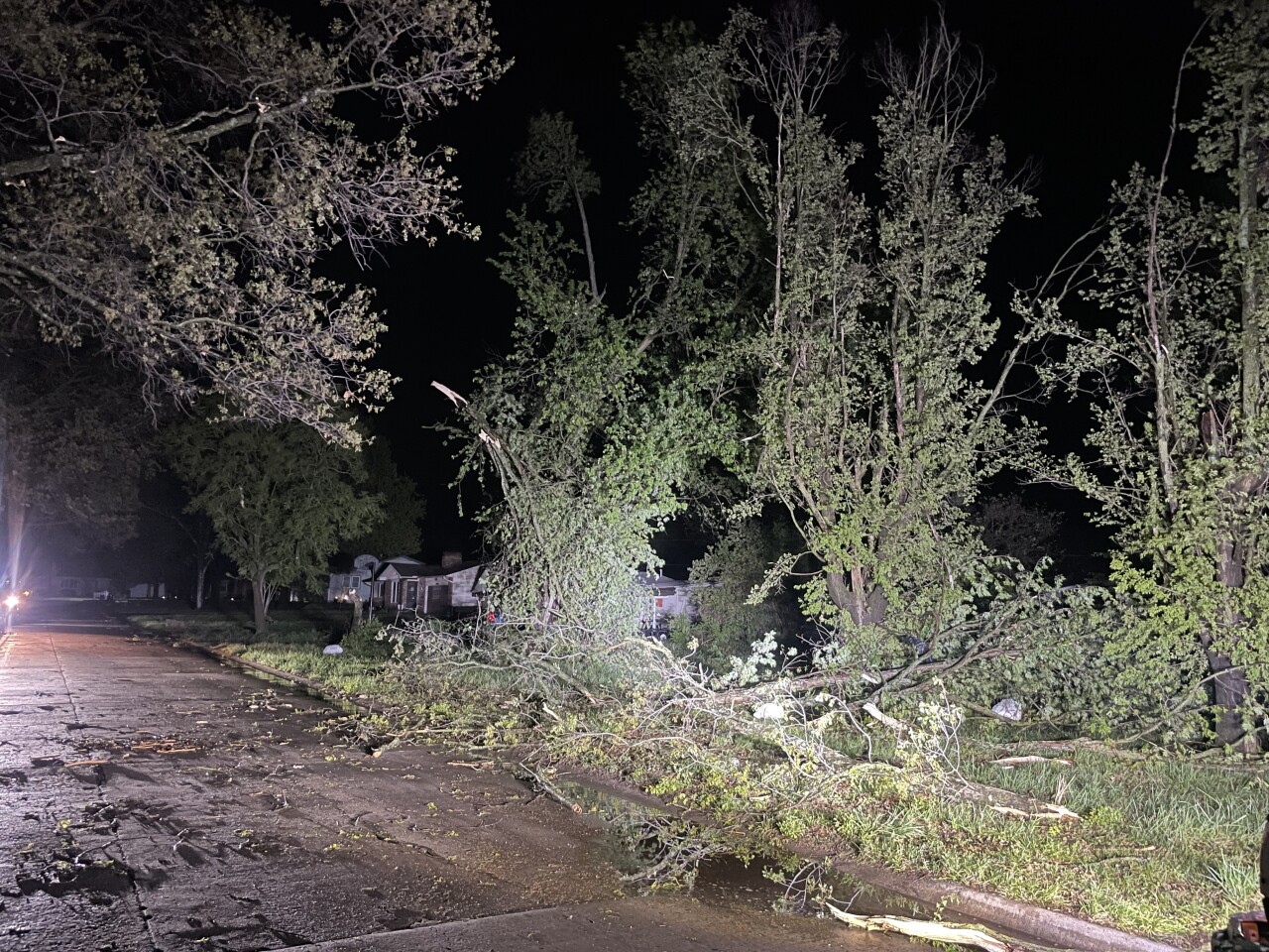
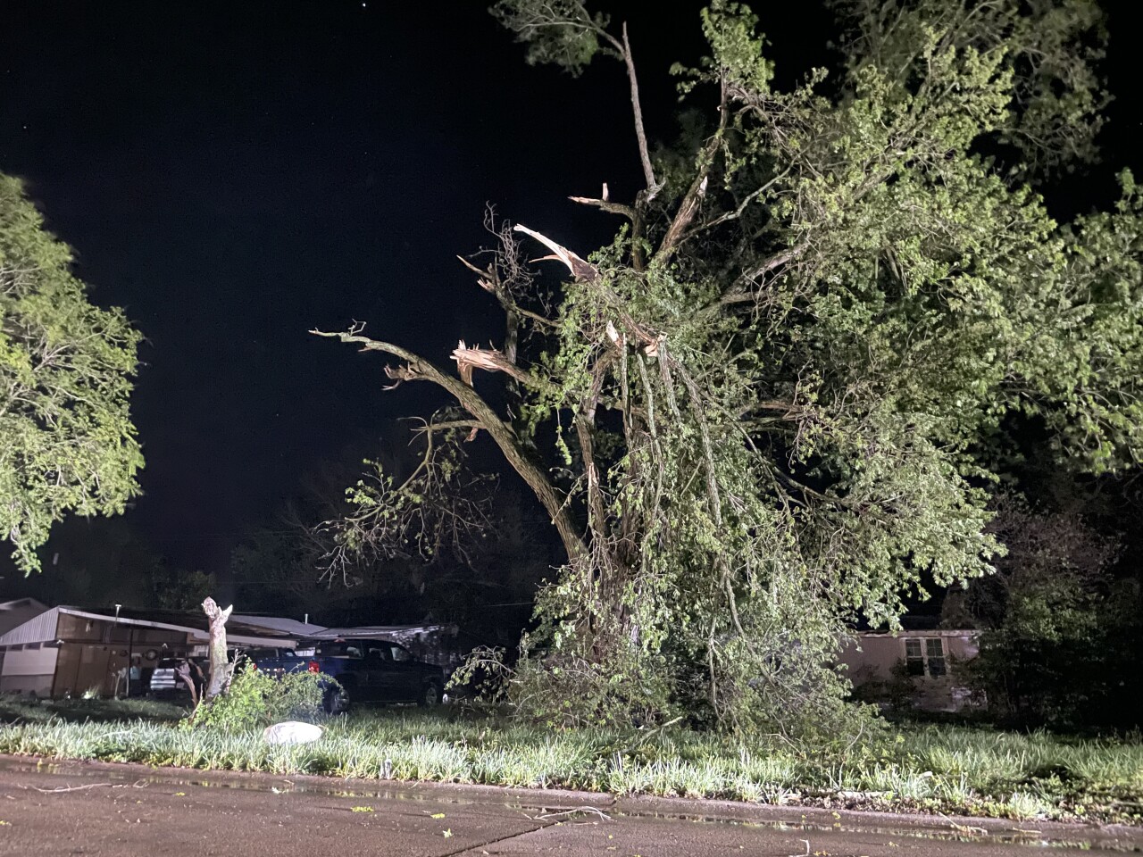
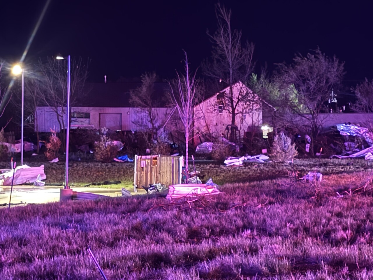
10:45 p.m. | KSHB 41's Fernanda Silva took photos that capture some of the aftermath of severe weather in the town of Hillsdale, located in Miami County.

10:25 p.m. | Ottawa Chief of Police Adam Weingartner provided an update on the impact of Monday's storm to KSHB 41's Ryan Gamboa. Watch Adam's comments in the video player below.
10:05 p.m. | A tornado watch for the immediate Kansas City metro area has been canceled.
Bates, Cass, Henry and Johnson counties in Missouri and Miami County in Kansas are still under a tornado watch.
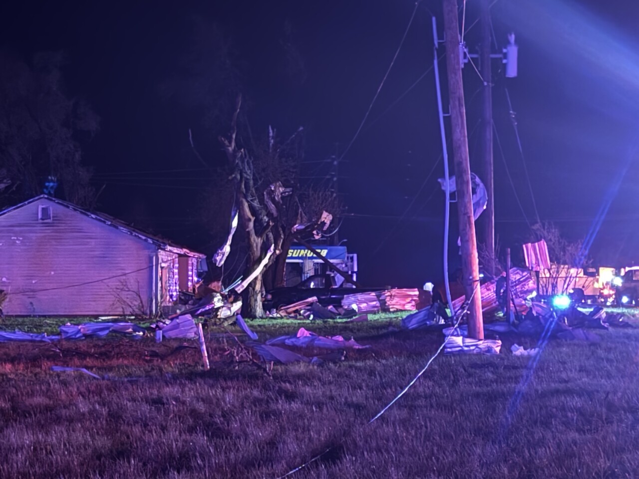
9:55 p.m. | Undersheriff Matt Kelly told KSHB 41 News that Miami County suffered significant damage.
According to Kelly, the worst of the damage is east of Hillsdale Lake near 225th Street and Old Kansas City Road. Buildings and houses were destroyed in the area, Kelly said.
9:45 p.m. | A viewer provided this video of lightning painting the sky in Kansas City, Kansas, earlier Monday evening.
9:42 p.m. | Here's video of lightning and thunder in Belton Monday evening, courtesy of a viewer.
9:39 p.m. | Several Kansas City-area counties remain under a tornado watch until 11 p.m.
The watch includes Johnson, Miami and Wyandotte counties in Kansas.
Bates, Cass, Henry, Jackson and Johnson counties in Missouri are included, too.
The only county where the watch has been canceled is Linn County, Kansas.
9:30 p.m. | All tornado warnings have been canceled.
Damage reports are beginning to roll in from several areas, including downed trees, lost power and more.
You can send storm/damage pictures to us at pics@kshb.com.
PHOTO | A viewer sent KSHB 41's Ryan Gamboa (@BabyGamz) this picture, which was taken at Louisburg Middle School earlier this evening.
— KSHB 41 News (@KSHB41) April 14, 2026
If you have any pictures of tonight's severe weather in the Kansas City area, send them over to pics@kshb.com.
📸: Cameron James Ray pic.twitter.com/R3dGEcqVuv
9:20 p.m. | Evergy's outage map reports 15,500 customers are without power. More than 2,000 of those reports are from Mound City to Ottawa.
9:16 p.m. | Cameron James Ray photographed the storm from Louisburg Middle School.
8:57 p.m. | A confirmed tornado is heading toward Butler, Missouri. The NWS says the warning for central Bates County is in effect until 9:45 p.m.
TORNADO WARNING UPDATE:
— Jeff Penner (@JeffPennerKSHB) April 14, 2026
Confirmed Tornado heading towards Butler, MO. The storm to the north entering Cass co. is looking weaker, but still take tornado precautions for Peculiar, Belton, Harrisonville. @KSHB41 pic.twitter.com/zOR1soKScS
8:55 p.m. | Evergy's outage map reports 13,059 customers without power. Just over 4,300 of those are reported around Gardner and Spring Hill.
8:49 p.m. | Debris has been confirmed via radar from at least Ottawa, Hillsdale and Mound City.
So far tonight we've confirmed debris via radar from three places: Ottawa, Hillsdale and Mound City.
— Caleb Chevalier (@MetCalebC) April 14, 2026
8:44 p.m. | A tornado was reported on the ground southwest of Spring Hill, according to the National Weather Service.
8:40 p.m. | Northeastern Miami County, Kansas, and northwestern Cass County, Missouri, are under a tornado warning until 9:15 p.m.
8:39 p.m. | The NWS says a spotter reported an ongoing tornado with the storm in Linn and Bates counties.
8:31 p.m. | Tornado warnings for Miami, Johnson, Linn and Bates counties are in effect until 8:45 p.m.
TORNADO WARNING UPDATE:
— Jeff Penner (@JeffPennerKSHB) April 14, 2026
Miami county, far southern Johnson county, Linn county KS @KSHB41 pic.twitter.com/nMR9Mjisxm
8:27 p.m. | A tornado has also been confirmed in Miami County, Kansas.

8:24 p.m. | The KSHB 41 Weather team reports a confirmed tornado near Mound City in Linn County, Kansas.

8:21 p.m. | The National Weather Service says northeastern Miami County and southeastern Johnson County are included in a tornado warning until 8:45 p.m.
8:16 p.m. | A new tornado warning has been issued for southern Linn County in Kansas and western Bates County in Missouri.
8:09 p.m. | Another tornado warning has been issued for Franklin County. The NWS says the warning lasts until 8:30 p.m.
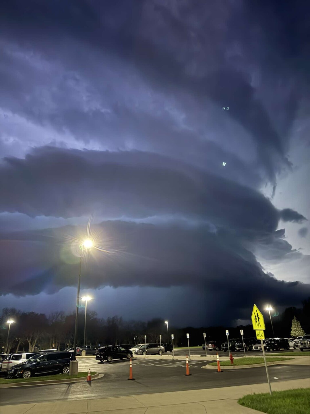
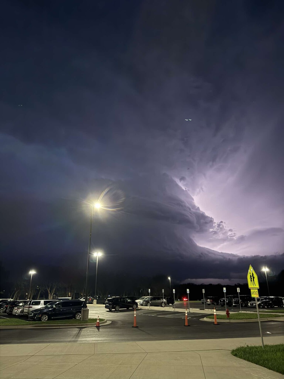
Three supercells out there right now, two of which with tornado warnings. Nothing confirmed at this time. pic.twitter.com/iHATLl1hKo
— Caleb Chevalier (@MetCalebC) April 14, 2026
8:07 p.m. | Trent Pittman/Johnson County Emergency Management shared an image taken between Ottawa and Paola around 7:50 p.m.

7:55 p.m. | The National Weather Service has issued a tornado warning for northwestern Miami County until 8:30 p.m.
TORNADO WARNING:
— Jeff Penner (@JeffPennerKSHB) April 14, 2026
Paola, KS to Louisburg, KS you are in the path of this storm. Take you tornado precautions now. @KSHB41 pic.twitter.com/re3Hy7ICeB
7:52 p.m. | A severe thunderstorm warning has been issued until 8:30 p.m. for Linn, Johnson and Miami counties.
Severe Thunderstorm Warning including Gardner KS, Paola KS and Edgerton KS until 8:30 PM CDT. This storm will contain two inch sized hail! pic.twitter.com/16W6FiTgKS
— NWS Kansas City (@NWSKansasCity) April 14, 2026
7:50 p.m. | Evergy's outage map reports 8,751 outages, with most centered around Topeka.
7:38 p.m. | KSHB 41's Jeff Penner reports the confirmed tornado warning is moving from Ottawa to Stanton.
The National Weather Service said it was reported near W. 15th Street and S. Eisenhower Avenue and is moving east.
TORNADO WARNING.
— Jeff Penner (@JeffPennerKSHB) April 14, 2026
If you are in Ottawa, KS to Stanton, KS you need to take your tornado precautions NOW! This is a confirmed Tornado Warning. @KSHB41 pic.twitter.com/ccwcWIcXat
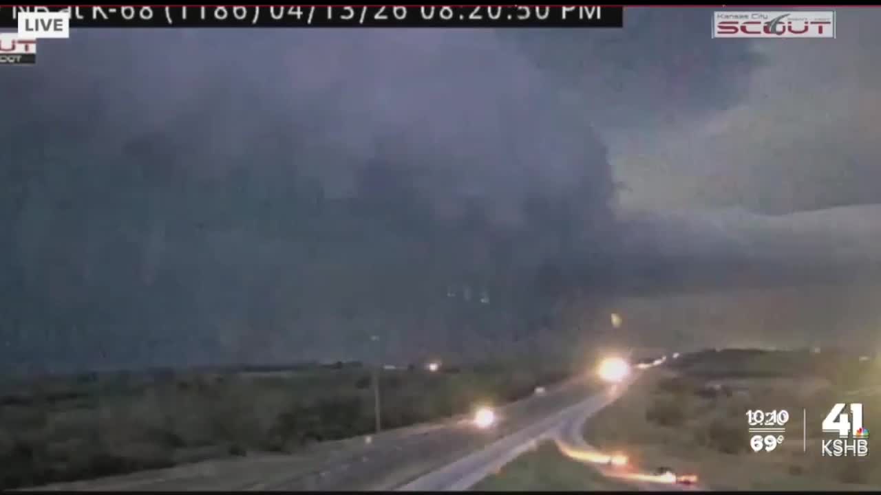
7:37 p.m. | KanDrive and KC Scout cameras are capturing the storm in Ottawa.


7:33 p.m. | Residents of Ottawa are urged to take shelter and find their tornado safe place.

7:23 p.m. | A confirmed tornado warning is in effect for Franklin County until 8 p.m.

7 p.m. | A tornado warning has been issued for northwestern Franklin County. The warning is set to expire at 7:30 p.m.
Tornado Warning including Pomona KS, Quenemo KS and Centropolis KS until 7:30 PM CDT pic.twitter.com/24liCmPTvF
— NWS Topeka (@NWSTopeka) April 13, 2026
6:55 p.m. | A severe thunderstorm warning has been issued for Ottawa, Baldwin City and Wellsville until 7:45 p.m.
The National Weather Service advises the storms could produce winds up to 60 mph and tennis ball-sized hail.
Severe Thunderstorm Warning including Ottawa KS, Baldwin City KS and Wellsville KS until 7:45 PM CDT. This storm will contain tennis ball sized hail! pic.twitter.com/aPQyzJVt6K
— NWS Topeka (@NWSTopeka) April 13, 2026
6:45 p.m. | KSHB 41's Wes Peery says strong storms will try to move into the Kansas City metro in about an hour.
6:40pm--This is why we've been watching storms so closely southwest of Kansas City!
— Wes Peery (@WesWeather) April 13, 2026
A tornado warning is in effect west of Ottawa, KS
These storms will try to get into the metro in about an hour #mowx #kswx #kcwx pic.twitter.com/cJvPj3rwcH
6:40 p.m. | The National Weather Service has issued a tornado watch for several Kansas City-area counties through 11 p.m. Monday.
The watch includes Johnson, Wyandotte, Linn and Miami counties in Kansas, as well as Bates, Cass and Jackson counties in Missouri.
KSHB 41 meteorologist Wes Peery says storms capable of large hail, damaging wind and tornadoes will move into the watch area.
6:35pm--- A TORNADO WATCH including parts of the KC Metro is in effect until 11pm
— Wes Peery (@WesWeather) April 13, 2026
Storms will move into this area capable of large hail, damaging winds, and tornadoes.
Please be ready to act on warnings! #mowx #kswx #kcwx pic.twitter.com/4rTC4CpyBT
The NWS advises the hail could be up to apple-sized.
Stay weather aware with the KSHB 41 team here.
—
![020626_KSHB_Image_NXA_Web_Standard Cube[88].jpg](https://ewscripps.brightspotcdn.com/dims4/default/0ead409/2147483647/strip/true/crop/300x225+0+13/resize/960x720!/format/webp/quality/90/?url=http%3A%2F%2Fewscripps-brightspot.s3.amazonaws.com%2F8f%2F6c%2Ffad8bd2346c5a4d4ead793017d4a%2F020626-kshb-image-nxa-web-standard-cube88.jpg)