

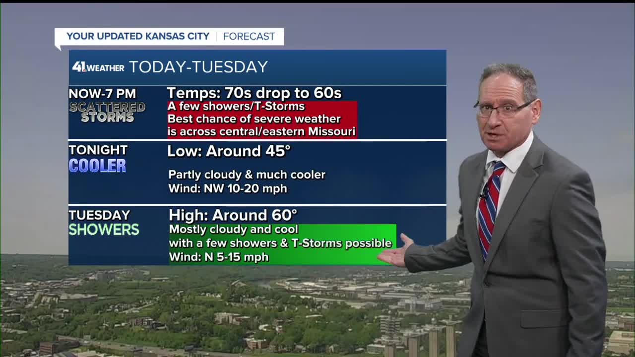



KANSAS CITY, Mo. — Thunderstorms, heavy rain and wind moved through the Kansas City area early Monday morning. Additional rounds of storms are possible through the evening in western Missouri.
Remember to stay weather aware.
LINK | KSHB 41 Weather Radar
LINK | KSHB 41 Traffic
LINK | KSHB 41 Weather Forecast
LINK | KSHB 41 Weather Blog
LINK | KSHB 41 Severe Alerts
If weather conditions warrant, you can watch live coverage in the video player below.
—
UPDATE, 2:30 p.m. | KSHB 41's Jeff Penner says thunderstorms have rapidly formed from Chanute, Kansas, south to Harrisonville, Missouri.
Penner said those storms are starting to produce big hail and will become more severe as they head east.
WEATHER UPDATE 2:30 PM (4/27/2026)
— Jeff Penner (@JeffPennerKSHB) April 27, 2026
T-Storms have rapidly formed from Chanute, KS to south of Harrisonville, MO along a a cold front. They are starting to produce big hail. They will become more severe as they head east across central & eastern MO. @KSHB41 pic.twitter.com/K2Mw2RT5wB
UPDATE, 2:15 p.m. | KSHB 41's Wes Peery says severe storms are developing in western Missouri that are capable of large hail and 60 mph wind gusts.
A severe storm watch is in effect for several counties in the southern part of the KSHB 41 viewing area.
2:10pm--Severe storms are developing in western Missouri capable of large hail and 60mph wind gusts
— Wes Peery (@WesWeather) April 27, 2026
A severe storm watch is in effect through this evening, a tornado isn't out of the question with these storms, though.#mowx #kswx #kcwx pic.twitter.com/5k00GWwGBF
UPDATE, 11:40 a.m. | Power outages continue to affect Johnson and Miami counties in Kansas. Evergy's outage map reported 322 affected customers in Johnson County and 67 affected customers in Miami County at 11:35 a.m.
The Miami County Sheriff's Office said in a Facebook post that Paola experienced "significant storm-related damage to power poles, power lines and trees."
Additionally, the sheriff's office said power restoration may be delayed due to severe weather across the region.
UPDATE, 11:20 a.m. | The Missouri State Highway Patrol reports troopers are out in Slater, Missouri, assessing storm damage. No injuries have been reported.
Troopers in Saline County are in the area assisting the residents of Slater, MO after storms caused damage earlier today. At this time no injuries are reported. pic.twitter.com/6KYRWhVSWc
— MSHP Troop A (@MSHPTrooperA) April 27, 2026
Rep. Mark Alford (R-4th District) shared a post from the city of Slater, stating Highway 240 is closed in both directions due to downed power lines and trees.
We are monitoring storm damage in Slater following severe weather.
— Rep. Mark Alford (@RepMarkAlford) April 27, 2026
Highway 240 is reported to be closed in both directions, with downed power lines and trees reported west toward Marshall and east toward Glasgow. Please avoid the area and use caution.
Thank you to MODOT,… pic.twitter.com/P2ik9LTOlG
UPDATE, 10:10 a.m. | KC Scout cameras show I-435 at 23rd Street remains under water.

UPDATE, 10 a.m. | Viewer Jackie Wiseman shared this image of storm damage in Harrisonville with KSHB 41's Cass County reporter Ryan Gamboa.

UPDATE, 9:15 a.m. | Here's the latest forecast update from KSHB 41 Weather meteorologist Lauren Rainson.
UPDATE, 7:45 a.m. | KCFD reports they responded to 11 water rescues this morning, most in typical high-water areas. Motorists were assisted out of their vehicles and to dry ground. No injuries were reported.
UPDATE, 7:32 a.m. | KSHB 41 reporter Olivia Acree says high water is still an issue at Gardner Avenue and Chouteau.
UPDATE, 7:24 a.m. | KSHB 41's Claire Bradshaw is checking road conditions on I-435 in Missouri.
UPDATE, 7:15 a.m. | Another tornado warning in our eastern viewing area.
Tornado Warning including Glasgow MO, Higbee MO and Clark MO until 8:00 AM CDT pic.twitter.com/lPKqflANCi
— NWS Kansas City (@NWSKansasCity) April 27, 2026
UPDATE, 7:02 a.m. | KSHB 41's Olivia Acree is seeing high water rescues in the Northland near Gardner and Chouteau.
UPDATE, 6:48 a.m. | Several area schools and organizations are delaying the start of the day. Check our website for the latest information.
- Allen Village School — delayed until 10 a.m.
- Guadalupe Center Charter Schools — 2 hour delayed start
- Lee's Summit R-7 — 1 hour delay
- Oak Grove R-6 — 2 hour delay
- Raymore-Peculiar R-2 — 2 hour delay
- Salvation Army Division HQ — delayed until 9 a.m.
UPDATE, 6:40 a.m. | KSHB 41's Claire Bradshaw is checking out road conditions.
UPDATE, 6:17 a.m. | Interstate 70 westbound at 18th Street in Kansas City, Missouri, is closed due to high water.

UPDATE, 6:09 a.m. | The National Weather Service has issued a tornado warning including Harrisonville, Peculiar and Garden City in Missouri until 6:30 a.m.
Tornado Warning including Harrisonville MO, Peculiar MO and Garden City MO until 6:30 AM CDT pic.twitter.com/kVXyeaRPwK
— NWS Kansas City (@NWSKansasCity) April 27, 2026
UPDATE, 5:41 a.m. | The National Weather Service has issued a tornado warning until 6 a.m. in southern Johnson County, Jackson County and Cass County.
TORNADO WARNING | Parts of Jackson and Cass counties in Missouri and Johnson and Miami counties in Kansas are included in a tornado warning until 6 a.m.
— KSHB 41 News (@KSHB41) April 27, 2026
Live coverage: https://t.co/RlmHdJ5XyW pic.twitter.com/JTzssobdIF
UPDATE, 5:05 a.m. | A jack-knifed semi is blocking the northbound lanes of Interstate 35 near Missouri Highway 291.
UPDATE, 4:20 a.m. | A flash flood warning is now in effect for most of the Kansas City area through 10 a.m.
Flash Flood Warning including Kansas City MO, Overland Park KS and Kansas City KS until 10:00 AM CDT pic.twitter.com/ZXQba7GLQv
— NWS Kansas City (@NWSKansasCity) April 27, 2026
UPDATE, 4 a.m. | Several severe thunderstorm warnings are in place across Kansas City.
Severe Thunderstorm Warning continues for Kansas City MO, Overland Park KS and Kansas City KS until 4:30 AM CDT. This storm will contain wind gusts to 70 MPH! pic.twitter.com/vo48fjS8q2
— NWS Kansas City (@NWSKansasCity) April 27, 2026
UPDATE, 3:45 a.m. | A severe thunderstorm watch that includes the Kansas City area is now in effect until 10 a.m. Monday.
A severe thunderstorm watch has been issued for parts of Kansas and Missouri until 10 AM CDT pic.twitter.com/gPlMUzeDek
— NWS Kansas City (@NWSKansasCity) April 27, 2026
UPDATE, 3 a.m. | Here's the latest weather forecast update from KSHB 41's Caleb Chevalier.
—
![092126_KSHB_WX_480x360[61].jpg](https://ewscripps.brightspotcdn.com/dims4/default/79e7fad/2147483647/strip/true/crop/480x360+0+0/resize/960x720!/format/webp/quality/90/?url=http%3A%2F%2Fewscripps-brightspot.s3.amazonaws.com%2F6f%2F6d%2Fa3758caf4c0984b0ecf100f620d1%2F092126-kshb-wx-480x36061.jpg)