


Happy Sunday, blog readers —
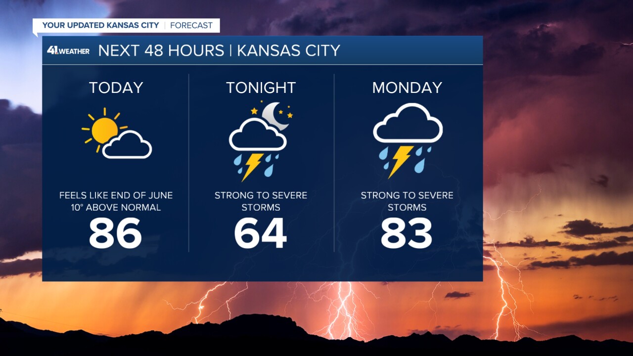
We've got a beautiful day ahead with more mid- to upper-80s expected across the region. The difference today, though, is we will see more clouds, and winds will increase through the afternoon.
If you are heading to the Royals, Monarchs or wherever your Sunday takes you, it will feel more like an end-of-June day overall.
Sunday
Through south-central and southwest Kansas today, severe weather will be brewing.
The Storm Prediction Center has issued a level 4 risk for the areas between Salina, Wichita and Dodge City. A dry-line cold front combo will fire up storms in this area this afternoon and evening.


In Kansas City, we could see some afternoon and early evening storms, but they will stay near the warm front and near the Iowa border.
Our bigger threat for storm activity comes as this line of storms organizes after 10 p.m. this evening. Through Topeka, up to 80 mph winds are possible with this line.
As this line moves toward us, it should weaken, with 60-70 mph winds possible as the line first starts to impact us from the west.
Our main impacts tonight will be damaging and gusty winds.

This gnarly line of storms will be knocking on our door by 10 p.m., but take a look at how fast it weakens.
This is a snapshot of what radar could look like as storms begin to enter our area and how they look a few hours later.


Monday
Through the morning, some of the storm activity could persist around and south of I-70, making it a wet start to your Monday.
It does look like this activity hangs for areas near KC and south through much of the morning. We could still see a few severe storms with wind and low-end hail impacts.
Then Monday afternoon, a few scattered showers could fire for areas north of KC with 60 mph winds and quarter-sized hail concerns as the main focus.
Right now, we are in a level 2 risk out of 5 for severe weather concerns.

The moisture field Monday is pretty diffuse, so expect wet weather to easily linger through the morning and midday.
We do look to take a bit of a break from severe storms Monday overnight through much of your Tuesday.
Tuesday
By Tuesday afternoon and evening, severe weather concerns start to ramp up, as all modes of severe weather will be possible.
The moisture field becomes more concentrated and the front starts to get some movement to it. This means afternoon supercells as well as threats from a line of storms through the evening will be possible.
The SPC currently has us in a level 3 out of 5 risk for severe weather.
The bull-eyes for Tuesday is likely to shift a bit, so make sure you are staying up to date with our forecast and that your weather alerts are turned on.


—
