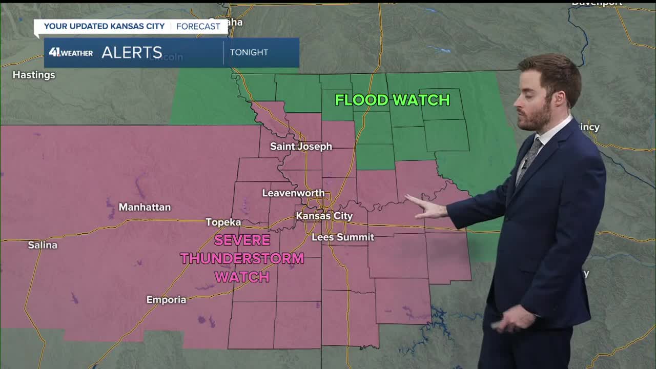


WEATHER HEADLINES
- Flood Watch this evening into Monday
- The 1st round of rain and thunderstorms arrives 2-4 PM
- Periods of rain and thunderstorms tonight, ending early Monday
- Damaging wind, hail and flash flooding are the main threats
KANSAS CITY'S FORECAST
Sunday night: Flood Watch. Periods of rain and thunderstorms, some may be severe. Damaging wind and hail are the main threats along with flash flooding.
Low: 63°
Wind: Variable and gusty
Monday: Rain and storms end 8-10 AM then partly cloudy, breezy and warm. A few showers/T-Storms are possible during the afternoon. The main severe threat will be across central and eastern Missouri.
High: 78°
Wind: SW 15-25 mph
Get more updates from our weather team:
View our interactive radar
