


KANSAS CITY, Mo. — Good Wednesday morning, blog readers —
Are you ready for some sunshine!? We've got a nice day on tap with temperatures staying 10° above normal as we cruise into the mid- to upper 70s.
Expect a little bit of a breeze to persist, but otherwise, we will take the break from stormy weather.

Storm recap
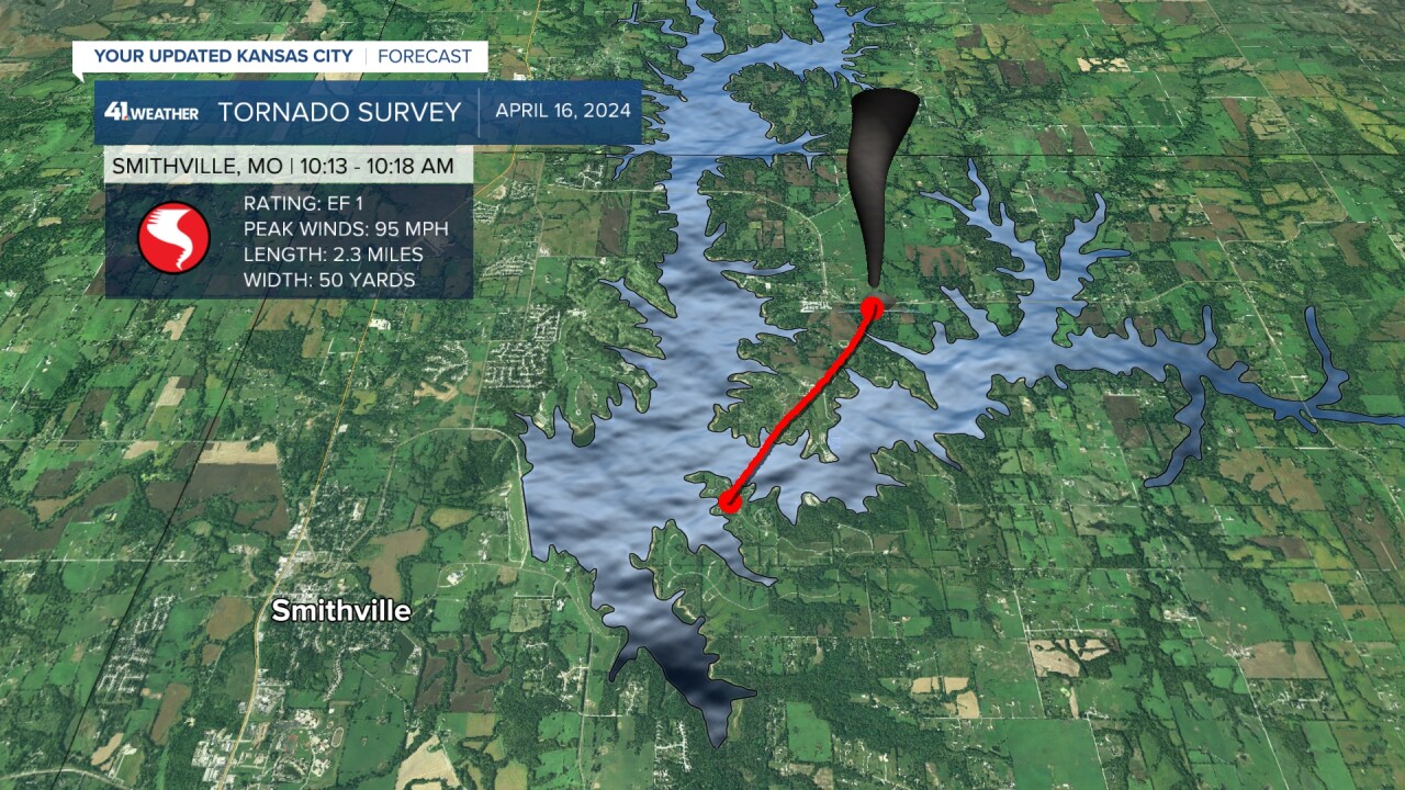
Tuesday's severe weather did produce one tornado in our area that cost a family their home near Smithville Lake. The National Weather Service completed their survey report and rated it an EF-1 with the track showing it jumping the lake at one point.
Lindsey Anderson and Wes Peery tracked the line move through Kansas City as multiple severe thunderstorm warnings were issued. Besides one tornado, the main threat we watched all morning was focused on wind.
Then, in the afternoon, winds began to howl again with 60 mph wind gusts reported in multiple locations. This wind came on the back side of the dry line ahead of the cold front passage, which produced damage in the Leavenworth area.

Next round of rain
More storms are loading by Wednesday night into Thursday morning. This looks to stay low-end severe with some steady rain by Thursday midday.
The bigger punch we will feel from the front moving through Thursday morning will be the cool-down loading by Friday into Saturday.
We are in a Level 1 risk come Wednesday overnight into Thursday. This looks to be a low-end severe threat with gusty winds and quarter-size hail as our main risks. The storm window looks to open around 10 p.m. to midnight Wednesday night.

But this system will get fueled up a bit better as it exits the KC area, bringing severe weather toward the bootheel of Missouri and into northern Arkansas Thursday night.

The back side of this cold front does come with a cool-down. Last weekend, we were sweating it out. This weekend, we are tracking sweater weather!
A quick spring cool snap is loading for Friday into Saturday. The good news is this cool-down will be short-lived lived, and there are hints that a big warm-up is expected to return to the Plains by the end of the month.

—
