


KANSAS CITY, Mo. — Brace yourself bloggers - we've got some weather whip lash coming!
We are starting off the work week with 60s and sunshine. Then Tuesday it's all about the rain and thunder with the potential for some storms to reach the severe threshold. By Wednesday we will take an important break from active weather for the parade. But Thursday arrives with rain and snow in the forecast... Oh and it's going to get really cold.
Let's go through each day:
Tuesday: Rain and Thunder
Rain arrives after 2 a.m. and will stick around for much of the day. We are expecting the heaviest rain to hit during the morning commute. This all occurs while the front approaches. We might even see some clearing in the early afternoon. Don't let any early afternoon clearing fool you we are watching for some severe weather potential between 2 and 6 p.m.

We have enough energy (CAPE) at this point in the day to see a few supercell thunderstorms fire. But upper level moisture is limited, which means storms should rain themselves out fairly quickly. This is where the concern for gusty outflow winds comes into play. As a storm collapses they can kick up some wind in the process. So it's a safe bet we can expect to feel winds near 50-60 mph around some of these storms. Another key variable we watch for with severe weather is called shear. This is basically the atmosphere's ability to "twist."
There is enough of this shear or supporting wind profile that could create rotating thunderstorms. In which we could see some small hail form, think pea size. But doesn't rotation mean tornadoes? Yes, but not always. We have some limiting factors including our mid-level moisture being limited and the atmosphere should stabilize fairly quickly given it's still winter and sundown comes quickly. This means any rotation will be brief and the threat is very limited meaning tornado concern is low but not a complete no.

When it is all said and done rain totals for Tuesday look decent. You can expect to see 0.25-0.5" of rain around the Kansas City area with some areas seeing locally higher amounts. And if you get stuck underneath a thunderstorm expect to exceed all expectations.

Wednesday: Chief's Parade
After Tuesday's cold front passes through, expect our "warm wave" to come to a close. We will return to a more seasonable February temperature trend with 40s in the forecast. The good news about parade day is we are dry! So grab your winter coat (leave the sunglasses at home) and cheer on the Chiefs!

Thursday: Rain and Snow
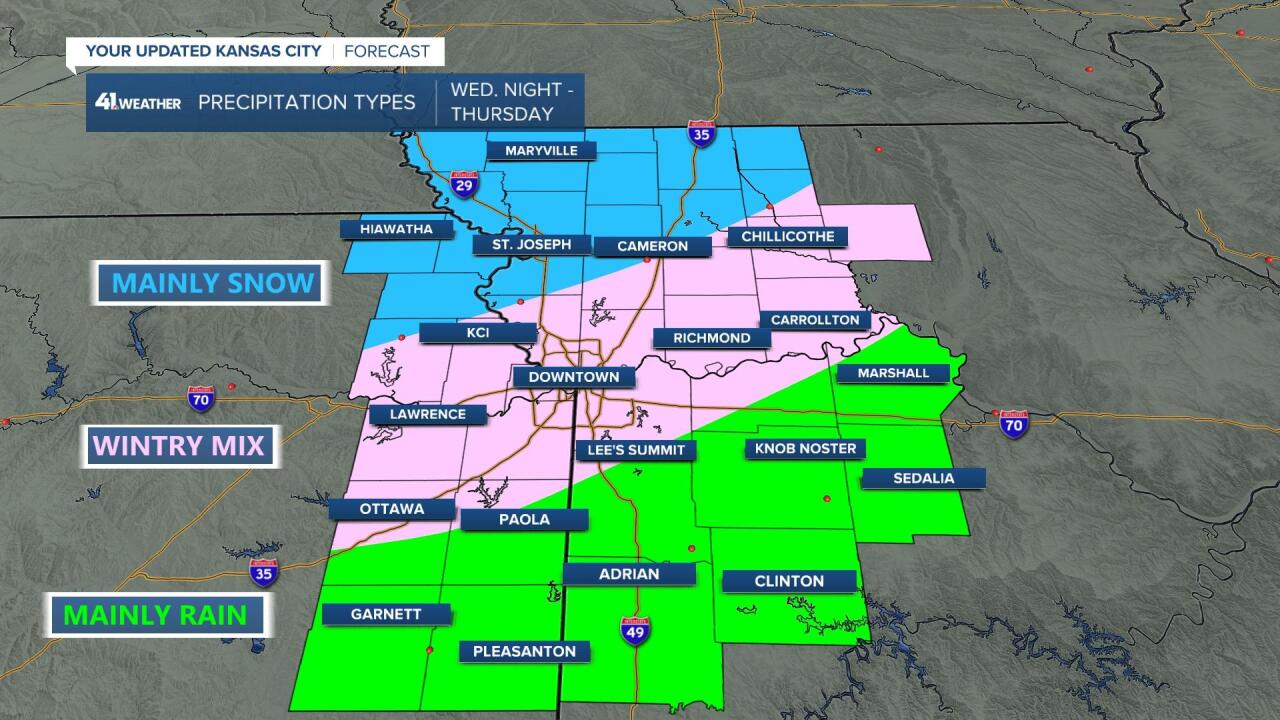
We've got a colder storm approaching by late Wednesday night into Thursday. This system's main precipitation core looks to arrive while we are sleeping which means it will be another tricky overnight snow forecast for us. Expect the rain-snow line to fall somewhere through the metro, again.
It will start off as a rain/snow mix Wednesday night.

Then transition to mostly snow overnight.
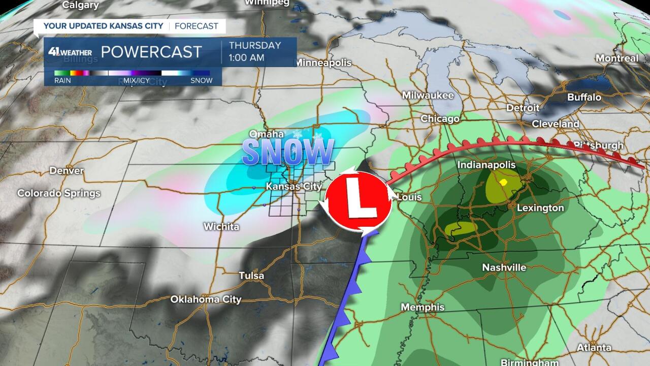
The timing of this system, the track of this system, and the cold nature of it all indicate we will see snow. How much and how far south the accumulating snow will be... the answer to that is still up in the air. So stay will us bloggers as we will be fine-tuning the snow forecast. For now here's a look at what type of precipitation to expect.
Oh and about that cold air... expect highs to be in the 20s & 30s Thursday & Friday. But remember I did promise weather whip lash... so of course we are tracking a really nice weekend warm up with highs in the upper 50s & low 60s.
—
