


Good Chiefs Sunday bloggers,
Mother Nature seems to be happy seeing the Arctic air retreat and exit as we had a super Sunday sunrise.


Before we bring out the cake to celebrate we have some weather to deal with as a series of storm systems track into the southwest USA from the Pacific Ocean and into the middle of the USA. The first of these systems will move through tonight before temperatures can truly get above freezing. This means we will likely see a period of freezing rain and some sleet.
Let's go through this interesting transition out of the Arctic cold.
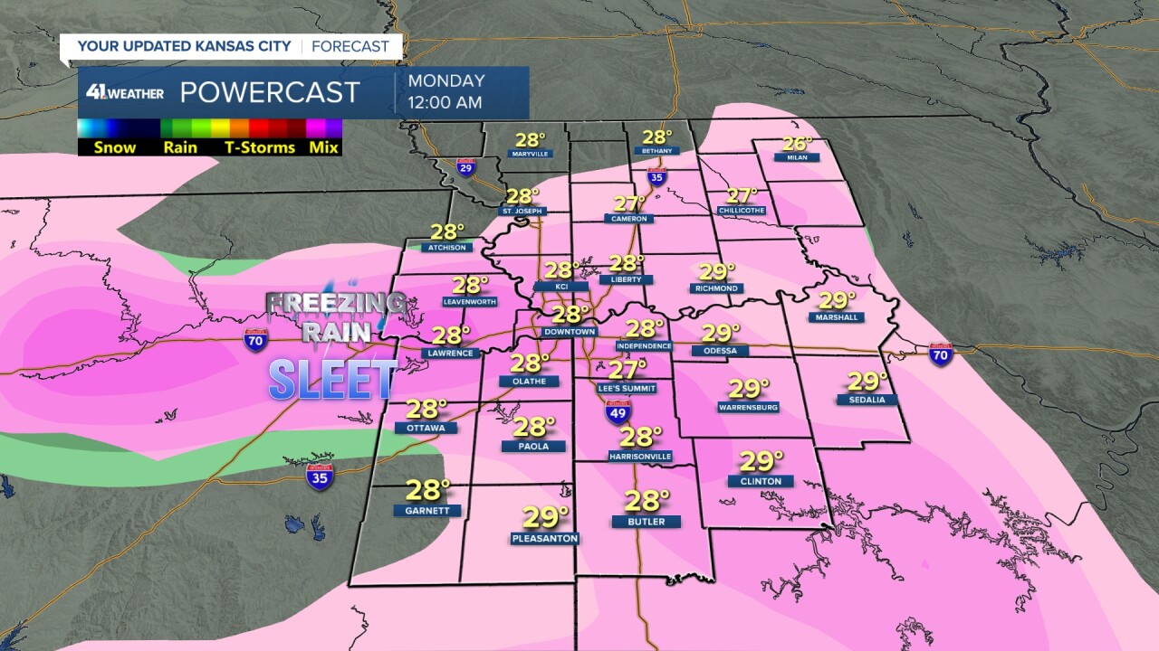
WINTER WEATHER ADVISORY 9 P.M. TONIGHT-NOON MONDAY:
This has been issued for what we have been talking about the last several days.
RELATED | Winter Weather Advisory issued in Kansas, Missouri from Sunday night to Monday afternoon
That is a chance for icy roads tonight into Monday morning before we can get temperatures above freezing.

TODAY:
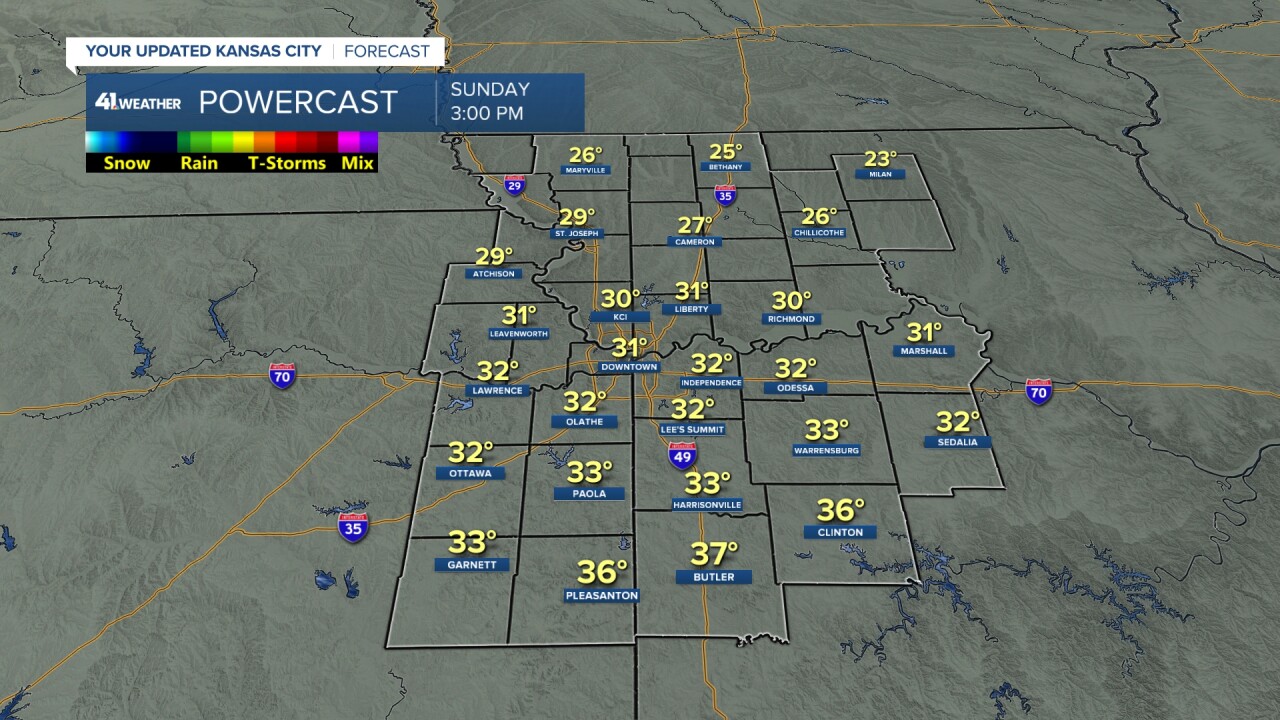
We will see an increasing wind with periods of clouds as temperatures warm to 26°-31° north of I-70 to 31°-37° south of I-70. There is more snow cover to the north, that is why it is colder. The wind will become south at 15-25 mph, gusting to 30-35 mph.
TONIGHT:
Before 9-10 p.m. it will be dry, so if you are headed out to watch the Chiefs game it is fortunate that it is a 5:30 p.m. kickoff. It will likely be over by 9-10 p.m. (assuming no overtime) and you can return home before the roads are likely to get slick.
A period of freezing rain and some sleet is likely between 9 p.m. tonight and 5 a.m. Monday with temperatures ranging from 28° to 31°. Even if the temperatures are 32°-34° we will see most surfaces get icy as we are just coming out of 10 days with temperatures mostly way below freezing. Now, it will still be much more icy if the temperatures are 28° to 31°. Total rainfall will be .01"-.10" which is light. But it doesn't take much to get icy in this situation. Also, it will get icy in minutes after the onset of the precipitation. If you are out use more caution than usual.
MONDAY (5 AM-NOON):
The precipitation will be over during the commute, but the effect of the freezing rain will remain. Surfaces will be icy as temperatures remain below freezing, around 30°.

MONDAY (NOON-MIDNIGHT):
Temperatures will warm to just above freezing, 33°-35°. A large area of rain will move in after 4-6 p.m. So, the roads will improve during the day and when the rain arrives, it will really help out the surfaces, but there is going to be a lot of water out there with the rain and melting ice and snow.

TUESDAY (MIDNIGHT-10 A.M.):
The rain will end as temperatures remain, just above freezing, like 1-2 degree above freezing at 33°-34°. This is all it will take to keep surfaces wet. Could it be 1-2 degrees colder? Yes, we will have to watch this closely.
Total rainfall will be .25"-.75". Assuming it stays above freezing, it will help to melt the snow and wash off the salt and chemicals off the roads.

TUESDAY (10 A.M.-4 P.M.):
It will be mostly cloudy with no precipitation expected. There may be some drizzle around however. The most important item is that temperatures will warm to the mid and upper 30s.

RAINFALL FORECAST TONIGHT-FRIDAY:
We are tracking three-four storm systems the next five days. We have the system tonight that will bring .01"-.10" freezing rain, some will be sleet. The second system is timed for later Monday into early Tuesday. It will bring .25"-.75" of rain. A third system is possible Wednesday with a fourth possible Friday into Saturday. They will each bring rain.
When you add them all together, you get totals ranging from 0.85" north to 1.70" south. That is a lot of rain for one week in January as we average 1.16" rain/melted ice, snow for the entire month. It is on average the driest month of the year for KC.

It still looks like a ton of rain from the southern Plains to southeast USA and east coast. The heaviest rain from eastern Texas to Tennessee is falling over some significant drought areas.

WEATHER FORECAST SUMMARY TIMELINE:
The period where roads and surfaces will be most icy is from around 9-10 p.m. to noon. Between 9 a.m. and noon we will see a transition from icy to wet.

Have a great week ahead.
Stay healthy.
GO CHIEFS!
