


KANSAS CITY, Mo. — Good morning bloggers,
The nice and quiet weather we had last week is officially OVER after that intense line of thunderstorms rolled through our region last night! The wind gusts along the leading line got up to 60-70 mph for many locations and resulted in several trees and power lines down. This was along a bowing segment of an MCS (Mesoscale Convective System) that rolled through.
LINK | Storm damage prompts school closures, power outages
So...here's what's in store this week!
TODAY
Some scattered storms are possible through the afternoon. These will likely stay low-end severe although strong wind gusts and hail are possible. Temperatures will be a bit cooler than this weekend as well - in the low 80s.

TONIGHT
Any storms that do form during the afternoon and evening will quickly shift north into Iowa. Overall, it will be a much quieter night than last night!
TUESDAY
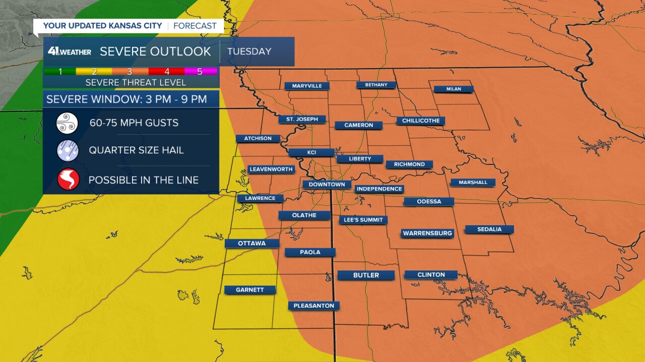
Much of the work and school day will be quiet with a mostly sunny sky, very warm temperatures and high humidity. That changes quickly once a cold front is able to tap into all that building instability. A line of severe thunderstorms will form after 3 p.m. and the threat continues through 9 p.m. That's a six-hour window to stay most aware. Here's what our radar could look like from 4 to 9 p.m:


Storms will likely start in northern Missouri and southern Iowa. The question remains how far south will storms develop along the cold front. It will be important to keep yourself updated Tuesday as they start to pop up.
All severe weather hazards are possible as this line rolls through. Mainly concerned with strong, damaging wind, up to 60-75 mph, along with some embedded tornadoes along the line. Hail is also a possibility.
We'll continue to keep you updated!
