


Good morning bloggers! Happy Wednesday and Super Bowl week!
Before we get to the gorgeous weather this weekend, we have two chances of wintry weather to track.
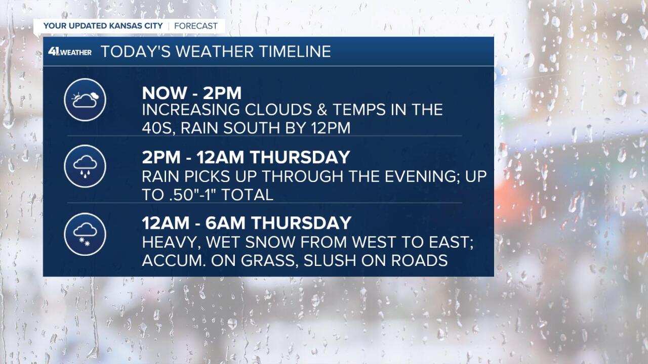
Here’s what you need to know.
The first system arrives today. Clouds increase through the day with rain arriving between 12-3 p.m. from the south. Light to moderate rain is expected during the evening commute with the heaviest rain after 10 p.m. as we enter the comma head of the storm.
The comma head is normally where we would pick up on the greatest amount of snow accumulation from a big winter storm. This time around, temperatures are once again, a little too warm at the surface for any significant accumulation. But don’t worry snow lovers, we’re still going to get SOMETHING.
Between 12-6 a.m. the rain will change to heavy, wet snow as the entire column of air in the atmosphere cools below freezing. The only trick is that the surface/road temperatures may be between 32-34°. This means our roads will stay wet to slushy while the snow mainly sticks to grass, elevated surfaces/objects and untreated surfaces like our patios.

The snow is out in time for the morning rush hour, exiting from west to east between 5-7 a.m. We’re not expecting snow during the commute but still plan on giving yourself a little extra time on your way to work!

Most areas will pick up between a coating-1" of snow with slightly higher totals near 1-3" in northern and north central Missouri.

Now let’s talk about the second system.
This one is much weaker, with very little moisture, but it has the cold air available for any snow to stick. The disturbance swings by and brings snow between 10 p.m. Thursday and early Friday. It will be out before the early commute Friday.
This storm could produce an additional coating of snow on all surfaces, and this time, could result in more slick spots on roads during the commute.

Luckily, the temperatures and sunshine will limit any road issues long term Friday and everything will melt for super bowl activities over the weekend! We’re headed for 60° Sunday!
Thanks for reading and we’ll have updates through the storm right here!
