


Happy Hump Day Bloggers —
It's been a week full of pop up thunderstorm activity, and this morning the storms certainly soaked areas SW of Kansas City.
That was a solid soaking of rain, check out some of these reports! We got caught in a endless cycle of outflow boundaries producing storms over the last 24 hours. More storms are possible this afternoon but the severe threat will stay well southwest of us.@KSHB41 pic.twitter.com/0ApIwksFDO
— ☀️ Cassie Wilson (@CassieKSHB) May 31, 2023
Another round of storms are possible tonight, but they shouldn't produce quite as much rain and will be much more isolated in nature.
It does look like we will see a lingering boundary that could prompt some morning storms for your Thursday as well.
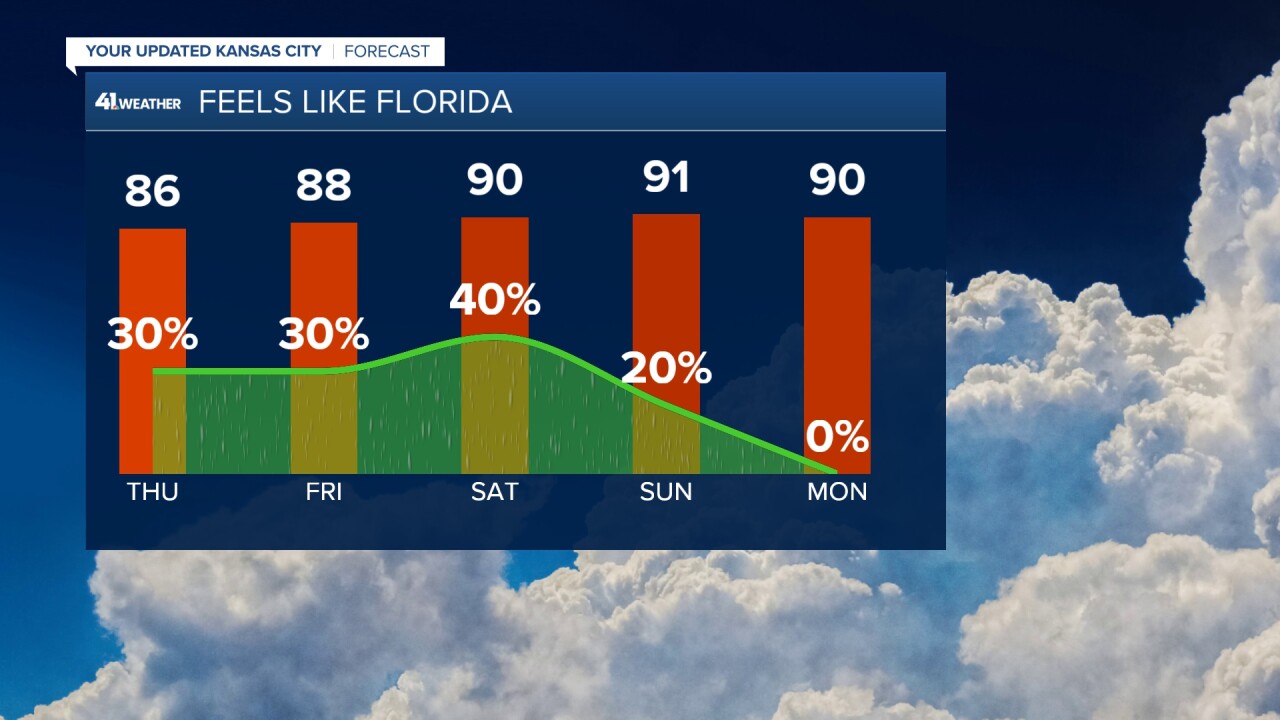
The severe weather concern for today stays well to our southwest and should stay that way the rest of the work week. But this "Florida-like" pattern of heat and pop up storms is far from over.
Much of the storm initialization this week has been focused on a ridge of high pressure over the Rockies and a trough that forms on the lee side of it. This set up has prompted day after day of rain chances for western Kansas south into the Texas panhandle, leaving us mainly with just generalized thunderstorms (light green) and not a whole lot of dynamic forcing behind them. Expect this trend to continue.


This pattern overall has prompted a series of short waves, or outflows, or just pulses of energy to push into our area.
And honestly, these are very small scale features that just don't model well. So basically this means be prepared for afternoon scattered storm activity and stay up to date with our forecast each day.
Since models struggle with unorganized systems, we try and identify these features as they move in and make a more educated short-term forecast vs relying on model trends.
The model trends tell us storm chances are holding but these short term features tell us a better story about where the storms will pop.
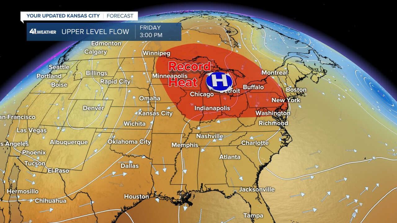
There is a small pattern change to watch — high pressure building over the Great Lakes. This ridge will open a highway of heat that will clip just northeast of Kansas City for the next two days.
We will see our temperatures push into the 90's easily while record heat is possible from Chicago-Minneapolis-Buffalo over the next two days.
This heat and storm activity has us feeling like the middle of summer by this weekend, but there is some hope that this pattern will relax a bit.
A series of strong lows are looking to impact the northeastern pocket of the US and this means we will start to nudge out the high pressure that has been holding in the plains.
This pattern looks to begin to try and set up June 6-8.

But it may not mean much for us except near normal temperatures in Kansas City, which means 80s vs 90s. Sorry, that's the best we can do right now.
When it comes to the outlook for early June rain a western rainy trend looks favorable.

So at least we aren't talking bone dry and record heat for early June. As for the Florida like pop up storms and heat, that will calm down a bit come next week.
In the mean time, stay up to date on the storms as we track where the best set up is today through the weekend.
BONUS note, this soggy pattern has been good for drought stricken Kansas! Stay tuned for a drought update from Wes coming up tomorrow.
—
