


KANSAS CITY, Mo. — Happy Friday Eve Blog Readers-
Let's talk space and snow!
What's NEW
Snow is popping up in the 10 day forecast. Now normally when you see storms 10 day out you take a deep breath, let the excitement go and wait for more data. But... the reason I bring it up is with Thanksgiving week looking cold with arctic air just to our north... we are kind of setting the stage a bit.
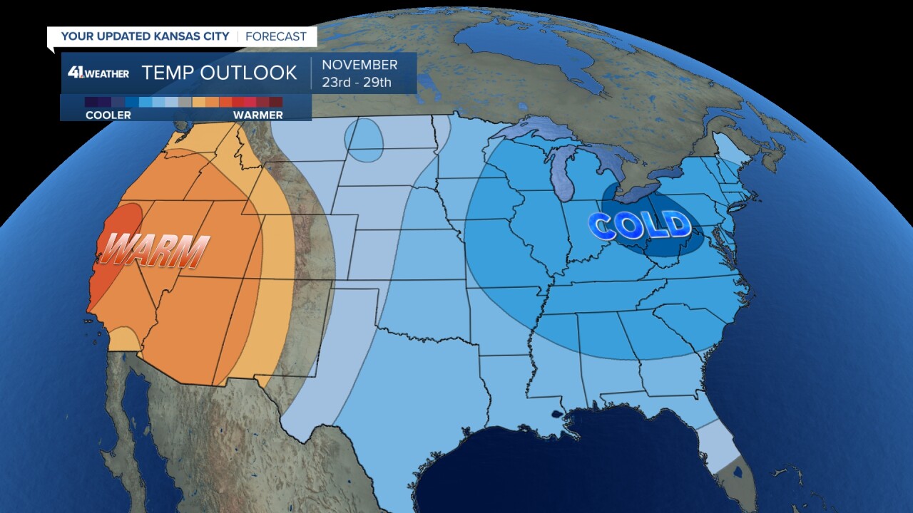
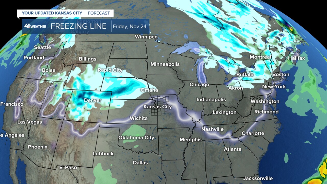
This cold outbreak will allow for the freezing line to drop south a bit toward Kansas City and there is a system that is looking to develop over the Rockies by November 24th. This will certainly be a set up be will watch for the time frame between November 24-26th.
Keep in mind, the average first 1'' of snow for the Kansas City Area is Dec. 13.
What's Happening NOW
Space. The only thing we have to look up and see right now in the forecast are clearing clouds tonight and space sighting the next couple of nights. While tonight cloud cover may be pesky, the next couple of nights look great for those interested in spotting the International Space Station (ISS) and for trying to watch the Leonids Meteor Shower.

The ISS can be viewed quite regularly with opportunities monthly and to keep track check out this website from NASA. The ISS is visible because is reflects the light of the sun, however it isn't bright enough to see during the day. It can only be seen when it is dusk or dawn and appears similar to an airplane. It is a quick moving bright light, but in this case no blinking.

Also on the final frontiers cue this weekend is the Leonids Meteor shower. The Leonids is one of the most famous meteor shows of them all as it has the potential to create meteor storms, a sort of celestial firework show. The most famous Leonid meteor storms happened in 1799, 1833 and 1966. So if you pay attention that's about once every 30-100 years give or take... marking it quite rare. Recently some weaker displays have happened in 1999, 2001 and 2002 and we witnessed meteors falling at a rate of a few thousand meteors per hour. This year experts say to not expect a storm, and there could be long stretches between these streaked sightings. Nonetheless, it will reach peak activity in the early morning hours Saturday.
Meteor showers are named after the constellation they seemingly fall through. So find the constellation Leo or look for the star Regulus Friday night or Saturday morning. Regulus is the 3rd brightest star in the night sky making it hard to miss.

What's NEXT?
The weekend is loading and with it rain chances are returning. So we move from tracking meteors to tracking hydrometeors. The sunflower showdown is shaping up to be perfect fall football weather in Lawrence. Rain chances return Sunday by the midday and will stick around through the night and into Monday.
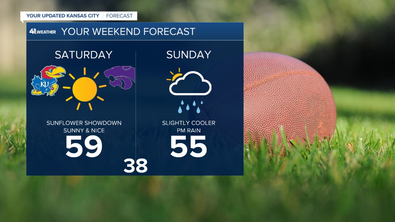
Our weekend storm isn't on a direct path for Kansas City, the main path of the rain will be just to our south. If you are on the Kansas side or south of I-70 this is a better rain set up for you, but still we aren't talking a super soaker here.
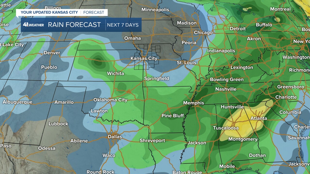
But some rain will linger in the forecast into Chiefs Monday as we have a secondary front dropping in behind it to keep the atmosphere primed for moisture transport. Expect light rain or drizzle for much of Monday, including a dreary forecast for the Chiefs game with temperatures in the 40s.

The snow with this system will stay north into Minnesota, honestly probably closer to Canada. This second front sure is colder, and will be a snow producer, it's just running on the heals and left overs of the southern system. As we head into Tuesday some rain could linger early but we should see clearing and then COLD weather set up as we head into Thanksgiving week.

Expect a COLD Thanksgiving with that setting the stage for our next chance for precipitation come November 24-26th. Stay tuned for those SNOW updates, the season is just getting started!!!
