


Good Tuesday bloggers,
We are in an active weather pattern today through Thursday as we track two storm systems. Mother Nature has to be a Chiefs fan as it looks like the parade will occur perfectly in between both systems.
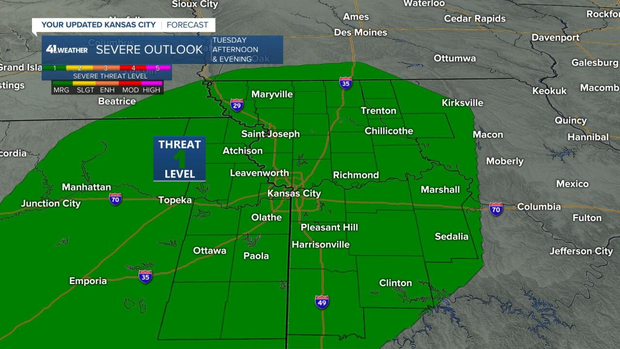
Today we are in a level 1 of 5 severe weather risk for a quick period of thunderstorms between 2 p.m. and 8 p.m. This is due to the first storm.
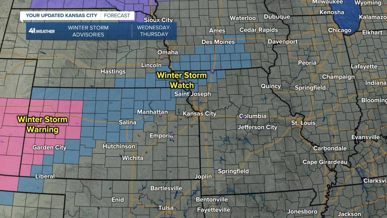
Second, there is a Winter Storm Watch for northwest Missouri Wednesday night and Thursday. This is due to the second storm.
Let's go through the details of this complex forecast.
TODAY (NOW-2 P.M.):
The rain started around 2 a.m. and has produced .25" to .40" as of 10:30 a.m. These are radar estimated rainfall totals, so you rain gauge may read different.

The widespread rain will end noon-2 p.m. from southwest to northeast across KC bringing amounts to around .50" in most locations. The wind will gust to 40-50 mph from the south during and after the rain. Keep both hands on the wheel, especially on the west-east roads as the wind blows at a 90 degree angle.
After the rain ends we will go into the dry slot of the storm. This may allow for some sun to peek out. This in turn will take us to the 50s.

TODAY (2-8 P.M.):
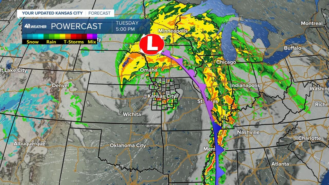
The temperatures warming to the 50s may be just enough to cause just enough instability, so that any thunderstorms may get just strong enough to produce some severe weather. Scattered showers and thunderstorms will likely generate due to a last disturbance that will rotate around the main storm. It was in southwest Kansas at 11:30 a.m. It will race northeast through our region between 2 p.m. and 8 p.m.
Here is the surface set up for 5 p.m. today. The main surface low will be way north across northeast Nebraska and northwest Iowa. We are being influenced by that disturbance swinging around the south side of the main storm. Usually, the best chance of severe weather is near the surface low.
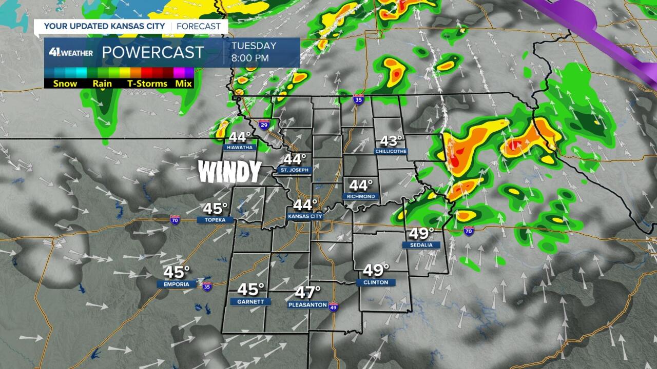
Here is a zoomed in look at the map for 5 p.m. today. There is a bigger area of rain and thunderstorms moving through KC, with smaller, more individual cells in northwest Missouri. If there are going to be any brief "spin ups" which means a brief and small tornado it would most likely occur with the individual thunderstorms as they are allowed to rotate more.
The thunderstorms in KC have potential to bring heavy rain, wind gusts 40-60 mph and small hail.
So, all locations will need to watch for hail (mostly small), gusty winds 40-60 mph, and a very slight chance for a brief, small tornado.
Now, all this being said there are limiting factors. By the time the thunderstorms get here, we may have cooled to the upper 40s to near 50. That will limit already limited instability. And the main surface low is way north. We will have south winds at all locations at the surface. It is the surface lows that cause the biggest problem when there is a severe weather threat.

By 8 p.m. any thunderstorms are much weaker and long gone. The threat of any showers and thunderstorms lasts one hour in any one location. So, if you have evening Valentine's Day plans, they should be fine. You may have one hour where you need to be really weather aware.
After the thunderstorm threat it will become windy, dry and cool then cold with temperatures in the 40s, dropping to 30s.
That was a lot, and we are not done. Let's go over the parade weather and storm system two.
WEDNESDAY 7 A.M.:
It will be mostly clear and cold with much less wind. Lows will be around 35, so any water leftover will not freeze.

WEDNESDAY (NOON-5 PM):
The parade begins at noon with exclusive coverage on KSHB41. It is looking pretty good with some sunshine a north breeze at 15 mph and temperatures around 40. The last Super Bowl parade it was in the 20s with flurries and very light snow with wind chill values in the single digits. See, I think Mother Nature is a Chiefs fan!


WEDNESDAY (5-8 P.M.):
We will see temperatures drop to around 32 as the second storm approaches. We may already see some light sleet and freezing rain form. It does not take much of that to cause road issues.

WEDNESDAY (8 P.M.-MIDNIGHT):
KC may see some light freezing rain or sleet, but the main storm really gets its act together to the north and west where heavy snow will fall from central Kansas to northwest Missouri. Notice, the temperatures, dropping into the low and mid 20s as a cold blast moves in.

THURSDAY (MIDNIGHT-7 A.M.):
This is when the main storm races by. Heavy snow is likely across northwest Missouri. The KC area has a chance to see new light freezing rain and sleet followed by some light snow. Temperatures will be heading to the teens. So, it would not take much freezing rain/sleet to snow to make roads slick.

By 7-8 a.m. there may be lingering flurries with wind and cold. Temperatures will be in the teens with wind chill values near zero.

How much snow?
A long band of 3"-6" of snow will occur from western Kansas to northeast Kansas to northwest Missouri to southern Wisconsin to northern lower Michigan. They need the moisture in western Kansas.

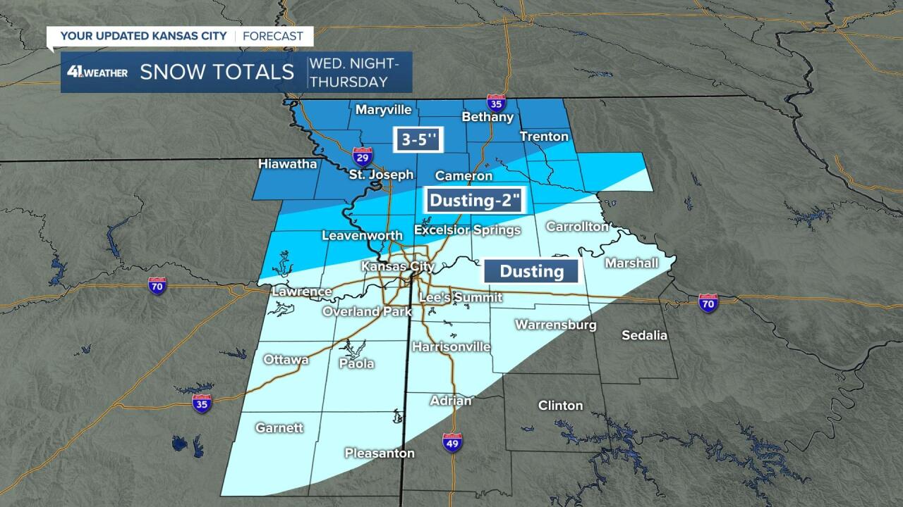
Here is a zoomed in look at KC.
We are on the southern edge of any accumulation. A dusting is likely with a a dusting to 2" possible north of I-70. The big snow, 3"-5" or even 6" will occur across northwest and northern Missouri.
This can still shift 20-50 miles north or south. You can see how big of a change that makes to the snowfall forecast with such a small shift for a storm system.
Also, a dusting of snow on top of a little bit of ice can cause big problems on all surfaces at the cold temperatures.
Have a great rest of your week. Have fun at the parade if you are going.
Stay healthy.
