


Good morning bloggers,
We have clouds streaming across our sky this morning, and there is an upper-level disturbance producing thunderstorms over central Kansas. These thunderstorms are heading our way, and they are still a few hours from Kansas City. Let's take a look.
Sunny and Rainbow The Weather Dogs do their "pose" trick to show us the building cumulus and stratocumulus clouds this morning:

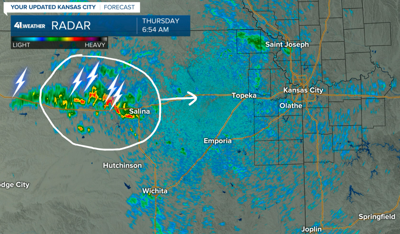
There is an upper-level disturbance moving our way. Here is the radar from just before 7 a.m.:
We are in the monsoon flow of moisture, and I will do my best to explain on KSHB 41 tonight. A disturbance in the flow is moving our way this morning. It is causing these thunderstorms, as shown above.
This disturbance is caught in the monsoon flow. Monsoon means "seasonal wind." The summer monsoon in the United States is a description of the seasonal flow aloft that brings moisture to the southwestern U.S. At times, this moisture will get diverted east over Kansas City, and this has been happening this week.
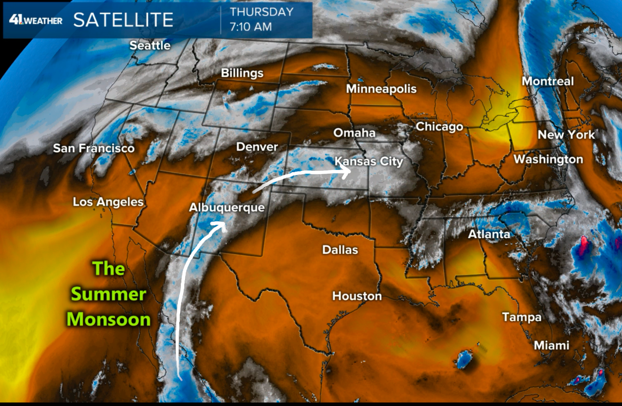
As shown above, we can see the tropical flow of moisture being transported across Mexico into New Mexico, and then the current pattern is diverting this moisture directly over our heads this morning. So, when you look up and analyze those clouds today, explain to the kids that this moisture is coming from the tropics, deep down into Central America crossing into the U.S. The clouds you see today are a direct result of this monsoon flow.
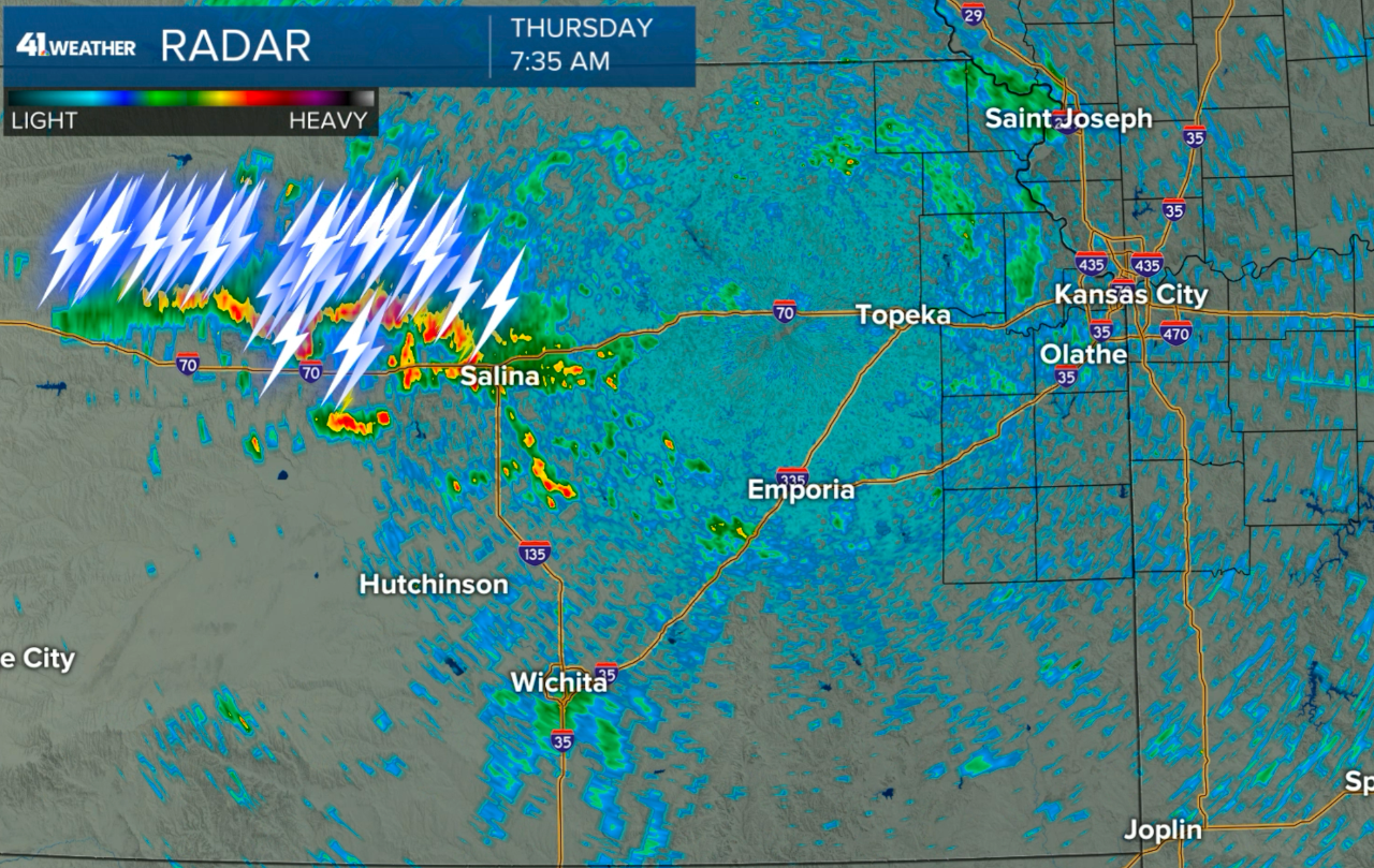
Now, look at this updated radar as of 7:20 a.m.:

Notice how the lightning strikes have doubled in 26 minutes when you compare it to the first radar image I posted. This is a sign that this disturbance is strong enough to maintain these showers and thunderstorms for at least another six hours or so. And, if you look real closely, you can see some new showers forming in an arcing band closer to KC.
Here is one more update showing a doubling in lightning strikes again in 15 minutes:
We will be monitoring these thunderstorms and this disturbance closely. There is a small risk of severe weather in our area later today or tonight. A new area of thunderstorms may form tonight, and this is the area that will be monitored for some stronger thunderstorms.
Kansas City weather timeline:
- Today: Increasing and thickening clouds with a chance of showers and thunderstorms by noon. The chance of rain is 5% early this morning, then 20% by 10 a.m. and 50% by noon. The chance of showers and thunderstorms increases to 60% this afternoon. High: 83°
- Tonight: There is a 60% chance of showers and thunderstorms. Low: 67°
- Friday: Any lingering showers or thunderstorms will end by midday, and then it will heat up into the lower 90s.
Thank you for sharing this weather experience and spending a few minutes of your day reading the weather blog.
Have a great start to your day,
Gary
