

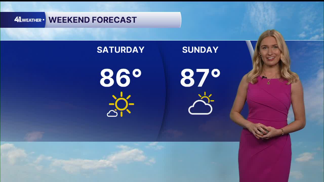


KANSAS CITY, Mo. — It may be the second weekend of October, but high temperatures over the next few days will be closer to what we typically see in July.
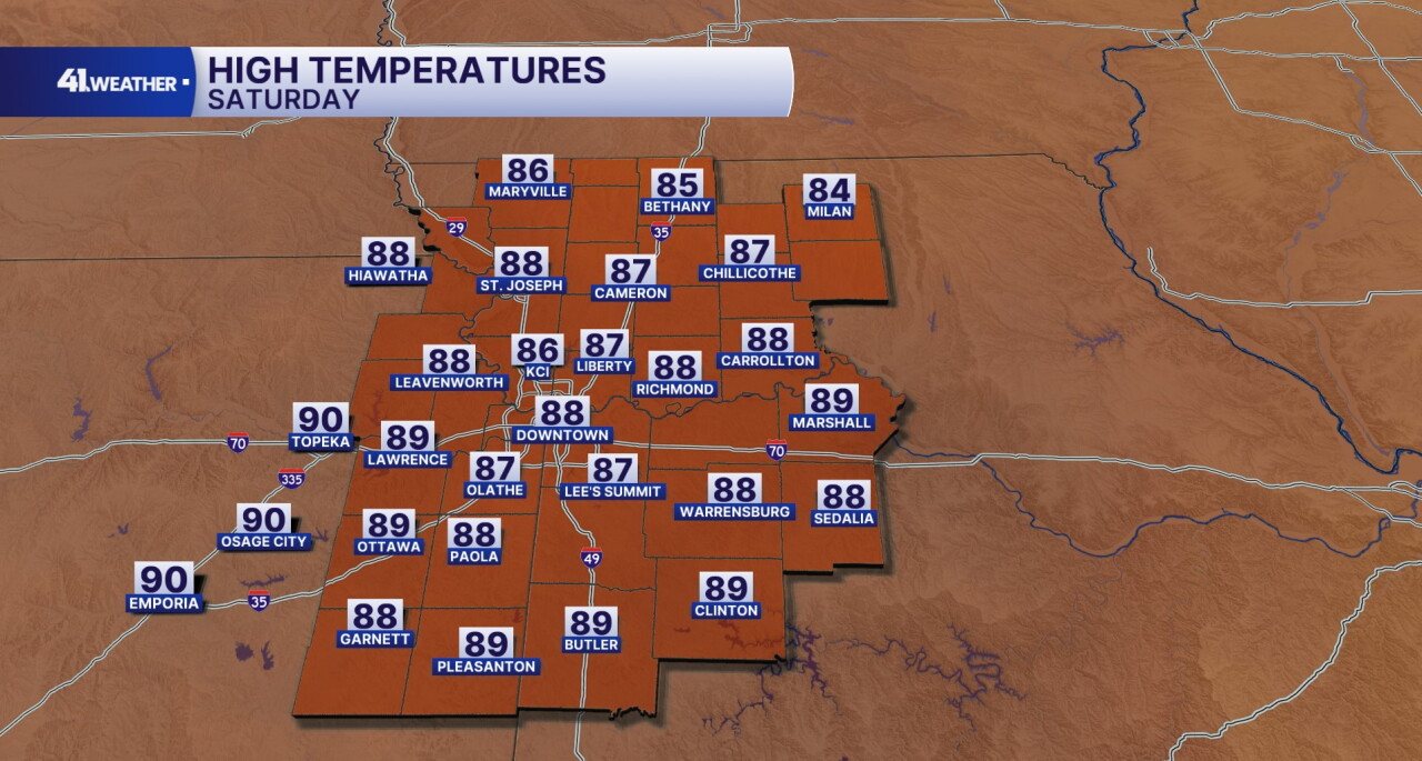
After a refreshing start to the day on Saturday in the 50s and 60s, you can expect another afternoon with sunshine and highs in the mid to upper 80s. Outside of the heat, humidity will be low with calm conditions.
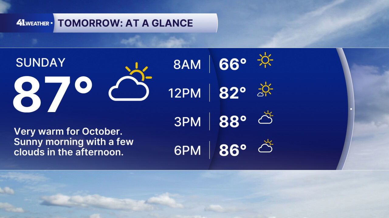
Sunday will bring similar conditions, with a few more clouds moving in during the afternoon and evening. Winds will be a bit stronger as well, gusting up to 25 mph out of the southwest.
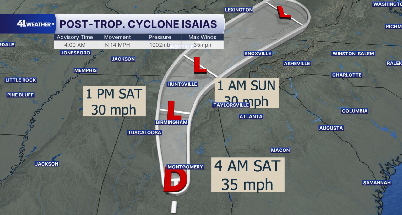
Meanwhile, Post Tropical Cyclone Isaias will continue to track northward after making landfall Friday evening. Once the system hits Tennessee, it will start to track northeast.
Because of this, I do not expect Isaias to cause any impacts to the Kansas City area.
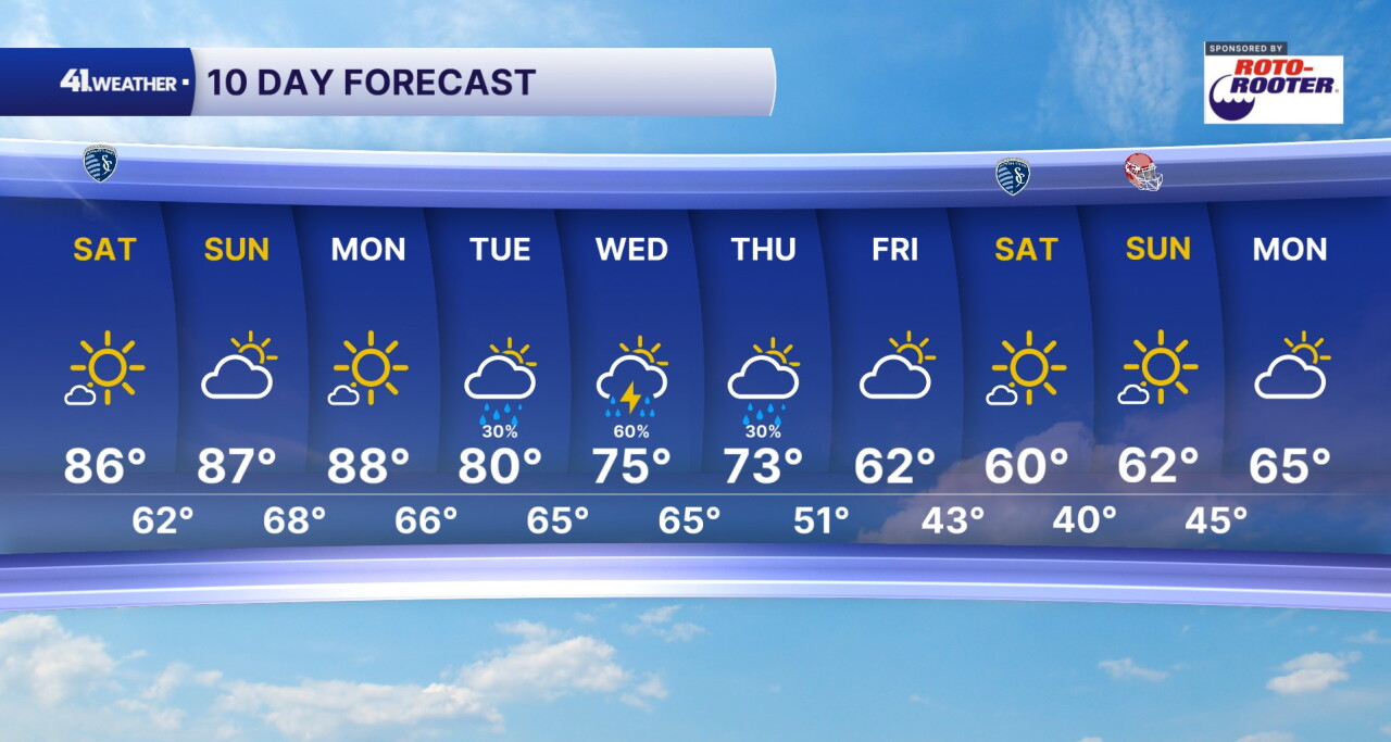
Temperatures will remain well above average for October all the way through Monday. By Tuesday, our next cold front will be moving in. This will bring midweek rain chances as well as much cooler temperatures for the rest of the week.
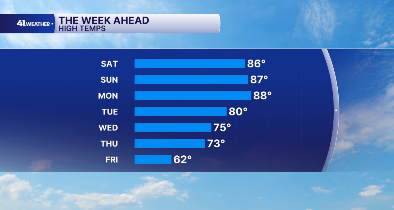
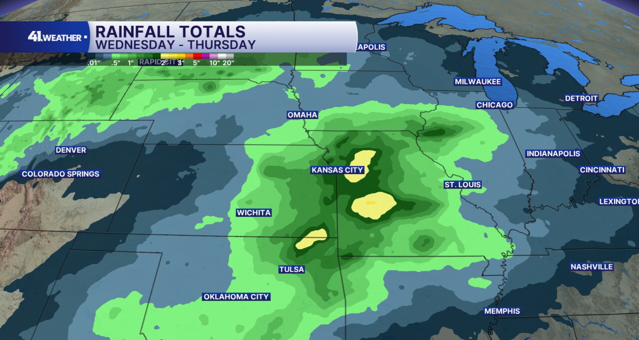
The best chance for rain will be on Wednesday, but we could see rain in the area any time between Tuesday and Thursday.
This may result in some healthy rain totals too. I expect anywhere from one to two inches of total rainfall throughout the week.
Temperatures should be much cooler by the end of the week. By Friday, conditions should be drying out with temperatures in the low 60s.
Next weekend will feel much more like fall. Morning temperatures will likely be near 40° with afternoon highs in the low 60s. Just in time for the Chiefs game.
For the week of Oct. 18 through 24, temperatures should be near to slightly above average for this time of year. Average highs for this time period are typically in the mid 60s.
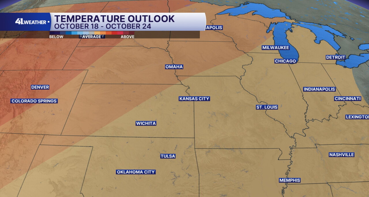
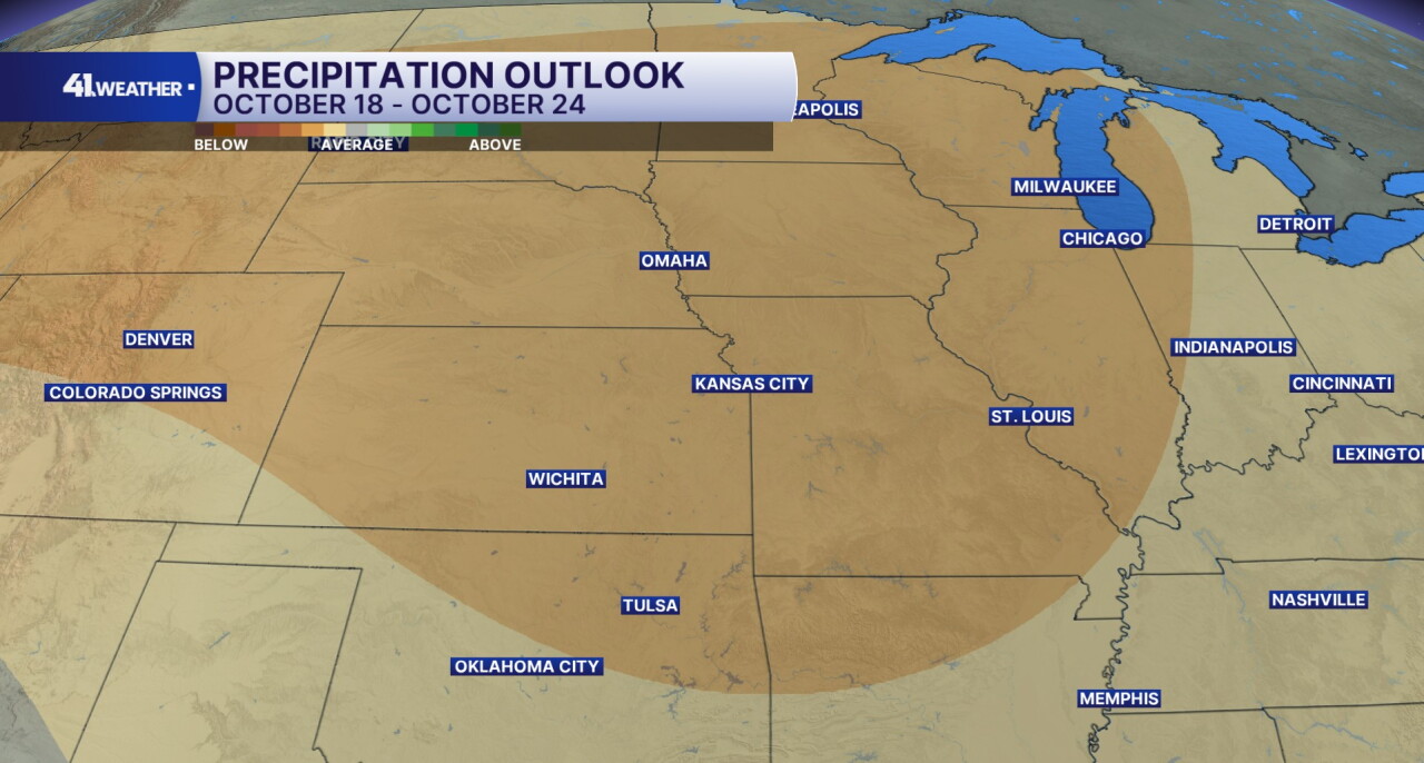
The KC area and a majority of the country will likely be drier than average for the same week.
Have a question about the forecast? I'd love to hear it! Reach out to me, and I'll answer your questions in this weather blog.

Enjoy the sunshine today!
—