

KANSAS CITY, Mo. — Good morning bloggers,
The Olympics begin in 46 to 47 days. To the average meteorologist this would be insignificant. To many of you who have followed the Long-Range Caster, or LRC, for the past 20 years in the blogs, it is quite significant.
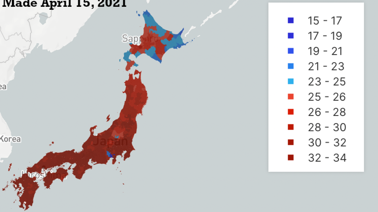
Here is the LRC forecast for the 2021 Tokyo Olympics, beginning with a broad view of Japan.
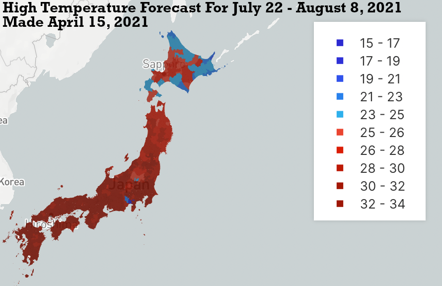
This map above shows the LRC prediction for the high temperatures across Japan and the map below shows the LRC prediction for rainfall during the entire Olympics.

The broad view of Japan is shown above with the total rainfall forecast for the entire period of July 22 to August 8, 2021.
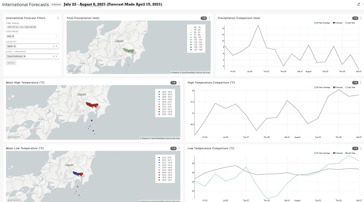
The dashboard that visualizes the weather for most locations around the world is powered by the LRC, and this pattern that set up last October.
The LRC Computer Model shows highs near 87° F (31°C) with lows between 70° and 75° F (21° to 25°C).
The best chances for rain are in the first few days of the Olympics forecast. Most of the days look dry!
For more information for locations around the world, or a discussion of this weather pattern, check out Weather 20/20. Click on the weather blog or the technology blog to learn more.
Kansas City Weather:
It is drying out in Kansas City, although there is an upper-level storm system over Missouri today.
This would more typically result in some heavy thunderstorms rotating around a storm like this, but the rain has been not even come close to KC the past few days.

The center of this upper-level storm system is forecast to be near Columbia, Missouri, this evening. The main jet stream is crossing over northern California and rising up into Canada, which is stalling the cold fronts and, as a result, we will be getting a bit warmer as we move through this week.
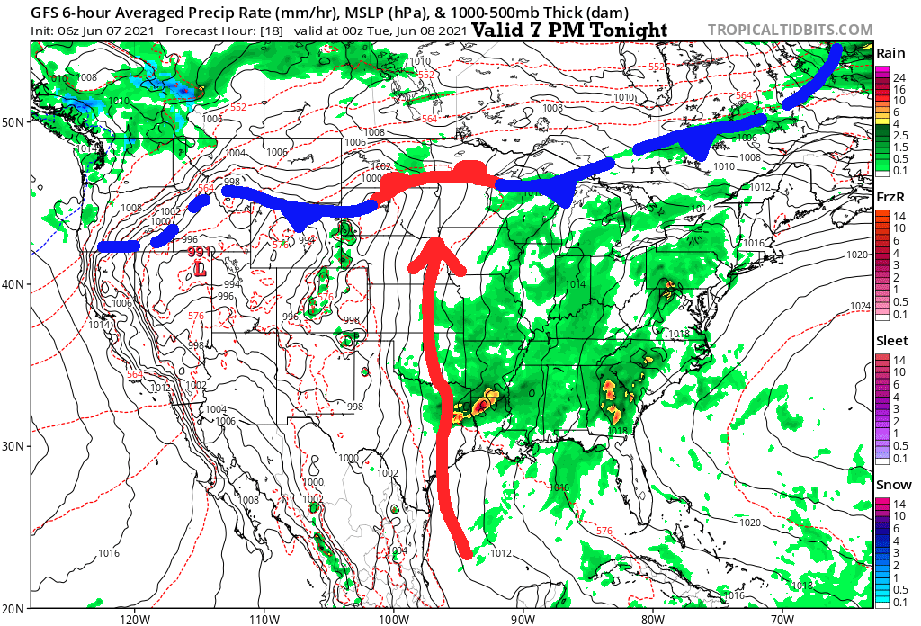
The blue/red/blue fronts over the northern United States show the stalled front. It will be quite warm near and south of that front.
For Kansas City, notice the green shade. This shows that the model is predicting a few showers and thunderstorms. It would more typically be widespread shower and thunderstorm activity each afternoon, but this system has not been producing much near Kansas City.
So, we are going with a 20% chance of rain the next couple of days. Then, there will be a warm up into the lower 90s later this week for high temperatures as this system weakens and falls apart.
Have a great start to the week. Thank you for spending a few minutes of your day reading the "Gabbing with Gary" blog.
The Olympics are on NBC in 46 days and we will continue monitoring the LRC as we get closer!
Gary Lezak
