


KANSAS CITY, Mo. — We've been talking about the cold temps and snow storm all week, and the storm is now on our doorstep.
Check back for updates on storm impacts, including school and organization closures throughout the evening.
LINK | KSHB School Closings
LINK | Latest KSHB Weather Forecast
LINK | KSHB 41 Weather Alerts
LINK | KSHB 41 Weather Blog
—
UPDATE, 8 p.m. | KSHB 41's Tod Palmer spent Thursday listening to people talk about keeping safe as a nasty winter storm bears down on the area.

Palmer has more in his report.
UPDATE, 7:30 p.m. | With a dangerous winter storm headed for the region, KSHB 41's La'Nita Brooks heard from a Missouri Department of Transportation official who shared the department's plans for keeping roads cleared.

Read Brooks' report here.
UPDATE, 7:10 p.m. | Missouri Gov. Mike Kehoe signed an executive order Thursday evening declaring a state of emergency for an impending winter storm set to impact the Kansas City area.
"This allows the state to respond quickly and support local communities as needed, but each of us must do our part during this potentially dangerous winter weather," Kehoe wrote in a Facebook post.
Kehoe's full Facebook post is below.
UPDATE, 6:35 p.m. | In preparation for a winter storm expected to impact the Kansas City region this weekend, shoppers stopped by the Price Chopper in Roeland Park.
KSHB 41's Lily O'Shea Becker has more in this report.
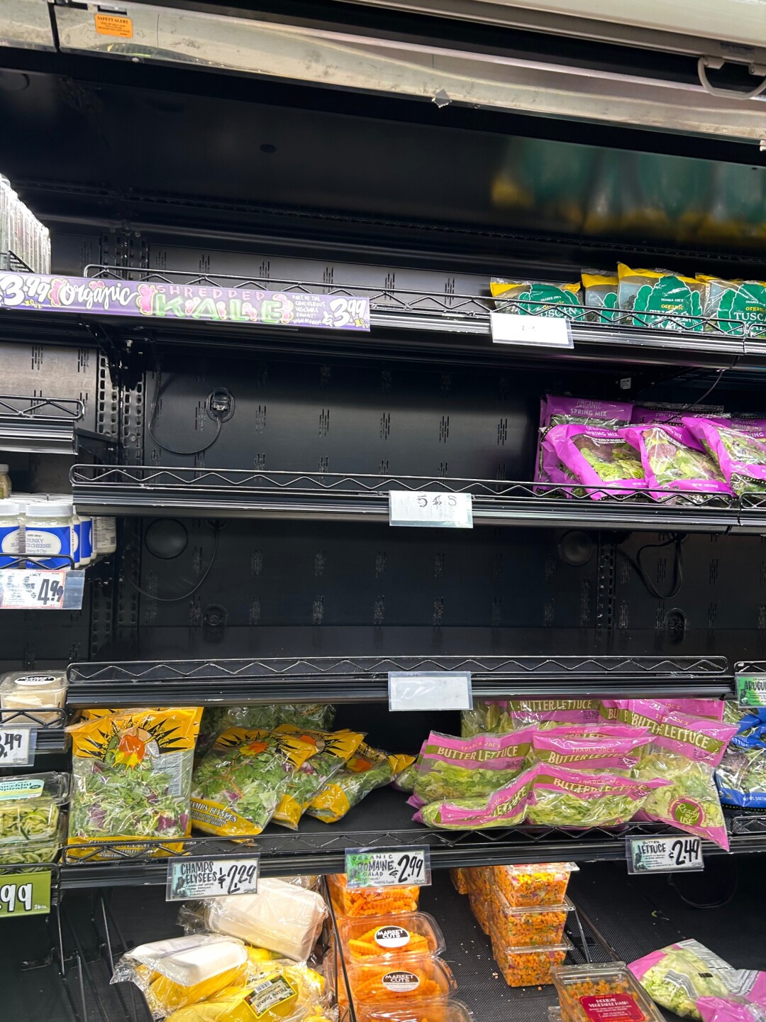
UPDATE, 6:05 p.m. | Shelves are starting to look lighter at the Trader Joe's located at 8600 Ward Parkway. A viewer sent these photos to KSHB 41's Elyse Schoenig.

UPDATE, 5:35 p.m. | We're starting to receive school closings for Friday, Jan. 23, due to the extreme cold temperatures.
KCPS has called an AMI Day for Friday, Jan. 23, due to dangerous cold conditions.
— KCPS (@kcpublicschools) January 22, 2026
Full details and access to Choice Boards: https://t.co/AxDscamU1Z pic.twitter.com/v3OmuUjEeY
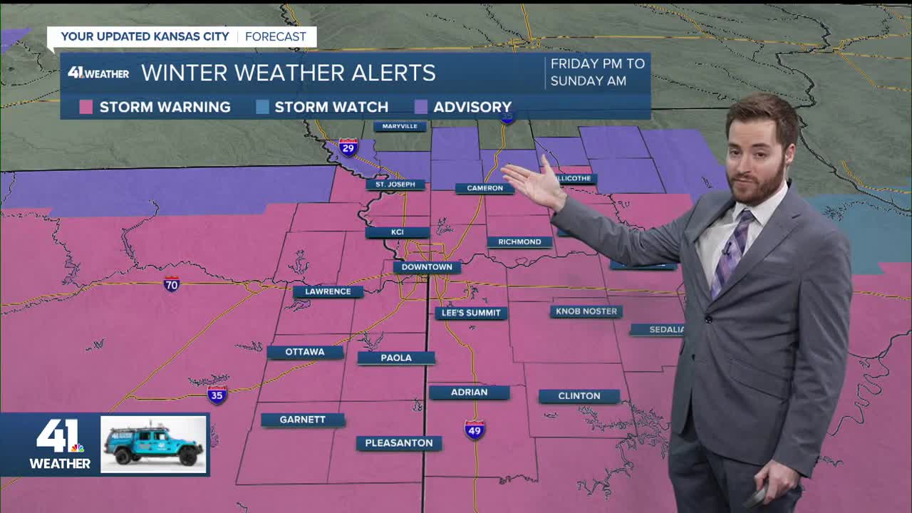
ORIGINAL REPORT | A winter storm warning now includes most of the Kansas City area starting Friday night through Saturday night.
The National Weather Service first issued a winter storm watch on Wednesday afternoon, which included counties in the southern half of the KSHB 41 viewing area. As new model data arrived overnight, the watch was extended several counties further north to include the Kansas City area.
By Thursday afternoon, the Kansas City area has been upgraded to a winter storm warning running from 6 p.m. Friday to 6 p.m. Sunday.
Travel could be very difficult starting Friday night, with the weather service forecasting five to seven inches of snow possible from the storm.
In addition to the winter storm warning, a cold weather advisory is in effect for the entire Kansas City region from midnight Friday to noon Saturday.
Expect dangerously cold air to settle into the KC area Thursday night - Friday. @KSHB41 #KCwx #mowx #kswx pic.twitter.com/ddyLWMx4s8
— Lauren Rainson (@LaurenRainson) January 22, 2026
Wind chills as low as 18 below are possible early Saturday.
Further north, along the Missouri/Iowa border, an extreme cold warning is in effect from midnight Thursday to noon on Friday, with wind chills as low as 25 below possible. The cold weather advisory is then in effect from noon Friday to noon Saturday.
—
